


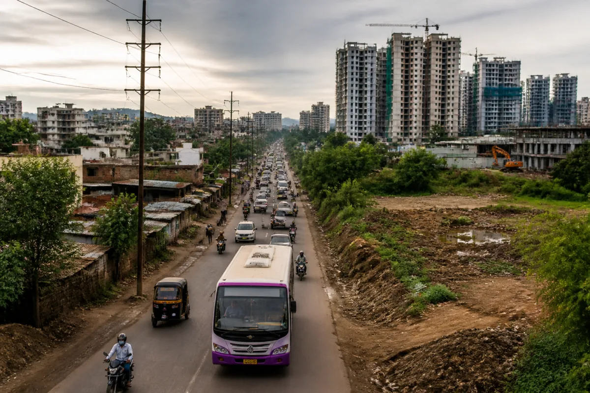
Pune’s development plan for nine newly included villages has exposed a difficult urban-planning choice: whether the city will reserve enough land for future mobility and civic services before urbanisation makes that land expensive or impossible to acquire. According to a report by Pudhari, 84 of the 143 changes made after public objections concern reductions in road width. The objections have been raised before the plan is submitted to the state government for approval.
The issue is not only the width of individual roads. It is about whether Pune’s expanding municipal boundary is being planned as a connected urban system or as a collection of villages that will gradually absorb development without adequate transport, waste, water and public-service capacity. The nine villages are still at a stage where land reservations and road alignments can be decided on paper. Once construction advances, correcting those decisions would become more difficult and costly.
The development plan has been prepared by the town-planning department and is to be sent to the state government for approval. That makes the current stage institutionally important. The plan is not being presented in the report as a completed infrastructure programme; it is a planning framework that will influence how land is reserved and how roads and civic facilities are accommodated as the area develops. The state approval process is therefore the next formal milestone identified in the report.
The principal criticism has come from Pune Municipal Corporation opposition leader Nilesh Nikam, who has asked Chief Minister Devendra Fadnavis not to reduce road widths in the plan. Nikam has linked the proposed changes to Pune’s rising population and vehicle numbers, arguing that a city already facing congestion should not reduce the capacity of roads in areas expected to urbanise.
The report also cites a significant gap between the road land expected in a development plan and the area currently available within the municipal limits. At least 15 per cent of land is expected to be allocated for roads, Nikam said, while only about 9 per cent is presently available in the municipal area. These figures, as reported, frame the dispute as a question of cumulative network capacity rather than a disagreement over isolated road segments.
A road reservation performs more than one function in a growing city. It provides space for moving vehicles, but it can also determine whether buses can operate reliably, whether emergency services can reach new neighbourhoods, and whether utility networks can be installed or maintained. The supplied report does not provide the proposed width of each affected road, the reasons for the 84 changes, or a road-by-road assessment of traffic demand. Those details will be important for evaluating whether individual modifications are justified or whether they collectively reduce the future network’s resilience.
The concern becomes sharper because Pune is already experiencing congestion, according to the report. It also states that Pune ranks fourth in the country in the sale of four-wheelers and two-wheelers. The report does not identify the dataset, year or definition behind that ranking, so it should be treated as a claim made in the reported political objection rather than as independently established evidence. Even so, the planning dilemma is clear: if vehicle ownership continues to place pressure on existing roads, reducing planned road capacity in newly urbanising areas could constrain the city before those areas are fully built out.
Road width alone, however, cannot solve Pune’s mobility problem. More road space does not automatically produce efficient movement if public transport facilities, junction design, walking connections and land-use planning are inadequate. The report’s reference to future bus depots is therefore important. Nikam has said that the Pune Mahanagar Parivahan Mahamandal Limited does not have enough space for its buses and that some vehicles have to be parked on roads. He has also sought reservations for bus depots in the development plan.
The reported requirement is substantial. An additional 2,500 buses are expected to enter the fleet over the coming year, according to the objection cited by Pudhari. The report does not specify whether this is a confirmed procurement, a sanctioned fleet expansion or a projected requirement. It nevertheless raises a concrete land-use question: where will a growing public transport fleet be stored, maintained and operated if new urban areas do not reserve land for depots and related facilities?
This is where a development plan connects transport policy to municipal land management. A bus service requires more than vehicles and routes. It needs depots, maintenance space, staff facilities and road access. If these functions are not accommodated in the plan, buses may be parked on public roads or placed far from the areas they serve. The report identifies the shortage of depot space but does not provide the number, location or capacity of existing facilities. That information would be necessary to measure the scale of the gap.
The same planning issue appears in the report’s discussion of waste management. Nikam has argued that a large share of Pune’s waste-processing facilities is concentrated in the Hadapsar area, creating additional pressure there and contributing to health concerns reported by residents. He has called for decentralised waste-processing projects and separate land reservations in different parts of the city.
The report does not establish the number or capacity of the facilities in Hadapsar, the volume of waste handled there, or the specific health impacts claimed by residents. It does, however, highlight a recurring municipal challenge: when essential infrastructure is concentrated in one area, the operational burden and the effects of traffic, odour, movement of waste vehicles and land-use conflict can also become concentrated. A citywide development plan is one of the mechanisms through which authorities can decide whether such infrastructure is distributed or clustered.
The requests made in the objection extend beyond roads, depots and waste facilities. Nikam has asked that the plan reserve sufficient land for schools, gardens, water tanks and sewage-treatment plants. These facilities are often treated as later additions to residential growth, but their land requirements compete with development once parcels are subdivided or built upon. Reserving land in advance does not by itself guarantee construction or funding, but failing to reserve it can make future provision more difficult.
The Pune case therefore illustrates the difference between a development plan and an implementation plan. A plan can identify roads, reservations and public amenities, while actual delivery will still depend on municipal budgets, land acquisition, development permissions, infrastructure agencies and the timing of construction. The report does not specify how the proposed reservations will be funded, which agency will implement each facility, or whether infrastructure capacity assessments were carried out before the 143 changes were made.
The number of changes is itself a measure of the plan’s contested nature, although it does not reveal whether the changes improve or weaken the final document. Public objections have resulted in 143 modifications, with 84 related to road widths. That means road-width changes account for more than half of the reported modifications. The figure signals that access and mobility are central to the dispute, but it cannot, on its own, establish that every reduction is inappropriate. Some changes may have responded to land ownership, existing settlement patterns, technical constraints or objections from affected landholders. The supplied report does not state the reasons for individual revisions.
That missing explanation is important for the approval process. A credible planning decision would need to show how proposed road widths relate to expected development, public transport operations, emergency access, pedestrian movement and the existing village fabric. It would also need to explain how the plan balances private property impacts with the public need for connectivity. Without that information, the headline number of 84 changes describes the scale of the dispute but not the planning logic behind it.
The timing gives the state government an opportunity to examine these questions before approval. The immediate next step identified in the report is the submission of the nine-village development plan to the state government. The material supplied does not say when approval is expected, whether further public consultation will occur, or whether the government has responded to Nikam’s demands.
What the available evidence confirms is that Pune is making land-use decisions for newly included villages while facing pressure from vehicle growth, congestion, public transport capacity, waste-processing concentration and shortages of civic infrastructure land. What remains unclear is how the 84 road-width changes were assessed and whether the plan includes adequate reservations for the facilities required to support urbanisation. Those details will determine whether the plan gives Pune room to build a more connected city or leaves future infrastructure to be fitted into an already constrained urban landscape.

