


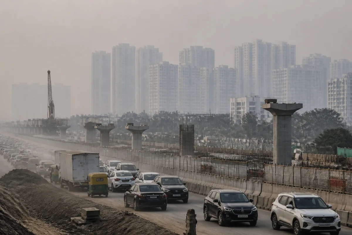
Delhi air pollution is being shaped by activities far beyond the capital’s administrative boundary, according to an analysis of Indian Institute of Tropical Meteorology, Pune, data cited in a report by Live Hindustan – NCR. Over the preceding three days, cities across the National Capital Region contributed more than one-third of Delhi’s estimated PM2.5 pollution, with Noida and Ghaziabad identified as the largest external urban sources.
The finding exposes a basic mismatch in the way the pollution problem is governed. Delhi may impose restrictions on vehicles, construction activity and other local sources, but the air entering the city does not follow municipal limits. It moves with wind, settles according to geography and carries emissions from industrial areas, construction sites, roads and neighbouring urban settlements.
The data cited in the report comes from the city-wise assessment available on IITM’s Decision Support System, or DSS. The system separates the estimated contribution of local and external sources to Delhi’s air pollution. According to the report, the combined contribution of cities in the NCR exceeded one-third of Delhi’s PM2.5 pollution during the period assessed.
Noida was estimated to account for 8.7 per cent and Ghaziabad for 6.8 per cent. Bulandshahr accounted for 5.5 per cent, while Faridabad and Gurugram were listed at 3 per cent and 3.5 per cent respectively. The report also recorded contributions from other cities, which together were described as exceeding 30 per cent. These figures should be read as source-apportioned estimates for the specified period, not as a permanent ranking of the cities or a fixed annual pattern.
That qualification matters because the regional contribution changes with atmospheric conditions. The report said wind speeds had remained between 4 and 8 kilometres per hour for three days, while north-easterly winds carried polluted air from industrial areas in Ghaziabad and Noida towards Anand Vihar, Patparganj and parts of east Delhi. Low wind speeds also meant that pollution remained concentrated rather than dispersing quickly.
The assessment cited in the report further indicated that the direction of pollution movement could shift. For the following Wednesday, IITM’s DSS estimated that Gurugram and Jhajjar could become the largest external contributors to Delhi’s pollution after a change in wind direction, with their combined share expected to exceed 16 per cent. This illustrates why a city-by-city blame framework is inadequate: the same source may have a different effect on Delhi as wind direction, speed and atmospheric conditions change.
The regional picture also complicates the way pollution controls are designed. The report listed transport as contributing 17 per cent of Delhi’s PM2.5 pollution, while stubble burning contributed 3 per cent and construction 2.25 per cent in the cited assessment. These categories sit alongside city-level sources and cannot be addressed through one restriction or one agency. Transport emissions, construction dust, industrial activity and agricultural burning operate across different jurisdictions and require different administrative responses.
For residents, the consequence is that local action may not produce an immediate improvement when a substantial share of pollution is entering from outside the capital. Restrictions within Delhi can reduce some emissions, but they cannot by themselves prevent polluted air from moving across the NCR. The report’s geographic detail is particularly significant for east Delhi, where the cited wind pattern brought pollution from neighbouring industrial and infrastructure zones into densely settled areas.
The infrastructure connection is also direct. According to the report, dust from infrastructure projects along the Ghaziabad, Noida and Greater Noida Expressway corridors was adding to the pollution entering Delhi’s atmosphere. The report does not establish the individual contribution of each project, but it identifies construction activity across the regional transport network as part of the external pollution problem.
This creates an institutional challenge. Environmental controls are commonly announced and enforced within the jurisdiction of the authority issuing them, while the atmosphere operates as a shared regional system. Delhi’s administration, neighbouring city authorities and agencies responsible for roads, construction, industry and transport therefore influence the same air basin through separate decisions. The data cited by IITM’s DSS makes that interdependence visible, but the supplied report does not identify a single regional mechanism that can enforce all the required measures across these jurisdictions.
The distinction between PM10 and PM2.5 adds another layer to the policy problem. Environmentalist Dr Gufran Beig, quoted in the report, said that authorities were concentrating heavily on preventing PM10 pollution, while planning for PM2.5 was not sufficiently developed. PM10 is generally associated more visibly with dust, whereas PM2.5 can be generated by combustion and other sources and can travel with regional air movement. The report’s central evidence suggests that controls focused only on visible dust within Delhi may miss a significant part of the pollution entering from neighbouring cities.
The geography of the capital further increases the importance of regional coordination. Professor Meenakshi Dhote of the School of Planning and Architecture told the publication that Delhi’s location allows pollution to become trapped after arriving with air from surrounding cities. Her explanation links the pollution episode to the interaction between urban emissions, wind direction and the physical setting of the city. In this account, Delhi is not simply producing pollution; it is also receiving and retaining pollution generated across the wider urban region.
The stubble-burning figures cited in the report show how the source mix extends beyond the built-up NCR. Punjab recorded 198 new stubble-burning cases on the Monday referred to in the report, taking the total since September 15 to 4,657. Tarn Taran recorded the highest number at 659, followed by other districts including Firozpur and Sangrur. The report placed stubble burning at 3 per cent of Delhi’s PM2.5 contribution in the cited assessment, showing that its role during this period was measurable but smaller than the combined contribution attributed to NCR cities.
This comparison is important because public discussion often searches for a single dominant cause. The figures presented here instead show a layered source structure: transport, regional urban activity, construction, agricultural burning and weather conditions all contribute, but their relative weight changes over time. The contribution estimates from Noida, Ghaziabad, Bulandshahr, Faridabad and Gurugram are therefore most useful as evidence of a connected regional system rather than as a permanent league table.
The larger planning question is whether the NCR is being managed as one air-shed while its development is being approved and regulated as a collection of separate cities. Expressways, industrial areas, housing expansion and construction projects connect the region economically and physically. Yet the pollution generated by those activities can be recorded as an external contribution only after it has already crossed into Delhi. The source-apportionment data provides a way to see that connection, but it does not by itself resolve the administrative fragmentation behind it.
The evidence currently confirms three points. First, external NCR cities made up more than one-third of Delhi’s estimated PM2.5 pollution during the period cited. Second, the largest contributors can change when wind direction changes. Third, regional infrastructure and urban activity are part of Delhi’s air-quality story even when they occur outside the capital. What remains uncertain from the supplied report is how these contributions vary over a longer period and which specific interventions would reduce them most effectively. The next key issue is whether air-quality controls can be coordinated across the NCR according to the movement of pollution rather than the limits of individual cities.

