


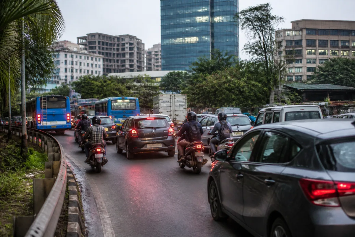
The Kerala government’s assurance on widening the Kakkanad-Infopark road has brought immediate attention to a commuting corridor where road safety, land acquisition and the expansion of Kochi’s technology economy have become inseparable. The reported death of an IT employee in a mishap at Kuzhikattumoola has intensified demands for action, but the debate now extends beyond whether the existing road should be widened. It is about whether the current alignment can safely carry the next phase of traffic from Kakkanad’s growing employment hubs.
Thrikkakara MLA Uma Thomas submitted a memorandum to Chief Minister V D Satheesan seeking a comprehensive project for the IMG Junction-Infopark stretch. According to the report, the Chief Minister assured that necessary steps would be taken to implement the project. Thomas also sought immediate funding for land acquisition and road expansion, arguing that temporary fixes would no longer be sufficient for the corridor.
That assurance addresses the immediate administrative question: whether the state will move towards a formal widening project. It does not, on the evidence currently available, settle the more consequential planning question of which project should be pursued. The existing road and a proposed new greenfield corridor represent two different approaches to the same urban problem. One would expand the established route, while the other would attempt to bypass its most difficult sections altogether.
The corridor between Kakkanad IMG Junction and Infopark Carnival Junction is described as the main commuting route to an important concentration of employment. Kakkanad houses Infopark and Smart City Kochi, with the report stating that the two hubs employ more than 100,000 technology professionals daily. The scale of that workforce means the road is not simply a local access street. It is a piece of economic infrastructure connecting a major employment cluster to the wider city.
Yet the same route is described as a narrow, two-lane road that is less than 10 metres wide in several stretches. The report identifies severe bottlenecks, aggressive private bus driving and dangerous 90-degree curves as factors that have made daily travel hazardous. These details matter because they indicate that congestion is not only a question of insufficient carriageway width. The alignment itself may be contributing to conflict between buses, cars, two-wheelers and other road users.
Thomas has called for widening the existing IMG Junction-Infopark stretch and for funds to acquire the land required for the work. Her position is based on the need to address an urgent safety and capacity problem on a route already used intensively. Existing corridors can appear administratively attractive because they are familiar, already connected to surrounding streets and directly associated with the current bottleneck. However, widening an established road also brings the difficult question of how much land must be acquired and how much disruption the work will create for properties and businesses along the alignment.
The report says the existing road could be widened to about 15 metres, but IT employees and urban transport advocates argue that this would not meet future traffic demand. Arjun P Bhaskar, an Infopark employee and administrator of the social media collective Kochi First, has described such an expansion as a short-sighted fix. His objection is not limited to the proposed width. He also points to the need for land acquisition along the two-kilometre stretch and argues that widening may not resolve the hazardous bends.
This is the central distinction in the debate. A wider road can provide additional space, but it does not automatically correct a dangerous geometry. If sharp curves remain, road users may continue to face visibility and speed-management problems even after construction. The supplied report does not provide a design assessment, crash analysis or engineering estimate establishing which intervention would be safer. It does, however, make clear that the proposed widening and the alternative corridor are being evaluated against different criteria: immediate expansion of existing capacity on one side, and the removal of problematic bends and reduced disruption on the other.
The alternative put forward by technology workers is a new four-to-six-lane greenfield corridor through open terrain to the north of the existing route. Bhaskar says the proposed alignment would bypass the sharp curves and require land acquisition across only a 200-metre stretch near IMG Junction. He also argues that this could reduce demolition costs and disruption. These are claims made by a named advocate and should be treated as part of the public debate rather than as an independently established project assessment. The report does not state that the corridor has been approved, technically evaluated or costed by the state government.
That limitation is important. A greenfield road may avoid some of the constraints of an existing built-up alignment, but the available material does not establish its full land requirement, environmental implications, junction design, funding source, construction timeline or connections at either end. Nor does it establish whether a four-to-six-lane corridor would solve congestion without creating new pressure at its approaches. Those questions would need to be answered through a formal feasibility study and project design before the competing proposal could be compared on equal terms with road widening.
The immediate governance challenge is therefore not merely to announce a road project. It is to define the problem accurately before committing scarce public funds. The memorandum submitted by the MLA seeks immediate funding for land acquisition, while the commuter proposal suggests that the state should first weigh alternative alignments. The sequence matters: land acquisition decisions can lock an authority into a particular design, especially when they involve a built-up corridor and require negotiations with affected owners.
The reported assurance from the Chief Minister creates an administrative opening, but it does not disclose the project’s funding allocation, responsible implementing agency, design status or delivery timetable. The report also does not mention whether a detailed project report exists or whether traffic, safety and land-use studies have been commissioned. These are not minor procedural details. They determine whether the response remains a short-term widening exercise or becomes a coordinated infrastructure project for an expanding employment district.
The numbers in the report show why the decision has a wider urban significance. A workforce of more than 100,000 daily technology professionals is being served by a route that is under 10 metres wide in several stretches. The suggested widening to about 15 metres would increase the road’s width, but the article does not provide traffic volumes, peak-hour speeds, crash records or projected employment growth. Without those figures, the capacity gap cannot be quantified and the competing options cannot be ranked on evidence alone.
What can be established is that the existing arrangement is already under strain. The commuting crisis has been linked to bottlenecks, private bus operations and sharp bends, while a fatal mishap has raised the cost of delay in addressing safety. The continuing expansion of Kochi’s IT footprint, as described in the report, means that transport planning for Kakkanad cannot be separated from land development and employment growth. Every additional workplace or commuter places more pressure on the road network that connects the cluster to the rest of the city.
The larger urban question is whether employment hubs should continue to depend on a single constrained access route and then receive incremental widening when congestion becomes acute. The material supplied does not establish that Kakkanad has only one viable access route, nor does it provide a complete public-transport or traffic-management plan. It does show, however, that the present corridor has become the focus of a debate over alignment, safety and future demand rather than a simple request for resurfacing or temporary traffic control.
For now, the evidence confirms a government assurance, a formal demand for widening and a competing call for a new greenfield corridor. It does not confirm approval of either proposal, a funding commitment, a final alignment or an implementation schedule. The next meaningful milestones are the state’s project decision, the release of any technical or feasibility assessment, and clarity on land acquisition and the safety treatment of the existing curves. Until those details emerge, the dispute remains a choice between two infrastructure strategies for the same underlying problem: a major technology employment district served by a road network that stakeholders say is no longer adequate.

