


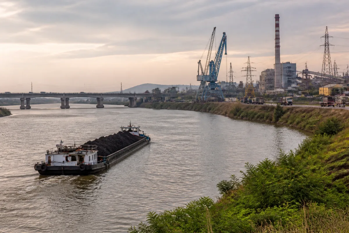
The latest push to expedite National Waterway-5 (NW-5) in Odisha shows that the proposed inland waterway is no longer defined only by dredging or navigation. Its progress will depend on whether the Centre and the state can coordinate land transfers, statutory clearances, water management, bridge works, electricity relocation, terminals and road links across a 332-km riverine corridor.
A high-level meeting chaired in the presence of Odisha Chief Secretary Anu Garg and Vijay Kumar, Secretary in the Union Ministry of Ports, Shipping and Waterways, reviewed the pending issues surrounding the project, according to Odisha Post. The meeting brought together industry stakeholders and senior officials from different departments as the state and Centre considered ways to move the project forward.
NW-5 is planned as a 588-km waterway extending across Odisha and West Bengal. The Odisha portion includes a 332-km riverine section from Talcher to Paradeep and Dhamra. The remaining 256 km is a canal section extending from Dhamra to Geonkhali in West Bengal. The project is currently awaiting approval.
That status is important. The meeting was not an announcement of an operational waterway, a completed terminal network or a confirmed cargo service. It was a review of the conditions that must be resolved before the project can progress. The stated objective is to strengthen the movement of cargo from Odisha’s mineral-rich hinterland towards major ports and support port-led industrial development, but the infrastructure required to achieve that objective remains under discussion.
The project’s geography connects several types of infrastructure that are usually administered separately. The proposed route begins at Talcher, an important industrial area in Odisha’s hinterland, and extends towards the coastal gateways of Paradeep and Dhamra before continuing through West Bengal. For the waterway to work as a logistics corridor, the navigable route must be supported by terminals, hydraulic structures, bridges, roads, power infrastructure and a dependable supply of water.
The meeting’s agenda therefore provides a clearer picture of the project’s real implementation challenge than the headline ambition alone. The Inland Waterways Authority of India, or IWAI, and the Odisha government must coordinate on land acquisition and land transfer for terminals and hydraulic structures. They must also determine how project assets will be maintained and clarify the state’s role in implementation and operation.
These are not secondary administrative details. A terminal cannot function without an identified site and legal control over the land. Hydraulic structures require statutory permissions, construction planning and long-term maintenance. Once built, the assets will need an agency responsible for upkeep and operations. The meeting’s focus on these issues indicates that the waterway’s delivery model has not yet been reduced to a simple construction schedule.
Water availability is another central constraint. The project must maintain the Least Available Depth, or LAD, needed for navigation. The source report does not specify the required depth, the proposed water-management arrangements or the seasonal performance of the route. It does, however, identify adequate water availability as a key issue discussed by the Centre and the state.
That places the waterway’s viability alongside its physical construction. A navigable corridor must provide sufficient depth not merely when conditions are favourable, but through the operating conditions for which it is designed. The source material does not establish how that requirement will be met, making water management one of the questions that will need to be addressed in the project’s approval and implementation process.
The Khalpal Navigational Lock was also listed among the project’s pending matters. A lock is a major piece of waterway infrastructure because it enables vessels to move between water sections with different levels. In the case of NW-5, the lock is part of a wider system of hydraulic works rather than an isolated structure. Its construction, operation and maintenance would have to be aligned with the navigational requirements of the route.
Bridges create a different kind of coordination problem. Existing crossings may need to be modified, while new bridge works could be required to accommodate navigation. The meeting also considered the construction and dismantling of bridges. This suggests that the waterway’s development will interact directly with road and other surface transport infrastructure already serving the corridor.
The same applies to power lines. The need to shift high-tension and low-tension lines shows that the proposed route and associated structures may conflict with existing utility networks. Relocating such infrastructure requires technical planning, approvals, funding and coordination with electricity agencies. Until those conflicts are resolved, construction activity around terminals, locks or other structures can face delays.
Last-mile road connectivity is another test of whether NW-5 can function as a logistics system rather than remain a navigable stretch on paper. Cargo transported by water must move between production areas, terminals and destinations. The meeting’s inclusion of road links indicates that the project’s intended industrial role depends on connections beyond the river and canal sections themselves.
This is particularly relevant to the stated aim of unlocking the industrial potential of Odisha’s mineral-rich hinterland. The source report does not provide projected cargo volumes, freight-cost estimates, vessel capacity, terminal numbers or a construction deadline. It therefore cannot establish the scale of the economic gains expected from NW-5. What it does establish is that the proposed corridor is being considered as a link between inland industrial activity and coastal ports, with supporting infrastructure required at multiple points along the route.
The institutional arrangement is equally significant. The discussions involved IWAI and the state government, but also senior officials from various departments and industry stakeholders. The range of issues indicates that responsibility will be distributed across agencies dealing with water transport, land, roads, bridges, utilities, clearances and industrial development. The state’s role in implementation and operation was specifically discussed, and the Chief Secretary assured the Centre of necessary support for the Odisha stretch.
That assurance is an administrative commitment, not a completion milestone. The project still awaits approval, and the source does not report that land acquisition, statutory clearances, terminal sites, bridge works or utility shifting have been completed. Nor does it state that the Odisha or West Bengal sections have entered construction. The next phase will depend on converting the issues identified at the meeting into decisions, approvals, responsibilities and funded works.
NW-5 is also being discussed alongside other strategic proposals. These include Bahuda Muhan Port, a proposed shipbuilding cluster in Kendrapada district and a cruise terminal at Puri. The meeting therefore placed inland navigation within a broader maritime and tourism agenda for Odisha. The source describes these proposals as intended to expand the state’s maritime and tourism potential, but does not provide their individual timelines, costs or approval status.
The combination of projects points to an infrastructure strategy that links waterways, ports, industrial facilities, shipbuilding and tourism. Yet each component has a distinct operating model. Cargo movement through NW-5 would depend on navigability and terminal connectivity; a shipbuilding cluster would require industrial land and supporting utilities; and a cruise terminal would depend on passenger infrastructure and tourism operations. The available information does not show whether these initiatives share a common implementation framework or are progressing at the same pace.
For cities and towns along the corridor, the immediate question is not only whether a waterway is built, but how its associated infrastructure is planned. Terminals and road connections can alter freight routes and local land requirements. Bridges and power-line relocation can affect existing transport and utility networks. The source does not provide a village-level impact assessment, land requirement, rehabilitation plan or local consultation record, so those dimensions remain unestablished in the current account.
The project also illustrates why inland waterways cannot be assessed through route length alone. The 588-km figure conveys the scale of NW-5, but route length does not reveal whether cargo can move reliably from origin to port. Reliability will be shaped by water depth, locks, terminal access, road links, bridge clearances, statutory approvals and asset maintenance. The meeting’s agenda brings those less visible conditions into view.
At this stage, the evidence confirms a renewed administrative push, a defined route structure and a set of unresolved implementation issues. It does not confirm final approval, construction completion, commercial operations or a delivery date. The next meaningful developments will be the project’s approval, decisions on land and clearances, the treatment of the Khalpal lock and bridge works, arrangements for maintaining navigable depth, and clarity on the agencies responsible for operation and maintenance.
Odisha’s promise of support gives NW-5 political and administrative momentum, but the waterway’s success will ultimately be measured by whether that support produces coordinated, functioning infrastructure from Talcher to the ports and beyond. Until the pending approvals and physical linkages are resolved, the project remains a proposed logistics corridor rather than an operational alternative for cargo movement.

