


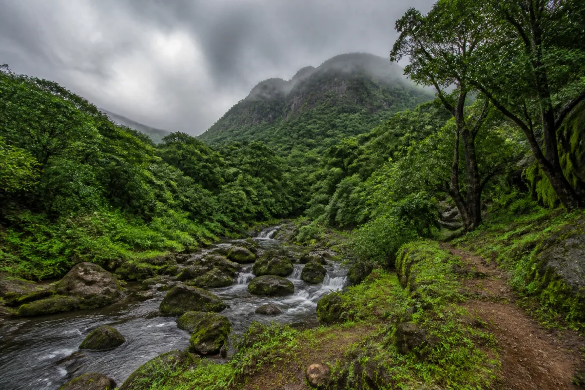
The reported declaration of the Bhorgiri Conservation Reserve in Pune district could create a protected ecological link between the Bhimashankar wildlife sanctuary and forest areas around Lonavala, Rajmachi and Tamhini. The decision, attributed to a meeting of the Maharashtra State Board for Wildlife held on 26 October, covers 35.64 square kilometres, or 3,564 hectares, according to a report by Lokmat – Pune.
The proposed reserve is significant because it places wildlife movement, water sources and tourism within the same conservation framework. The area includes parts of Khed and Ambegaon talukas and is described as covering habitats used by the Indian giant squirrel, leopard, sambar, barking deer, pangolin and tree frogs, along with rare orchids. It also includes the source areas of the Ghod and Bhima rivers, water sources around Kondhwal, Bhorgirigad fort and natural waterfalls.
The report says the state government’s decision is intended to connect wildlife movement routes associated with the Bhimashankar sanctuary and protect biodiversity across the Western Ghats landscape. This is more than a forest-protection measure in a narrow sense. By including river origins, streams, tourism sites and settlements within the reported reserve landscape, the decision brings ecological protection into direct contact with land-use decisions and local economic activity.
The administrative scale of the reported decision is notable. Lokmat – Pune says that the wildlife board decided to grant conservation-reserve status to 14 forests across Maharashtra at the meeting chaired by Chief Minister Devendra Fadnavis, who is also the board’s president. Three of those areas are in Pune district, with 87.41 square kilometres under the Pune forest division receiving conservation status. The Bhorgiri reserve is reported to account for 35.64 square kilometres of that area.
The conservation-reserve model described in the report differs from an approach based on removing residents from the landscape. The report specifically states that local residents’ land will not be acquired and that they will not be relocated. It also says that legally recognised traditional rights will continue. A management committee is expected to include representatives of local gram panchayats and villagers.
That local role will be central to whether the designation becomes an effective governance arrangement or remains only a formal protection status. The reported management structure places village institutions and residents inside the decision-making framework. It also indicates that conservation is being presented alongside sustainable tourism and traditional livelihoods rather than as a measure based only on restrictions.
The land-use controls mentioned in the report are substantial. Commercial-scale tree felling, mining, heavy industrial projects and land-use changes that damage the environment are expected to face restrictions within the reserve. These controls could affect how future economic activity is planned in a landscape where forests, water sources, farms, heritage sites and tourism destinations overlap.
The distinction between restricting damaging activity and prohibiting all local activity matters for the region’s settlements. The report says local residents will be encouraged to pursue sustainable, nature-based tourism and traditional livelihood activities. It does not provide details on the tourism model, visitor limits, infrastructure standards, revenue-sharing arrangements or the process by which local communities will participate in approvals and monitoring. Those details will determine how the reserve affects residents and visitors in practice.
The ecological logic of the designation is linked to landscape connectivity. Bhimashankar is not being treated as an isolated protected island in the reported decision. The proposed reserve is intended to provide a biological connection towards forest areas in Lonavala, Rajmachi and Tamhini. Such a landscape approach recognises that animals move beyond the boundaries of individual sanctuaries and that fragmented forest patches can be important for movement and habitat continuity.
The reported species list illustrates the range of habitats involved. The Indian giant squirrel, Maharashtra’s state animal, depends on connected forest cover. Leopards and ungulates such as sambar and barking deer use larger and varied habitats, while pangolins, tree frogs and orchids point to the importance of ground conditions, moisture and microhabitats. The inclusion of these species in the conservation rationale indicates that the area’s value is not limited to one flagship animal.
Water is another important part of the reserve’s urban and regional significance. The report identifies the source areas of the Ghod and Bhima rivers and water sources in the Kondhwal area. Protecting headwaters can influence downstream water security, although the supplied report does not quantify the populations, settlements or agricultural areas dependent on these rivers. It also does not provide hydrological data or a management plan showing how water protection will be implemented.
This lack of implementation detail is the main unresolved question surrounding the announcement. A formal conservation designation can set the direction for land-use management, but its effect depends on boundary maps, notification language, committee powers, enforcement capacity and coordination between forest officials, gram panchayats and other local authorities. None of those documents is included in the supplied material.
The report also contains an inconsistency that requires clarification before the exact geographical scope can be treated as established. It says the reserve includes 15 villages, with seven in Ambegaon taluka and areas in Khed taluka. However, the subsequent list names seven places in Ambegaon and nine villages or areas in Khed, while also referring to the Killa area and the source of the Ghod river. The total and the status of each listed location should be checked against the official notification and boundary map.
That verification is important because conservation boundaries affect more than forest administration. They can determine where mining, tree felling, construction, industrial activity and tourism infrastructure face additional controls. They can also shape the responsibilities of local bodies and the expectations of residents whose customary or legally recognised rights are said to continue.
The Bhorgiri decision therefore sits at the intersection of biodiversity protection, rural governance and regional infrastructure planning. The source report presents it as a way to protect wildlife corridors, water systems and natural tourism assets without land acquisition or displacement. The available evidence supports the existence of a reported government decision and identifies its broad objectives, but not yet the complete administrative framework.
The next important documents are the formal notification, the mapped boundaries, the management committee’s terms and the rules governing local tourism and livelihoods. Until those details are available, the reported reserve should be understood as a significant conservation announcement whose exact village coverage and implementation arrangements remain to be confirmed.

