


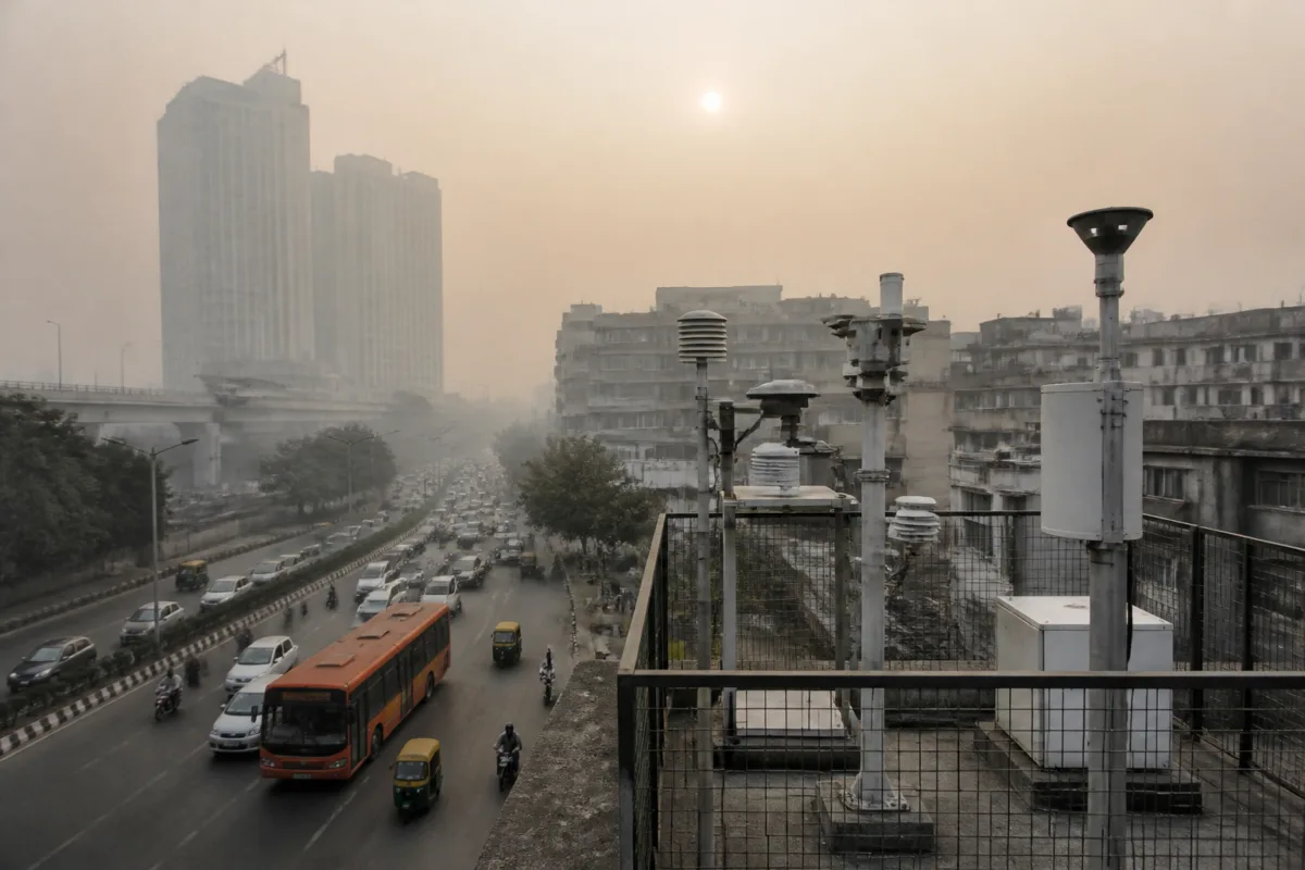
Delhi-NCR is preparing a new map of its pollution sources at a level of detail that previous assessments could not provide. The high-resolution emissions inventory and source apportionment study, now being carried out across Delhi and 27 National Capital Region districts, is intended to show not only how much pollution is being generated, but where it is coming from, how sources vary by season and how pollution moves across administrative boundaries.
That distinction matters because Delhi’s air-quality response has often depended on estimates drawn from different studies, methodologies and base years. The new exercise is an attempt to create a common evidence base for the region’s next phase of pollution control. It will use a 500-metre by 500-metre grid, activity data, emission factors, satellite imagery, geographical information and field verification. Its findings are expected to be analysed by mid-2027, with scenarios prepared for 2030, 2035 and 2040.
The immediate institutional question is whether a more precise inventory can help government agencies move from broad source categories to targeted interventions. Delhi’s pollution is not generated by a single activity or contained within a single municipal boundary. Vehicle movement, industrial activity, road dust, waste management, construction and agricultural activity can operate across different jurisdictions and change in importance according to location and season. A map that identifies these variations could change how responsibilities are assigned and how pollution-control measures are evaluated.
The study is being led by the Automotive Research Association of India in Pune, in association with IIT-Delhi, the Energy and Resources Institute and the Indian Institute of Tropical Meteorology in Pune. The Central Pollution Control Board is funding the project, while the Commission for Air Quality Management developed the framework for emissions inventory and source apportionment in April 2025. CAQM member technical SD Attri is heading the project review committee monitoring its progress.
The design reflects an effort to address weaknesses in earlier assessments. The first attempt to develop an emissions inventory for Delhi was undertaken by the CPCB during 2007-2010 as part of a six-city exercise. Delhi later received a source apportionment study from IIT-Kanpur in 2016, followed by an ARAI-TERI study in 2018. The supplied report notes that these assessments differed in methodology, geographical coverage, source-sector classification and base years. Those differences make direct comparisons difficult, particularly when policymakers want to determine whether a change in pollution levels reflects real progress or a change in the way emissions were counted.
A common framework does not eliminate the difficulty of measuring urban pollution, but it can make the results more comparable. The current study will cover particulate matter smaller than 10 micrometres, fine particulate matter known as PM2.5, nitrogen oxides, sulphur dioxide, carbon monoxide, non-methane volatile organic compounds and ammonia. It will also include elemental carbon, organic carbon, methane and hydrogen chloride. The broader pollutant list is important because different sources produce different combinations of pollutants, and the same source may require different controls depending on the pollutant being addressed.
The grid-based approach is intended to make the inventory operational at the scale where interventions occur. Each 500-metre cell covers 0.25 square kilometres. Attri said the resolution would help identify emission hotspots and distinguish areas with different source profiles. That could allow agencies to separate a road-dust problem from an industrial-emissions problem, or identify locations where traffic patterns and vehicle categories are more important than surrounding land uses.
The planned methods show why an emissions inventory is more than a table of pollution shares. Vehicular emissions will be estimated using road networks, traffic volumes, vehicle categories and activity patterns. Industrial estimates will use information on industrial locations, production, fuel consumption and pollution-control equipment. Road-dust estimates will require road characteristics, silt loading and related activity patterns. Each of these inputs depends on the quality and freshness of the underlying urban data.
This is also why the study includes field verification. The report says teams are being deployed to check smaller sites and improve the identification of sources, alongside artificial-intelligence-based mapping using satellite imagery. Satellite data can help locate and classify sites across a large region, but ground checks are necessary when the goal is to identify how a particular facility, road or activity contributes to emissions. The combination is intended to reduce the risk of relying only on modelled or remotely observed information.
The study’s geographical scope is another important change. It covers Delhi and 27 NCR districts and will extend into the wider north Indian domain to examine regional transport. Pollution that is measured in Delhi may partly originate outside the capital, while activities within Delhi can affect neighbouring districts. A city-focused response can therefore miss the movement of pollutants across the region. The proposed framework treats the NCR and its surrounding air shed as connected, even though governance remains divided among states, districts, municipalities and specialised agencies.
That institutional mismatch has shaped the limits of earlier decision-support systems. IITM’s Decision Support System estimates the contribution of local and regional sources to Delhi’s winter PM2.5, but the report says the system relies on a 2021 emissions inventory and is not accurate enough for the current purpose. The new inventory is expected to be incorporated into the system once it is prepared. This creates a direct link between data production and daily policy support: the value of the new study will depend partly on whether its findings are integrated into the tools used during pollution episodes.
The proposed scenario assessments extend the study beyond a snapshot of current emissions. The project is expected to model different mitigation pathways for 2030, 2035 and 2040. These scenarios are intended to show how emissions and air quality could change under different conditions and provide a scientific basis for long-term pollution-control planning, according to Attri. The scenarios will not be a substitute for implementation, but they can give agencies a common framework for comparing possible interventions.
The policy context has already changed in some sectors. Attri said coal has been banned in the NCR except for specified processes and that industries have shifted to cleaner fuels. The new inventory is intended to test how such changes have affected the relative contribution of different sources, alongside changes in vehicle technology, fuel standards, industrial practices, pollution-control measures, urban development, waste management and agricultural activity. In other words, the study is designed to examine whether regulatory action has changed the pollution mix, not simply whether pollution remains high.
This is a crucial distinction for urban governance. A measure can succeed in reducing emissions from one source while another source becomes more prominent because of growth, seasonal conditions or improved measurement. If agencies continue to use older source profiles, they may direct resources towards yesterday’s dominant problem. A current inventory can help establish whether the policy priority should be vehicles, industry, dust, waste, regional transport or a combination that varies by location and season.
The proposed real-time source-apportionment super-sites are intended to complement the inventory. IITM’s super-site at New Rajendra Nagar was inaugurated on the Saturday before the report, while the Delhi Pollution Control Committee’s super-site at Rouse Avenue is to be revived. Four more have been proposed at Sonipat, Rohtak and Rewari in Haryana and Greater Noida in Uttar Pradesh. A network distributed across the NCR could provide more continuous evidence of changing source contributions than a single location in Delhi.
The number and location of these monitoring sites matter because the study’s central challenge is spatial as well as temporal. A pollution source identified in central Delhi may not explain conditions in an NCR district, and a winter estimate may not represent the source mix during other parts of the year. The inventory will run from January 1 to December 31, allowing the assessment to capture seasonal changes. This full-year design is intended to produce a more complete picture than a study limited to a particular pollution episode.
The central urban question is whether Delhi-NCR can turn better information into coordinated action. The administrative system has multiple agencies with separate responsibilities, while the air shed crosses state and local boundaries. The new study can clarify where emissions are concentrated and how they move, but the supplied material does not establish how its findings will be translated into enforceable targets for individual agencies, districts or sectors.
What is established is that the region is building a new evidence base with finer geographical resolution, a wider pollutant list, year-round data collection and a regional scope. What remains to be seen is whether the inventory becomes a regularly updated foundation for pollution-control decisions, rather than a one-time technical report. Its next formal milestones are the completion of the annual study period, analysis by mid-2027, preparation of the 2030, 2035 and 2040 scenarios, and the proposed expansion of real-time source-apportionment monitoring across the NCR.

