


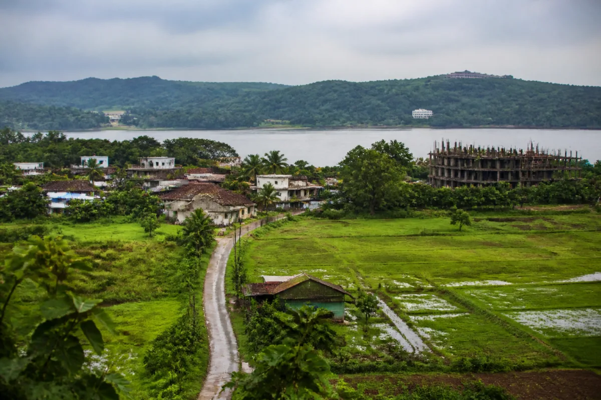
The opposition to Bambolim’s inclusion in the North Goa Planning and Development Authority’s planning areas is not simply a disagreement over an administrative notification. It is a contest over who gets to define the future of a village where agricultural land, traditional fishing areas, hills and biodiversity now sit alongside pressure from construction and urban expansion.
A gram sabha of the Curca-Bambolim-Talaulim panchayat unanimously opposed the inclusion at a recent meeting, according to a report by Times of India – Goa. Residents from Bambolim, Nauxi and surrounding areas said the decision had been taken without a study of infrastructure availability or environmental impact. They also argued that the village’s carrying capacity had already been exceeded.
The immediate trigger was a government notification announcing the appointment of Rohit Monserrate as chairman of the reconstituted NGPDA, with Bambolim listed as one of its planning areas. The notification, as described in the report, generated strong local opposition. The gram sabha’s response indicates that the dispute is centred not only on the identity of the authority but also on the consequences of bringing a landscape under a wider planning framework without first establishing what it can support.
That distinction is important. Planning-area inclusion can shape how development proposals are assessed and coordinated, but the report does not specify the precise powers, land-use provisions or approval procedures that will apply to Bambolim under the reconstituted authority. What it does establish is that residents believe the administrative change could accelerate or legitimise development in a settlement where infrastructure and ecological limits are already under strain.
The local objections are rooted in changes residents say have already taken place. Villagers told the gram sabha that illegal construction had wiped out parts of the hilly and agricultural landscape and placed additional pressure on infrastructure. The report does not identify the number, location or enforcement status of these constructions, nor does it provide an official response to the allegations. That absence is itself significant: a planning decision affecting land use cannot be properly assessed without a public record of existing development, infrastructure capacity and violations.
The dispute also has a documented history. Residents had submitted memoranda to the government in 2017 and 2018 and had passed resolutions opposing the proposed inclusion on several occasions. One memorandum described the proposal as arbitrary and undemocratic, arguing that the local body had not been properly informed and that no adequate study had been carried out. The continuity of these objections challenges any suggestion that the gram sabha’s opposition is a reaction limited to the latest notification.
The earlier resistance also reached the Greater Panaji Planning and Development Authority. Then MLA Francis Silveira and sarpanch Maria da Cunha resigned as members of that authority in 2018 while opposing the inclusion, according to the report. The episode shows that the question has previously crossed the boundary between a local land-use dispute and a wider debate over the appropriate scale of planning administration in the Panaji region.
Bambolim’s physical character is central to the disagreement. The village area is described as containing largely pristine agricultural land, traditional fishing areas and verdant hills with rich biodiversity. These are not interchangeable parcels waiting to be absorbed into an urban land market. They are also working landscapes and ecological systems. Any change in planning status therefore has implications beyond construction permissions: it can affect farming, fishing, drainage, access, slopes, habitat and the relationship between settlements and the Zuari river.
A memorandum cited in the report states that fisheries scientists had documented 300 fish species in the Zuari river. The source does not name the researchers, provide the study date or explain the methodology, so the figure requires careful attribution rather than being treated as independently verified in this report. Even with that limitation, the claim reveals what residents see as being at stake. The argument is not only that development may alter scenery, but that it could affect a river-based ecological and livelihood system.
The language of carrying capacity is similarly important but remains undefined in the available material. The memorandum says the village’s carrying capacity has been exceeded, yet neither the memorandum nor the reported gram sabha discussion provides figures for water supply, roads, drainage, waste management, traffic, housing growth or construction density. Without such information, the phrase cannot by itself establish the scale of the problem. It does, however, identify the central question that the government would need to answer before proceeding: what infrastructure and environmental thresholds are being used to judge whether Bambolim can absorb further development?
That question exposes a recurring weakness in planning disputes. Administrative boundaries can be changed through notifications, but the physical systems governed by those boundaries do not change at the same speed. Roads, slopes, river systems, agricultural plots, fishing grounds and village infrastructure continue to function as connected systems. If the planning authority expands its area without a publicly available assessment of those systems, residents are left to infer the consequences from construction activity already visible on the ground.
The report gives no details of a government infrastructure audit, environmental impact assessment or carrying-capacity study conducted before the proposed inclusion. It also does not report a response from the NGPDA, the state government or the authority responsible for the notification. These gaps prevent a definitive assessment of whether the government has complied with a specific statutory requirement. They do establish that the local community says it was not adequately apprised and that the evidence used to justify inclusion has not been made clear in the reported discussion.
This is where the institutional issue becomes more important than the notification itself. A planning authority is expected to provide a framework for deciding how land is used and how development is coordinated. A gram sabha, meanwhile, provides a forum through which local residents and the village-level body can record objections and concerns. The Bambolim dispute places these two forms of decision-making in direct tension: regional planning authority on one side, and local knowledge and consent claims on the other.
The available report does not establish that a gram sabha resolution automatically determines the legal outcome of the planning decision. Nor does it establish that the proposed inclusion will inevitably lead to more construction or ecological damage. Those conclusions would require the relevant notification, planning documents, statutory provisions and official responses. What can be said is that the legitimacy of the process is now part of the planning question. Residents are asking not only what the authority will do, but how the decision was reached and what evidence supports it.
The history cited by the report also raises questions about administrative memory. Objections were recorded in 2017 and 2018, yet the issue has resurfaced with the reconstitution of the NGPDA and the renewed identification of Bambolim as a planning area. The material available does not explain whether earlier objections were accepted, rejected or formally addressed. That missing institutional record matters because repeated local resolutions without a visible response can deepen distrust, while unresolved planning proposals can remain active for years without a clear public status.
For the government, the immediate challenge is therefore evidentiary. It would need to clarify the legal basis and scope of Bambolim’s inclusion, publish the relevant planning material, and explain whether infrastructure and environmental studies were conducted. It would also need to respond to the specific concerns recorded by the gram sabha, including illegal construction, pressure on infrastructure, biodiversity loss and effects on traditional fishing livelihoods. The supplied report does not say whether any such response has been issued.
For residents, the dispute is about the cumulative effect of decisions that may each appear manageable in isolation. A building, road change or land-use approval may not by itself transform a village. But when agricultural land, hills, river edges and traditional livelihood areas are considered together, the question becomes whether the planning system can account for cumulative pressure rather than assess each proposal separately. The report does not provide enough project-level data to measure that cumulative impact, but the objections are explicitly framed around it.
Bambolim’s case also shows why “development” and “conservation” cannot be treated as separate planning files. The residents’ concerns combine illegal construction, infrastructure stress, biodiversity and livelihoods. These are linked through land-use decisions. A loss of agricultural or hilly land can alter drainage and access; construction pressure can increase demands on roads and other services; changes near the river can affect fishing areas. The source does not quantify these relationships, but the gram sabha’s objections place them within one connected argument.
The evidence currently confirms three things. First, the government has announced the reconstitution of the NGPDA and identified Bambolim as a planning area. Second, the local gram sabha has unanimously opposed the inclusion and says no adequate infrastructure or environmental assessment was carried out. Third, opposition has a history extending back to memoranda and resolutions in 2017 and 2018. What remains unclear is the authority’s detailed rationale, the legal and planning consequences of inclusion, the status of earlier objections, and whether any carrying-capacity assessment exists.
Those unanswered questions will determine whether Bambolim’s inclusion becomes a negotiated planning exercise or another unresolved conflict over urban expansion. Until the relevant studies, planning documents and official responses are placed in the public domain, the dispute will remain less about a single notification than about whether Goa’s planning system can demonstrate that growth decisions are based on evidence, infrastructure capacity and meaningful local participation.

