


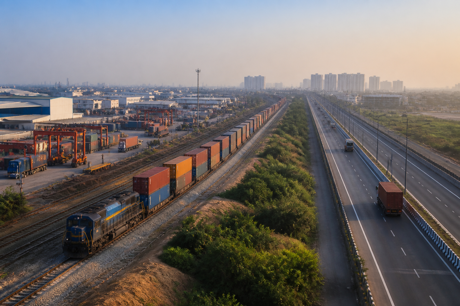
The proposed NCR industrial-logistics ring is not simply a plan to add warehouses around Delhi. It represents an attempt to reorganise how the National Capital Region manufactures, stores and moves goods by linking industrial districts, freight rail, expressways, airports and inland logistics facilities into one regional system. The proposal, outlined in the draft NCR Regional Plan-2041, places the Central NCR and particularly the Gurugram-Manesar-Bawal belt at the centre of that transformation.
The plan’s significance lies in the way it treats logistics as an urban-planning question. Warehouses, container terminals and freight hubs are often developed as isolated commercial uses, with their effects appearing later as truck traffic, land-price escalation, road congestion and pressure on surrounding settlements. The draft proposal instead seeks to give warehousing and logistics an industrial-activity status and reserve land for intensive industrial-logistics development and urban regeneration. That would make land-use classification a central instrument of the region’s economic strategy.
According to the report by Live Hindustan, the proposed network would include modern warehouses, logistics parks, dry ports, inland container depots, air-cargo terminals and multimodal freight hubs. The stated objective is to connect manufacturing, storage, road freight, airports, expressways and dedicated freight rail rather than treat each piece as separate infrastructure. Gurugram is being positioned as the principal centre, with links to Jhajjar, Sonipat, Charkhi Dadri, Ghaziabad, Gautam Buddh Nagar, Bulandshahr, Baghpat and Alwar.
That geography is important. Delhi remains the dominant economic and administrative centre, but much of the land-intensive activity that supports the capital has already moved into surrounding districts. The draft plan appears to formalise this regional pattern by creating a ring of production and distribution around Delhi. The proposal describes Central NCR as a “ring of opportunity”, but its practical test will be whether freight-intensive growth can be accommodated without reproducing the congestion and land-use conflicts that already affect the capital region.
The physical foundation for the proposal is partly in place. The report states that the 1,506-kilometre Western Dedicated Freight Corridor between Jawaharlal Nehru Port Trust and Dadri is operational. It also reports that more than 443 freight trains are running daily on the Eastern and Western Dedicated Freight Corridors, while double-stack container trains have increased the speed of freight movement. These figures indicate that the logistics ring is being planned around a rail-freight system that has already moved beyond the proposal stage.
However, a freight corridor by itself does not create an integrated logistics economy. Goods still require terminals where containers can be transferred, roads that can handle the last leg of movement, electricity and land with the correct permissions, and urban areas capable of supporting workers and related services. The proposed network therefore depends on the connections between national infrastructure and local land-use planning. A corridor can improve long-distance movement while leaving local bottlenecks unresolved if industrial estates, access roads and terminal capacity do not develop together.
The proposed integrated multimodal logistics hub at Nangal Chaudhary illustrates this connecting role. Under the Delhi-Mumbai Industrial Corridor, a hub is being developed across approximately 886 acres in Haryana’s Mahendragarh district. The report says a locomotive trial was completed on the project’s tracks in June 2026 and that external road, power and rail connectivity work has also been completed. These details suggest that the hub is intended to connect Haryana’s industrial areas directly with the wider freight system rather than depend entirely on road transport to reach distant terminals.
The Gurugram-Manesar-Bawal belt is expected to carry a particularly large share of this activity. The draft plan identifies the belt as a key component of the wider system and proposes inland container depots, container freight stations and integrated freight complexes. Its existing industrial significance makes the location logical, but concentration also creates an administrative challenge. Freight movement crosses municipal, district and state boundaries, while planning permissions, roads, utilities and enforcement remain distributed among multiple institutions.
The proposal to classify warehousing and logistics land as industrial activity is therefore more consequential than a technical change in terminology. The report says the change is intended to reduce land costs and make freight movement in the NCR more globally competitive. But industrial classification can also change where logistics facilities are permitted and how quickly land is converted. The eventual impact will depend on the detailed regulations attached to the classification, including the location of facilities, access standards, utility provision and safeguards for existing settlements. Those details are not established in the supplied report.
The plan also proposes greenfield and brownfield townships within the area around the Eastern and Western Peripheral Expressways. New townships would be developed in previously undeveloped areas, while older areas would be redeveloped. The stated purpose is to reduce traffic pressure and congestion inside Delhi while creating centres of industrial and knowledge-based growth. This is a significant shift from treating peripheral urbanisation as spillover from Delhi. Under the proposal, towns around the capital would be expected to function as planned economic nodes in their own right.
That approach brings the relationship between freight and housing into focus. Industrial and logistics employment requires workers, services and affordable access, but the source material does not provide details of housing provisions, public transport or social infrastructure for the proposed townships. Without those components, decentralising freight may not necessarily decentralise opportunity. It could instead produce longer daily commutes between employment zones and residential areas, particularly if growth is organised around expressways rather than public transport.
The proposed role of Noida International Airport adds an air-freight layer to the network. The report states that the airport is being developed with first-phase investment of Rs 11,200 crore and that its multimodal cargo hub is expected to handle 2.5 lakh metric tonnes of cargo annually in the initial phase. A 31.42-kilometre corridor costing Rs 3,630 crore is also being built to connect the airport with South Delhi, Faridabad and Gurugram.
These numbers show the intended scale of the airport’s economic role, but they also underline the need for integration. Air cargo is only one part of a larger supply chain. The airport must connect efficiently with road and rail terminals, manufacturing clusters and distribution centres. If those links are weak, the cargo hub could function as a standalone facility rather than as the multimodal anchor described in the plan. The report establishes the proposed capacity and connectivity projects, but does not provide operating forecasts or information on the institutions responsible for coordinating them.
The draft NCR Regional Plan-2041 is therefore best understood as an attempt to shift the region from project-by-project infrastructure development towards a coordinated freight geography. Its key elements—dedicated freight rail, logistics hubs, industrial land, peripheral townships, airport cargo and expressway access—are mutually dependent. The success of one component will affect the utility of the others. A rail line without terminals, a cargo airport without surface connectivity or a logistics park without planned urban services would leave the regional system incomplete.
The larger urban question is whether the NCR can absorb this economic expansion without allowing logistics-led development to become another source of unplanned sprawl. The proposal’s language of industrial and knowledge-based townships indicates an ambition broader than freight handling. Yet the available information does not establish how land acquisition, environmental management, local governance, worker housing, public transport or municipal service delivery will be handled. These are not peripheral concerns; they determine whether a logistics ring becomes a connected regional economy or a chain of high-intensity enclaves.
What the evidence confirms is that the NCR already has several major pieces of a freight network: operational dedicated freight corridors, emerging multimodal hubs, peripheral expressways and a planned international airport cargo system. The draft plan seeks to combine them through land-use reform and regional spatial planning. What remains uncertain is the implementation framework, the final status of the proposal and the safeguards that will govern urban expansion. Those details will determine whether the proposed ring reduces pressure on Delhi or simply moves the region’s congestion and land-use conflicts outward.
