


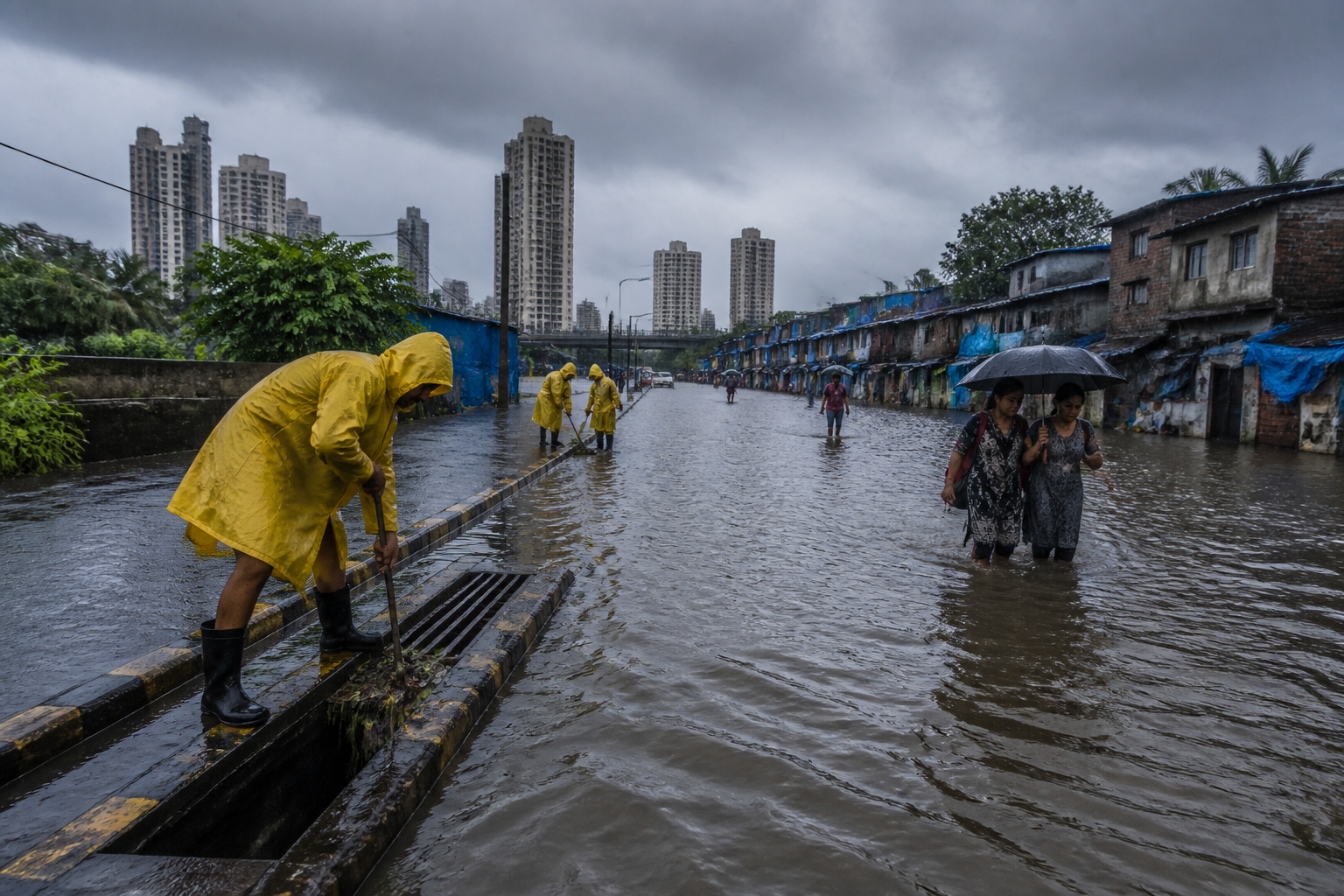
Mumbai flood management has gained an international platform as the Brihanmumbai Municipal Corporation presented its measures for improving the city’s disaster resilience at a forum in Incheon, South Korea. The presentation placed Mumbai’s flooding challenge alongside rising temperatures, intense rainfall, landslide-prone areas and densely populated coastal settlements—risks that increasingly overlap in the city’s most vulnerable urban spaces.
The presentation was made by Abhijit Bangar, the BMC’s additional municipal commissioner for projects, at the sixth International Disaster Resilience Leadership Forum held in Incheon on 7 and 8 September. The forum was organised jointly by Incheon Metropolitan City, the United Nations Office for Disaster Risk Reduction’s Northeast Asia office and the Incheon Institute. Representatives from more than 30 countries, international organisations and experts participated in the event.
Bangar spoke during a session on metropolitan-level engagement and communication, where he outlined Mumbai’s exposure to urban flooding and the municipal corporation’s preparedness measures. According to the report, the BMC also presented a flood-management plan and an artificial-intelligence-based early-warning system. The supplied account does not provide technical details of the system, its operating area, the data it uses, its alert protocols or any assessment of its performance.
That absence is significant because the central challenge for Mumbai is not only whether warnings can be generated. It is whether warnings can reach residents in time, whether local agencies can act on them, and whether the physical environment gives people a realistic chance of moving to safety. The available figures show that the city’s disaster exposure is shaped by a combination of climate conditions, terrain, settlement patterns and infrastructure pressure rather than by rainfall alone.
Bangar cited a rise in Mumbai’s annual average temperature between 1973 and 2020. The increase was estimated at an average of 0.25 degrees Celsius per decade. While this figure does not by itself establish how individual rainfall events will change, it indicates a long-term warming trend in the metropolitan environment. Higher temperatures can intensify the stress placed on buildings, roads, drainage systems and public services, especially when extreme weather events occur in quick succession.
The municipal presentation also stated that Mumbai receives more than 100 millimetres of rain on approximately 16 days each year. A rainfall threshold of this magnitude is important for a city where large sections are highly built-up and where the ability of water to flow, drain and be temporarily stored depends on engineered systems as well as natural channels. The supplied report does not state whether the number of such days has increased over time, nor does it provide ward-level comparisons or drainage-capacity figures.
Mumbai’s flood risk also intersects with its topography. The city has 249 landslide-prone areas, according to the figures presented at the forum. Landslides create a distinct but connected disaster-management challenge. Intense rainfall can affect slopes, roads, homes and access routes simultaneously, making evacuation and emergency response more difficult. A warning system that focuses only on water levels would not address the full range of hazards faced by communities living near unstable slopes.
The population distribution around flood-prone areas adds another layer to the problem. About 35 per cent of Mumbai’s total population lives within 250 metres of flood-prone zones, according to Bangar’s presentation. This is a measure of proximity rather than a direct estimate of the number of people who will be affected in every flood. Even so, it shows how closely urban settlement and hazard exposure are connected in Mumbai. Flood risk is not confined to isolated infrastructure assets; it exists close to a substantial share of the city’s residents.
The BMC also identified more than 50 densely populated settlements along the coastline as increasing Mumbai’s disaster risk. Coastal exposure can combine with heavy rainfall, flooding and disruption to transport or utilities. The supplied report does not specify the names of these settlements, their population, the extent of their protective infrastructure or the responsibilities of different public agencies within them. Those details would be necessary to assess how the city’s preparedness measures translate into neighbourhood-level protection.
The figures presented in Incheon point to a governance problem that extends beyond the municipal corporation’s drainage operations. Mumbai’s risk landscape includes rainfall management, slope safety, coastal settlements, emergency communication and land-use decisions. These functions may involve multiple authorities, but the report does not set out the institutional division of responsibilities or the funding arrangements behind the BMC’s resilience measures.
That institutional question matters because disaster resilience is often discussed through individual projects—drains, pumping stations, retaining structures, sensors or warning platforms—while residents experience the combined effect of many systems. A flood warning may be accurate but ineffective if roads are already impassable. A drainage upgrade may reduce waterlogging in one location without addressing runoff from adjoining areas. A landslide alert may not protect households if safe evacuation routes and temporary shelters are unavailable.
The reference to an artificial-intelligence-based early-warning system raises similar questions. The source material establishes that such a system was presented, but it does not explain whether it is operational across Mumbai or still under development. It does not identify the authority responsible for issuing alerts, the communication channels used, the languages or formats of messages, or the arrangements for residents who may not receive digital notifications. These are not peripheral details; they determine whether technology becomes a public-safety service or remains an administrative tool.
The international setting gives Mumbai an opportunity to compare its experience with other cities, but the supplied account does not report any comparison or commitment emerging from the forum. There is also no evidence in the report of a new funding announcement, a revised municipal policy, a project completion date or a binding decision by participating institutions. The event therefore appears to have functioned primarily as a platform for presenting Mumbai’s risk profile and preparedness approach rather than as a new implementation milestone.
What the available data confirms is the scale and proximity of the challenge. A warming trend, repeated episodes of very heavy rainfall, 249 landslide-prone areas, a population concentration near flood-prone zones and more than 50 densely populated coastal settlements together describe a city where multiple hazards overlap with high-density urban life. What the data does not establish is how much existing measures have reduced risk, which areas remain most exposed, or whether the proposed early-warning arrangements have been tested during major events.
For Mumbai, the larger urban question is whether resilience can be organised at the same metropolitan scale as the risk. The city’s hazards do not respect departmental boundaries or stop at the edge of a single project area. Effective preparedness would require clear responsibilities, reliable communication and coordination between physical infrastructure and emergency action. The Incheon presentation brings these issues into view, but it does not by itself demonstrate that they have been resolved.
The next meaningful evidence will come from implementation: the operational status of the BMC’s flood-management plan, the functioning and coverage of the AI-based warning system, and the measures directed at landslide-prone and coastal settlements. Until those details are publicly established, the international presentation is best understood as a statement of Mumbai’s exposure and preparedness agenda—not as proof that the city’s underlying disaster risks have been reduced.
