


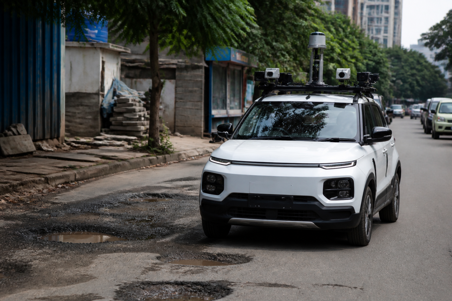
Bengaluru South municipal authorities have begun piloting an artificial intelligence-enabled vehicle system to identify road and public-space problems, including potholes, garbage piles, footpath encroachments, construction waste, dangerous overhead cables and damaged manholes. The vehicle uses cameras and GPS to capture conditions on the road, analyse them and automatically generate complaint tickets for the relevant officials.
The pilot covers about 75 kilometres of roads within a municipal jurisdiction that contains 311 roads, according to a report by Vijay Karnataka quoting Bengaluru South municipal commissioner K.N. Ramesh. If the trial produces the expected results, the system is intended to be expanded across all roads under the civic body’s control. The reported plan marks a shift from a system that depends primarily on citizen complaints towards one in which the municipality attempts to identify visible failures on its own.
That shift is significant because many urban maintenance problems are not difficult to see. A pothole, a mound of waste, a blocked footpath or a damaged manhole is often apparent to people using the road every day. The institutional difficulty lies elsewhere: recording the problem accurately, assigning it to the right department, ensuring that it is acted upon and establishing that the work has actually been completed. The proposed system is designed to connect those stages through a digital trail.
The technology itself is not presented as a substitute for municipal engineering or field inspection. The vehicle would capture images and video while travelling through selected roads. The AI system would then identify specified categories of problems and attach each detection to a GPS location. That information would be entered automatically into a complaint-ticket system and forwarded to the assistant executive engineers of the relevant wards and to the login systems of the departments concerned.
The reported workflow is important. Once an officer visits the location and resolves the issue, photographs taken before and after the work are to be uploaded before the ticket is closed. In principle, this creates a record not only of the complaint but also of its location, responsible authority, action taken and claimed outcome. The quality of that record will determine whether the pilot becomes a meaningful accountability mechanism or simply another layer of digital reporting.
The current pilot is limited in scale. The authorities have selected roughly 75 kilometres from the 311 roads in the municipal area for the initial survey. The supplied report does not state the total length of all roads, the number of vehicles being deployed, the technology provider, the frequency of surveys or the number of issues detected so far. It also does not provide a timetable for evaluating the pilot. Those details will matter in assessing whether the system can operate consistently beyond the initial test area.
The choice of problems to be detected reflects the everyday complexity of Bengaluru’s public realm. Potholes are associated with road safety and maintenance. Garbage piles and construction debris concern sanitation and enforcement. Footpath encroachments affect pedestrian access. Dangerous cables and damaged manholes create distinct risks involving utilities and public infrastructure. These issues may fall under different departments or agencies, meaning that detection alone will not resolve the coordination problem.
The commissioner’s reported comments also indicate that the system could eventually be used for purposes beyond road maintenance. The municipality is considering its use in identifying property-tax issues and violations of building regulations. The cameras may also record ground-floor premises that have been converted from mandatory parking areas into commercial shops, as well as unauthorised stalls, advertising boards and electricity poles occupying or obstructing footpaths.
This proposed expansion raises a central question about the role of automated observation in municipal governance. A vehicle moving through the city can potentially create a more regular record of public conditions than sporadic inspections. But the meaning of an image is not always self-evident. A camera may identify an obstruction, a damaged surface or a pile of waste, while the legal status, ownership, cause and appropriate remedy may require an officer’s assessment. The system can flag a condition; it cannot, by itself, settle every administrative question attached to it.
The pilot therefore appears to be testing two systems at once. One is a detection system that uses cameras, GPS and AI analysis. The other is a response system that assigns tickets to officials and requires photographic evidence before closure. The second system may be more consequential. If tickets are created faster than departments can investigate and resolve them, the municipality could accumulate a larger inventory of unresolved problems. If tickets are closed without adequate field verification, the digital record could create an appearance of responsiveness without improving conditions on the ground.
The reported use of before-and-after photographs is intended to address that risk. It provides a basic means of comparing the condition that generated the ticket with the condition after intervention. However, the supplied material does not explain who will verify the photographs, whether residents can see the ticket status, whether repeated failures at the same location will be tracked or what happens when the responsible department disputes the classification. Those unanswered questions are central to whether the system will improve accountability.
The initiative also places attention on the boundaries of municipal responsibility. A road may be maintained by one authority, a footpath occupied by a private or informal enterprise, a cable controlled by a utility agency and a waste pile created by a contractor or nearby property. The report says that tickets will be sent to the relevant officials and departments, but it does not identify the escalation process when responsibility is shared or contested. A technology platform can route information, but institutional rules must determine who is ultimately answerable.
The numbers available in the report provide a limited but useful baseline. The municipality has 311 roads in its jurisdiction and is beginning with a 75-kilometre survey area. The pilot will therefore test the system on a defined portion of the network before any proposed citywide expansion. No evidence is supplied yet on detection accuracy, response times, the number of tickets issued, the proportion resolved or the cost of operating the system. Without those measures, it is not possible to conclude whether AI-based inspection is more effective than existing methods.
The initiative is also notable because it reframes public complaints. Under a conventional complaint-led model, the municipality may learn about a problem only after a resident reports it. The proposed system is intended to generate tickets without waiting for citizens to complain. That could help identify problems affecting people who have limited access to complaint platforms or who have stopped using them because previous complaints were not resolved. It could also produce a more systematic picture of maintenance conditions across roads that receive less public attention.
At the same time, automated surveys should not make citizen reporting less important. Residents may identify hazards that a moving vehicle cannot detect, such as recurring flooding, blocked access to a particular building, unsafe conditions at a specific time of day or defects concealed by traffic and parked vehicles. The reported plan focuses on proactive detection, but its effectiveness will depend on how it interacts with existing public complaint channels rather than whether it replaces them.
For Bengaluru South, the next stage is the evaluation of the 75-kilometre pilot. The reported expansion to all roads is conditional on the system delivering the expected results. That makes the definition of success especially important. It should include more than the number of images captured or tickets generated. The relevant measures would concern the accuracy of detection, the time taken to assign and resolve problems, the quality of completed work and whether the same defects recur. The supplied report does not say whether such indicators have already been established.
What the announcement confirms is that Bengaluru South is testing a municipal model in which road conditions are surveyed continuously or repeatedly, defects are geo-tagged and departmental action is digitally recorded. What remains uncertain is how accurately the technology will identify problems, how authorities will handle disputed responsibility and whether the ticket system will produce measurable improvements in public spaces. The pilot’s results, its evaluation process and any decision to extend the system beyond 75 kilometres are the developments that will determine whether this becomes a functioning accountability framework or only a new method of documenting civic complaints.
