


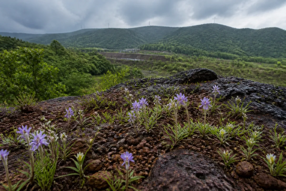
A new checklist of 305 geophyte plant species in the Northern Western Ghats and Konkan does more than expand the region’s botanical record. It shows how much ecological value is concentrated in small, difficult-to-replace habitats that are increasingly exposed to mining, infrastructure projects, renewable energy installations and other land-use changes. The study, led by researchers from Pune’s Agharkar Research Institute, identified 81 species found nowhere else in the world.
Geophytes survive unfavourable seasons through underground organs such as bulbs, corms, tubers and rhizomes. Their above-ground growth may disappear during the dry season, but the plants remain alive beneath the soil and resume growth when conditions improve, particularly during the southwest monsoon. This survival strategy is central to understanding why the region’s plateaus and rocky outcrops matter to conservation and planning.
The study, published in the journal Phytotaxa, covers the northern stretch of the Western Ghats from the Tapti river through Maharashtra and Goa to the Kali river in Karnataka, along with the adjoining Konkan coastal strip. It is described as the first comprehensive checklist of geophytes for this region, based on published research, herbarium collections and field observations.
The 305 species belong to 72 genera and 26 plant families. Of these, 140 are endemic at one or more geographical levels, including the 81 species restricted exclusively to the Northern Western Ghats and Konkan. The figures indicate that the region’s ecological importance is not limited to the presence of large forests or formally recognised protected areas. It also lies in smaller, specialised habitats whose value can be missed when land is assessed primarily through conventional development categories.
That distinction is important for the built environment. Lateritic plateaus, rocky outcrops and hill forts often appear to be sparse or seasonally barren landscapes. Yet the study shows that they can support plant communities adapted to shallow soils, intense seasonal variation and long dry periods. When such land is classified as vacant, degraded or otherwise available for construction, the ecological loss may not be visible for much of the year.
The researchers found that flowering is closely linked to the southwest monsoon, with the greatest number of species flowering in August and September. Tubers account for about 52% of the recorded species’ underground storage structures, followed by rhizomes at about 31%. These details reveal how closely the plants’ life cycles are tied to seasonal water availability and the physical conditions of their habitats.
The region can experience a dry season lasting up to eight months. According to the research team, this favours species that can survive underground for extended periods, while limiting the survival of plants that require consistently moist conditions. The same geography and climate that produce this specialised flora also create a pattern of ecological isolation. Lateritic plateaus, rocky areas and hill forts form smaller habitat units, and plants that cannot easily move between them may evolve separately over time.
For planning authorities, this means that the footprint of a project cannot be evaluated only by measuring the area directly occupied by roads, buildings, transmission infrastructure or construction compounds. A project that disturbs a small plateau or alters its drainage may affect a habitat containing species found nowhere else. The supplied study does not quantify the area affected by individual projects or establish the impact of any particular development. It does, however, identify the types of habitats and pressures that require closer attention.
The researchers specifically point to mining, infrastructure development and renewable energy installations as pressures on shallow-soil plateaus. These activities can involve excavation, grading, access roads, foundations, transmission lines and changes to surface drainage. The study’s findings do not suggest that all development is incompatible with conservation. They establish that the ecological baseline is more complex than the limited documentation previously available for the region.
That documentation gap is itself a governance issue. The researchers said the 305 species may not represent the final count. The pattern of discoveries suggests that the flora remains incompletely documented, and further exploration of lateritic plateaus and coastal Konkan habitats could identify additional species. In practical terms, decisions made before seasonal surveys are completed may be based on an incomplete understanding of what a site supports.
This creates a recurring tension in infrastructure and land-use administration. Project approvals typically require defined environmental information, but the quality of that information depends on what has been surveyed, when it was surveyed and whether seasonal ecological features were visible at the time. A plateau examined outside the monsoon flowering period may appear biologically unremarkable even though its underground plant communities are significant.
The study therefore adds a temporal dimension to urban and regional planning. Ecological assessments cannot rely only on a single season when the plants’ visible presence changes sharply across the year. The researchers’ observation that flowering peaks in August and September provides a specific indication of when field studies may be most informative for this group of plants. The study does not prescribe an approval process, but it makes clear that the timing of observation affects what can be recorded.
The institutional challenge extends beyond individual project permissions. The Northern Western Ghats and Konkan cross state and administrative boundaries, covering parts of Maharashtra, Goa and Karnataka. Their habitats also vary from plateaus and rocky outcrops to coastal areas and hill forts. Protecting the flora identified in the study would therefore involve coordination across departments and jurisdictions rather than a single local authority.
The findings also complicate the idea that conservation value can be inferred from species abundance alone. Some of the plants are known only from individual plateaus or hill forts. A species with a narrow distribution may not be numerically prominent across the wider landscape, but damage to its only known habitat could have consequences that cannot be offset elsewhere. The study’s record of 81 species found nowhere else makes this localised vulnerability particularly significant.
There is also a community dimension. The underground parts of some geophytes have traditionally been used by local communities for food, rituals and medicine. The researchers noted that harvesting tubers can kill the plants, making sustainable use important for species with limited distributions. This links biodiversity conservation with livelihood and cultural practices rather than treating habitats as isolated ecological units.
For local administrations and infrastructure agencies, the evidence raises several questions that must be answered through site-specific documentation: whether a proposed site contains lateritic or rocky habitat, whether seasonal surveys have captured monsoon-dependent species, whether access and construction activity could disturb shallow soils, and whether species with highly restricted distributions are present. The supplied research does not provide answers for particular projects, but it establishes why these questions matter before land-use change occurs.
The larger significance of the checklist lies in what it reveals about incomplete urban and regional knowledge. Development pressure often becomes visible through project proposals, while ecological value is recorded only after specialist surveys or academic research. In the Northern Western Ghats and Konkan, the discovery of 305 geophyte species, including 81 exclusive to the region, shows that the absence of documentation cannot be treated as evidence of ecological absence.
The study confirms three linked facts: the region contains a highly diverse geophyte flora; many species are restricted to small geographical areas; and those habitats face pressures from mining, infrastructure, renewable energy installations and land-use changes. It also leaves important questions open, including the full number of species present, the status of individual populations and the effect of specific projects. Those gaps make further field documentation and careful habitat assessment central to future decisions about the region’s built environment.

