


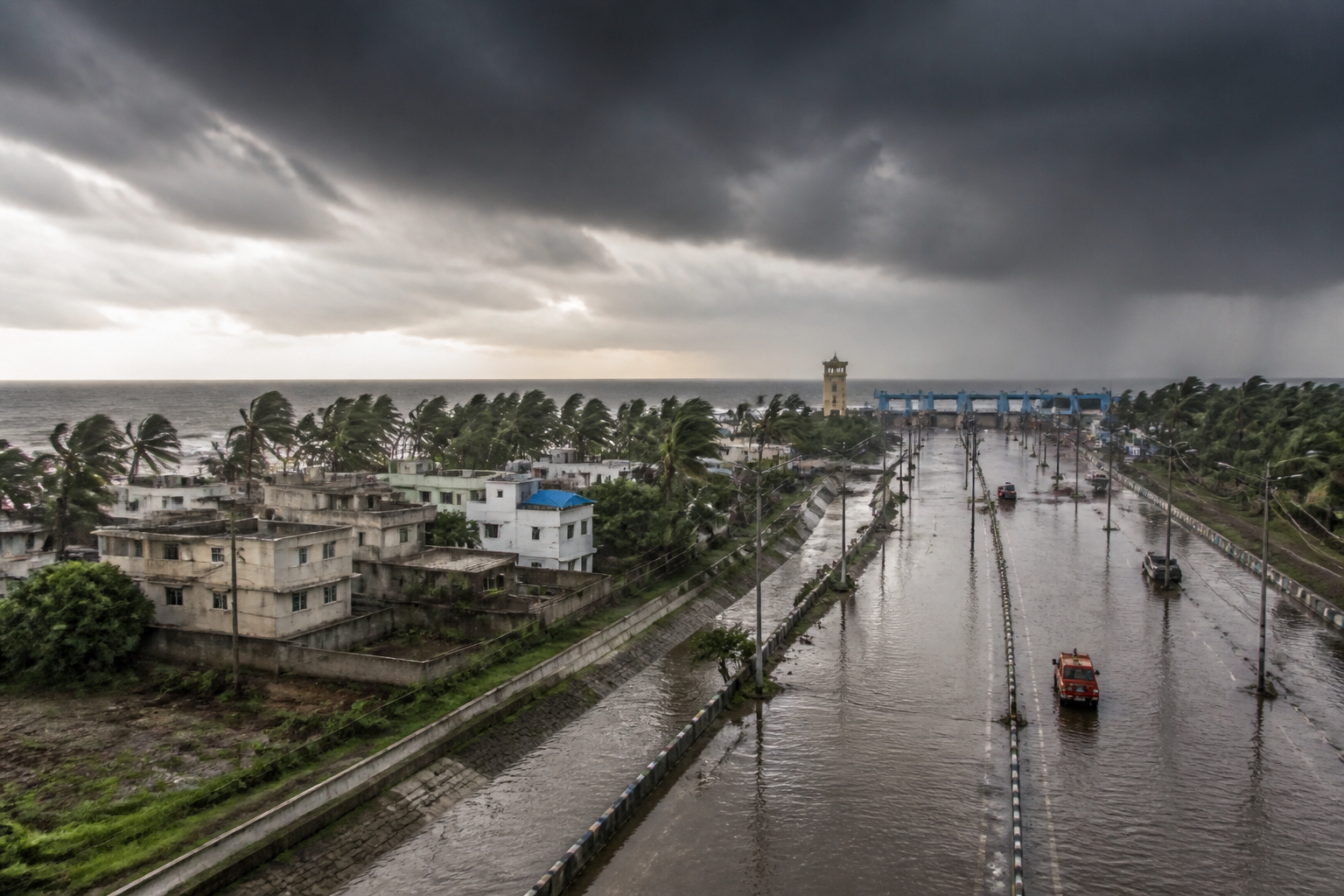
The Bay of Bengal’s rising sea surface temperature and ocean heat content are creating a more difficult risk environment for Odisha, where stronger cyclones, extreme rainfall, floods, coastal erosion and uncertain storm behaviour could place additional pressure on settlements, infrastructure, agriculture, fisheries and emergency systems. The concern is not only that storms may intensify, but that the conditions supporting their development are becoming harder to read in time.
The warning, reported by the Times of India, brings together the views of marine science researcher and retired professor Pratap K Mohanty, IIT Bhubaneswar associate professor Sandeep Patnaik and India Meteorological Department scientist Umasankar Das. Their comments point to a connected problem: warmer waters can supply more energy and moisture to storms, while changing interactions between the ocean, atmosphere and land can make their movement and intensity more difficult to forecast.
That distinction matters for a coastal state. Cyclone risk is often discussed through the number of storms that make landfall or the wind speed recorded at landfall. But the consequences for cities and coastal communities also depend on how quickly a system strengthens, how much rain it produces, whether it stalls near the coast and how accurately authorities can identify its likely path. A storm that changes character close to land can compress the time available for evacuation, road closures, power shutdowns and the protection of vulnerable infrastructure.
Mohanty said cyclones draw their energy from warm ocean water. In his assessment, higher sea surface temperatures make more heat and moisture available to storms, allowing them to intensify more rapidly and become more destructive before landfall. He described the Bay of Bengal as one of the world’s most cyclone-prone regions and said warmer waters increase the risk for Odisha.
His warning covers several systems that are usually treated separately. More intense cyclones can bring stronger winds and storm impacts, but the associated rainfall can also affect urban drainage, rivers, roads, power networks and low-lying settlements. Increased coastal erosion can damage shorelines and assets close to the sea. Risks to fisheries and livelihoods can affect communities whose income depends on predictable marine conditions. Agriculture can also be affected when extreme rainfall and weather uncertainty disrupt the timing of farm operations.
The urban implication is that cyclone preparedness cannot be limited to the immediate landfall zone. Heavy rainfall from a Bay system can affect both coastal and interior areas, while flooding can interrupt transport, water supply, electricity, communications and access to hospitals. The source report does not provide a city-wise assessment of these risks, but the expert comments indicate that the relevant planning geography extends beyond the coastline and includes the wider network of settlements and infrastructure exposed to rainfall and flooding.
Patnaik pointed to a change in the behaviour of severe weather systems over the Bay in recent years. He said deep depressions and cyclones often bring very heavy or extremely heavy rainfall to coastal and interior states. Typically, such systems form well inside the Bay, travel towards the coast and gradually intensify. However, he said many systems have recently been spending more time near the coast, either intensifying or decaying.
This creates a challenge for institutions that have to convert forecasts into operational decisions. A system that remains near the coast may not follow a simple pattern of formation, movement and landfall. Its interaction with land and sea can influence both its intensity and rainfall distribution. For district administrations and urban authorities, that uncertainty can complicate decisions about evacuation, the deployment of response teams, the opening of shelters and the management of transport and essential services.
Patnaik attributed part of the forecasting difficulty to complex interactions between the ocean, land and atmosphere. He said storm dynamics can confuse even state-of-the-art weather models. The observation is significant because forecasting is not merely a technical service operating in the background. It is an administrative input into public safety. The quality and timing of a forecast influence when local authorities issue warnings, move people from exposed areas, secure construction sites and prepare for service interruptions.
Das said the Bay of Bengal is difficult to forecast because it combines a warm ocean, complex atmospheric circulation, rapid system evolution and strong land-sea interactions. He added that the Bay generally maintains sea surface temperatures of around 28°C to 30°C, providing abundant moisture to the surrounding atmosphere. Small changes in sea surface temperature, ocean heat content and upper-ocean mixing, he said, can significantly affect intensification.
These figures show why surface temperature alone does not provide a complete picture of cyclone risk. The condition of the upper ocean also matters. Ocean heat content can influence how much energy remains available to a developing storm, while upper-ocean mixing can alter the relationship between surface warmth and the deeper water below. The supplied report does not quantify the recent rise in the Bay’s temperature or provide a time series of ocean heat content. It therefore establishes the mechanism identified by the experts, but not a measured estimate of how much Odisha’s cyclone risk has changed over a specified period.
That limitation is important for public planning. A general warning about warmer waters needs to be translated into local risk information: which coastal blocks are most exposed, which urban areas face the greatest flood risk, how much drainage capacity is available and which critical facilities could lose access during an extreme event. The report does not provide those assessments. It does, however, identify stronger observing systems as a necessary response to the data gap.
Das specifically called for stronger observing systems in data-sparse regions such as the Bay. Better observations can improve the information available to forecasting models and help scientists track changes in sea surface temperature, ocean heat content and upper-ocean conditions. For authorities, more reliable observation is relevant not only to cyclone warnings but also to decisions made before and during severe rainfall events.
The institutional challenge is therefore divided across several levels. Meteorological agencies are responsible for observations, modelling and forecasts. State and district administrations use those forecasts for warnings, evacuation and emergency response. Urban local bodies manage drainage, roads, solid waste clearance and local facilities that become critical during heavy rain. Fisheries and agriculture departments deal with livelihood risks, while electricity, water and transport agencies must protect and restore networks. The expert comments suggest that changing storm behaviour increases the need for these systems to work together, although the report does not detail any new government programme or funding arrangement.
For Odisha’s coastal settlements, the built environment is a central part of this question. Coastal roads, embankments, housing, ports, power infrastructure and public buildings are exposed not to one hazard but to combinations of wind, rain, flooding and erosion. The risk can also extend inland through transport links and supply networks. If weather systems spend more time near the coast or produce heavy rainfall away from their centre, conventional planning based only on the expected landfall location may leave other areas underprepared.
The evidence supplied in the report does not establish that every future cyclone will be stronger, nor does it provide a forecast for a particular storm. Instead, it identifies a set of conditions that can increase the difficulty of managing severe weather: warm sea surface temperatures, high ocean heat content, rapid storm evolution, changing system behaviour and complex land-sea interactions. The experts’ central concern is that these factors can operate together, creating uncertainty at the point when authorities need precise and timely information.
The larger urban question is whether coastal resilience can keep pace with a hazard that is becoming more difficult to forecast. Resilience is often measured through visible assets such as shelters, embankments and evacuation roads. The comments from the three experts broaden that frame. Observation networks, forecast accuracy, communication between institutions and the ability of local systems to act on warnings are also forms of urban infrastructure.
For now, the report confirms the need to treat the Bay of Bengal as a continuously monitored risk system rather than a seasonal backdrop to individual cyclones. It establishes expert concern about warmer waters and changing weather-system behaviour, while leaving several questions open, including the scale of recent temperature changes, the districts facing the greatest additional exposure and the capacity of local infrastructure to manage compound flooding and erosion. Those are the areas that require closer evidence as Odisha prepares for future severe-weather events.

