


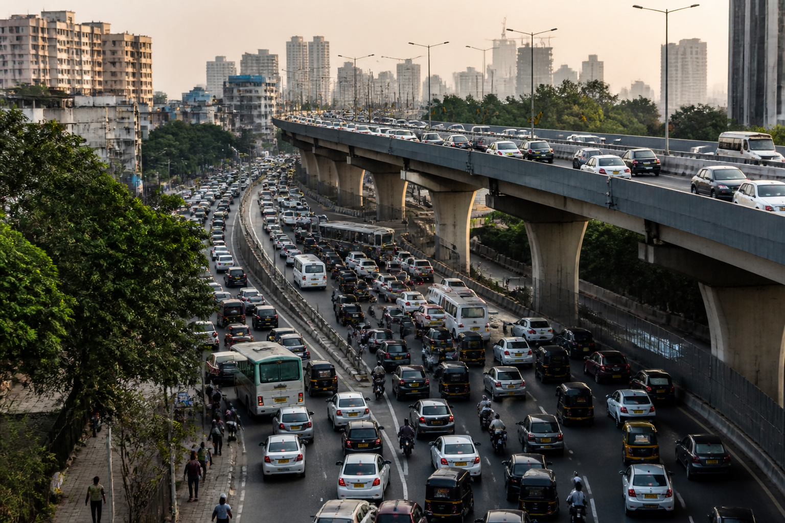
Mumbai’s redesign of the Ghatkopar road overbridge and Delhi’s congestion crisis on the Barapullah Phase-III corridor appear to be opposite responses to the same urban planning failure: infrastructure is being designed around road capacity without fully accounting for how different traffic movements interact.
In Mumbai, the Ghatkopar project is being changed while construction is still under way. Nearly 30% of the work is complete, but three pier caps—RP15, RP16 and RP17—will be partially demolished and rebuilt at a higher level. The original plan for a 2+2-lane cable-stayed bridge is being replaced with a two-tier arrangement that separates local traffic between Ghatkopar East and West from longer-distance movement between the Andheri side and the Eastern Express Highway.
In Delhi, the problem emerged after the road opened. Barapullah Phase-III, a 3.5-km elevated corridor connecting Mayur Vihar Phase-I with Sarai Kale Khan, was intended to reduce journeys towards AIIMS from approximately 35-40 minutes to around 15 minutes. Instead, tailbacks of nearly 3 km were reported shortly after opening, with commuters describing journeys of 40 minutes or more.
The contrast is important. Mumbai is absorbing the cost and disruption of redesigning a structure before traffic begins to use it. Delhi is attempting to manage a conflict that became visible only after thousands of motorists entered the corridor. Both cases show that the difficult part of urban road building is often not constructing a bridge or adding lanes. It is understanding what happens at the points where movements meet.
The Ghatkopar redesign recognises that a city road can serve two distinct populations at the same time. A resident travelling between Ghatkopar East and West may be heading to a school, market, hospital, railway station or ward office. That person needs a short local connection. A vehicle travelling between the Andheri side and the Eastern Express Highway has a different origin, destination and purpose. If both movements are placed on the same corridor without adequate separation, local trips can become entangled with through-traffic.
The revised Mumbai arrangement is intended to address that conflict through two levels. A proposed lower-level road overbridge between Shreyas, or LBS, Junction and Pant Nagar Junction would serve local movement. The main bridge would be raised by a few metres and widened to a 3+3-lane configuration for heavier through-traffic. The design change therefore goes beyond adding road space. It changes the allocation of road space according to the type of journey being made.
That distinction matters in a city where road demand is already intense. The Mumbai Traffic Police has said it deals with more than 2.7 million vehicles across the city every day. Ghatkopar has also recently required temporary one-way restrictions because of heavy vehicle movement on local roads. In such a setting, a corridor that appears sufficient when measured by lane count can still fail if it does not distinguish between neighbourhood access and longer-distance travel.
Delhi’s Barapullah experience exposes the same issue at a later stage. The elevated corridor was planned as a major link between East and South Delhi and as part of a wider Barapullah network expected to provide a largely signal-free route to South Delhi. But the corridor’s performance was determined not only by the traffic it carried on its elevated section. It was also shaped by the point where that traffic came down and merged with an existing, narrower road.
A joint inspection by the Delhi Traffic Police and the Public Works Department, supported by drone footage, identified the merger point near Sundial Park as a major bottleneck. Traffic from the multi-lane elevated corridor was joining a narrower section, while vehicles from other directions were also entering the same stretch. The result was a familiar urban transport problem: additional capacity at one point followed by an unresolved conflict at the next.
This is why the headline performance of a road cannot be judged only by its length, number of lanes or whether it is signal-free. A corridor’s effective capacity is shaped by its weakest connection. If a wide road feeds into a narrow section, or if several traffic streams converge without adequate separation, the extra infrastructure can shift congestion rather than remove it.
The evidence in these two projects also highlights the limits of designing around a single journey. Barapullah’s promised 15-minute connection focused attention on the time required to travel along the corridor. But the reported congestion showed that the journey included more than the elevated road itself. It included entry points, merging traffic, downstream capacity and the behaviour of motorists approaching the bottleneck.
Navigation technology added another layer to the Delhi problem. The Delhi Traffic Police said Google Maps was not displaying the congestion and continued directing motorists towards the corridor. The police subsequently asked commuters to use NH-24 and the DND Flyway. This does not make navigation software the cause of the congestion, but it demonstrates how digital directions can amplify pressure on a road when the underlying network is already constrained.
The short-term responses being considered in Delhi include an additional lane, a dedicated U-turn and changes to traffic management at the merger. These measures show that the operational life of a road continues after construction and inauguration. Traffic police, road agencies and commuters may have to adjust how a corridor is used when real-world movement reveals a design conflict that was not sufficiently resolved beforehand.
Mumbai’s approach, by contrast, places greater emphasis on correcting the design before the road becomes operational. That does not remove the cost of the change. Partial demolition and rebuilding of pier caps will require additional work and will alter a structure already under construction. But the project’s planners appear to have treated the anticipated conflict between local and through traffic as serious enough to justify intervention before opening.
The two cases therefore reveal different stages of the same institutional challenge. Mumbai is testing and revising the physical design before traffic begins to flow. Delhi is testing the completed corridor through live operations and responding to congestion at a critical junction. One approach carries the burden of construction changes; the other carries the burden of managing a road that has already failed to deliver its promised journey time at the network level.
The longer planning horizon makes the question more consequential. Mumbai’s new Ghatkopar bridge is being planned for an 80- to 100-year horizon. Delhi’s Barapullah project was expected to change movement between East and South Delhi. Infrastructure designed to last for decades cannot be assessed only on whether it meets an immediate traffic target. It must also account for origins, destinations, turning movements, joining traffic, local access and the way motorists actually distribute themselves across a network.
That does not mean every traffic outcome can be predicted perfectly before a project opens. Urban movement changes as soon as a new connection becomes available, and commuters adapt to the routes they perceive as faster. But the two projects show why planning must examine the full chain of movement rather than treating a bridge or elevated road as an isolated object.
The central lesson from Ghatkopar and Barapullah is not that large road projects are unnecessary. Both corridors respond to genuine traffic needs. The lesson is that a road can be technically substantial and still be operationally weak if the connections around it are not designed with equal attention. The decisive test of infrastructure begins when local residents, through-traffic, turning vehicles and navigation systems all meet the built road.
Mumbai’s redesign and Delhi’s congestion response leave the same question for future urban road projects: did planners model how people would actually use the corridor, or mainly how the structure would be built? The answer will depend on whether project agencies continue to measure success by construction milestones and lane capacity, or by how reliably the entire network functions after the city takes the wheel.
