


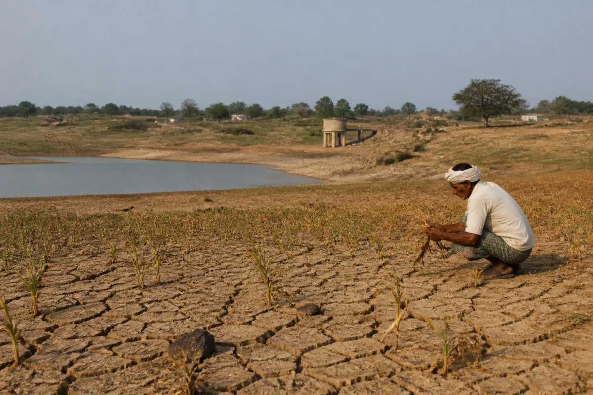
Telangana’s declaration of 365 drought-hit mandals across 31 districts is not merely a rainfall shortfall announcement. It is an administrative recognition that weak monsoon performance has moved through the state’s rural systems—from cropped area and soil moisture to reservoirs, livestock, drinking water and farm credit. The Government Order divides the affected mandals into 111 severely drought-hit and 254 moderately affected areas, while setting in motion a six-month relief framework and a request for central assistance.
The scale of the declaration is significant because it is based on more than a single rainfall number. The state government said Telangana received 615 mm of rain against a normal 740 mm between June 1 and September 30, representing a 17% deficit. Eighteen of the state’s 33 districts were classified as being in deficit. The rainfall outcome was accompanied by prolonged dry spells, reduced kharif cultivation and low storage in major and medium reservoirs.
The government attributed the conditions to the effects of El Niño, weak low-pressure systems over the Bay of Bengal and extended dry periods during the southwest monsoon. These explanations describe the immediate weather pattern, but the declaration’s wider significance lies in how the state has translated climate and rainfall stress into an operational decision. The drought assessment combines rainfall deficiency with crop stress, soil moisture, groundwater conditions, remote-sensing information and field verification.
That multi-criteria approach matters because rainfall totals alone do not describe how a mandal experiences drought. A region can receive rain unevenly, record heavy showers in some locations and still face crop or water stress elsewhere. The report noted that even Mulugu district, which received heavy rainfall in parts, had four mandals declared drought-hit. This underlines the difference between district-level or event-level rainfall and conditions experienced across villages and agricultural areas.
The classification process described in the Government Order included a mandatory assessment of rainfall and dry-spell records, followed by impact indicators covering agricultural shortfall, remote sensing, soil moisture and groundwater. In mandals where more than 75% of the area is irrigated, sample field surveys were conducted in 10% of villages. The findings from this ground verification were treated as the final basis for determining drought intensity.
This framework gives the declaration an institutional dimension. District collectors submitted surveys, and a cabinet sub-committee made recommendations on October 23 before Chief Secretary Sanjay Jaju issued the order. The planning department has been directed to prepare a memorandum for the Union ministries of agriculture and home affairs within seven days, seeking support from the National Disaster Response Fund. The process therefore connects local field evidence to state-level classification and a request for national disaster assistance.
The geographical spread is uneven. Nalgonda and Sangareddy recorded the highest number of drought-hit mandals, with 28 each. Suryapet followed with 23, while Adilabad and Vikarabad had 20 each. Nizamabad and Rangareddy recorded 18 each, and Yadadri-Bhuvanagiri and Khammam had 17 each. Medak had one affected mandal, Manoharabad. These figures show that the drought declaration is not limited to one contiguous belt; it spans multiple districts with different agricultural and water conditions.
The agricultural data indicates how rainfall stress has already translated into reduced land use. The state government said kharif crop area declined from 139 lakh acres to 126 lakh acres. Paddy cultivation fell by 18%, from 69 lakh acres to 57 lakh acres. The supplied report does not establish the full reasons for every acre left uncultivated, but the government has linked the reduction to deficient rainfall and related drought conditions. The figures nevertheless provide a direct measure of how water uncertainty affects production decisions.
Reservoir storage adds another layer to the crisis. Live storage in major and medium reservoirs stood at 179 tmc against a combined capacity of 589 tmc, according to the government. The state identified the low reserves as a risk to drinking water, agriculture, livestock and power. The figure is not only an indicator of current water availability; it also shapes the choices available to district administrations as they balance domestic requirements, cultivation and animal husbandry.
The relief response reflects this interconnected risk. Collectors have been instructed to coordinate agriculture, horticulture, animal husbandry and civil supplies departments. Measures include input subsidies through direct benefit transfer, augmentation of drinking water supply, fodder management, cattle camps where necessary and employment generation under rural job schemes. District administrations must maintain beneficiary and expenditure records and submit periodic progress reports.
The emphasis on records is important to the functioning of a drought declaration. Relief is not delivered only through a public announcement; it requires identifying beneficiaries, transferring funds, documenting expenditure and tracking implementation across hundreds of mandals. The order also asks districts to work with the state-level bankers’ committee to facilitate crop-loan restructuring and prevent coercive recoveries in accordance with Reserve Bank of India guidelines. This extends the response beyond water and agriculture departments into the rural credit system.
The declaration also shows why a drought classification can have a different meaning at different administrative levels. The state has declared a broad set of affected mandals, but the intensity varies between severe and moderate categories. Within those mandals, the final impact may still depend on local rainfall distribution, irrigation access, crop choices, groundwater conditions and the availability of drinking water and fodder. The assessment system attempts to capture these differences through field verification and multiple indicators rather than treating every affected area identically.
The six-month validity of the declaration creates a defined administrative window, but it is not a final boundary. The government may add more mandals if conditions worsen. That provision recognises that drought conditions can change after the formal assessment period, particularly when reservoir storage is low and recovery depends on subsequent rainfall or other water-management measures. The supplied Government Order does not establish how many additional mandals might be added or what future rainfall would be recorded; it only provides for expansion of the notified area if necessary.
For Telangana’s rural settlements, the immediate concern is the competition among essential needs. Lower crop acreage affects farm activity and demand for inputs. Reduced reservoir reserves create pressure on drinking-water planning and irrigation. Livestock require fodder and water even when cultivation contracts. Farm borrowers may face repayment stress, making loan restructuring and restrictions on coercive recovery a component of drought relief rather than a separate financial issue.
The declaration therefore offers a view of drought as a governance problem that crosses departmental boundaries. Rainfall is measured by one set of institutions, crops by another, reservoirs by water agencies, livestock by animal-husbandry officials and relief delivery by district administrations. The Government Order brings these strands together through a common classification and reporting process. Its effectiveness will depend on whether the identified measures reach affected households and whether progress reports translate into timely administrative action.
The evidence supplied confirms a substantial monsoon deficit, a reduction in cultivated area, sharply lower paddy acreage and reservoir storage well below stated capacity. It also establishes a formal basis for classifying drought intensity and a relief structure involving state departments, banks and the Union government. What remains to be seen is how the six-month declaration performs on the ground: whether drinking-water supplies are augmented, fodder and cattle support are provided where required, subsidies reach beneficiaries, loan restructuring is completed and the notified list is revised if conditions change. The next formal milestone is the state’s memorandum to the Union ministries within seven days.

