


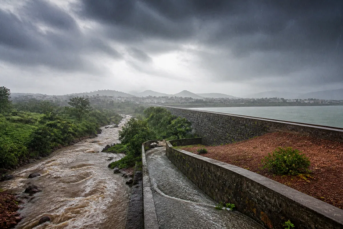
Cyclone Arnab may bring heavy rain to parts of Telangana, but it is unlikely to resolve the state’s wider water crisis because short-duration rainfall in a few eastern districts cannot automatically replenish depleted reservoirs, rivers and drinking-water sources. The immediate weather event therefore highlights a larger problem: Telangana’s water security depends not only on how much rain falls within the state, but also on where it falls, how quickly it runs off and whether wider river-basin catchments receive sustained rainfall.
The India Meteorological Department has forecast that Cyclone Arnab will cross the Andhra Pradesh coast on Wednesday and move north through Wednesday and Thursday. Its impact on Telangana is expected to reduce after landfall, with heavy but passing storms forecast in parts of the state. IMD authorities told Deccan Chronicle that wind speeds could exceed 50 to 60 km/h, with a maximum speed of around 70 km/h.
The weather system is significant because Telangana is emerging from a prolonged dry spell and deficient monsoon conditions. The cyclone could provide temporary relief to parched areas, improve soil moisture and recharge some local water bodies. But the available forecast does not indicate that rainfall from the storm will be sufficient to restore the state’s larger water systems over the following week.
That distinction matters for a state where drinking-water availability depends on a combination of rivers, reservoirs, local water bodies and linked supply schemes. Rainfall that improves conditions in one district may not translate into adequate inflows for the reservoirs that support urban and rural drinking-water networks. Water availability is shaped by the geography of catchments, not simply by the total amount of rain recorded at a weather station.
The IMD has issued red alerts for Bhadradri-Kothagudem, Mahbubabad, Mulugu and Khammam for Wednesday. Orange alerts cover Jayashankar Bhupalpally, Warangal, Suryapet, Nalgonda and Nagarkurnool. A yellow alert has been issued for Komuram Bheem Asifabad, Mancherial, Peddapalli, Karimnagar, Hanamkonda, Jangaon and Yadadri-Bhuvanagiri. Hyderabad and the remaining districts are under a green alert, with light to moderate rainfall expected.
For Thursday, moderate rainfall is forecast in Komuram Bheem Asifabad, Mancherial, Peddapalli, Jayashankar Bhupalpally and Mulugu. This distribution indicates that the heaviest effects may be concentrated in eastern and northern parts of Telangana rather than spread evenly across the state. Such concentration can produce local flooding or swollen streams while leaving major reservoir inflows below what is required for sustained water security.
The difference between rainfall and water replenishment is largely a question of timing and absorption. When intense rain falls over a short period, water can move rapidly into streams and drains instead of gradually infiltrating the ground. If the soil is unable to absorb the rainfall quickly, runoff rises while the amount retained for later use remains limited. Some of that runoff may reach rivers and reservoirs, but the outcome depends on rainfall intensity, duration, location and the position of upstream catchments.
This is why a heavy-rain alert cannot be treated as a guarantee of improved drinking-water availability. A district may receive substantial rainfall without the water reaching the reservoirs that feed larger supply systems. Conversely, rainfall across the relevant upstream catchment areas can generate useful inflows even when conditions at a particular location appear less dramatic.
Telangana’s water security is connected to the wider Krishna and Godavari basins, including catchment areas outside the state in Maharashtra and Karnataka. The state’s reservoirs and river systems are therefore influenced by rainfall patterns beyond its administrative boundaries. A cyclone that delivers rain mainly across eastern Telangana may improve local conditions without generating enough basin-wide inflow to reverse water stress.
This basin geography also exposes the limits of district-level weather reporting when it is used as a proxy for water availability. Alerts are essential for public safety because they identify areas likely to face strong winds and heavy rain. But reservoir recovery requires a different set of observations: rainfall across upstream catchments, inflow rates, storage levels, soil absorption and the condition of linked water-supply infrastructure. The supplied report does not provide current reservoir storage or inflow figures, so the precise effect of Cyclone Arnab on major water facilities cannot yet be established.
The storm’s likely benefits are more local and immediate. Rain may reduce short-term moisture stress in parched areas, recharge smaller water bodies and improve soil conditions. These effects can support local water availability, but they do not necessarily provide the sustained volume required by drinking-water schemes serving large populations. The distinction is especially important when water sources have already been depleted by deficient monsoon rainfall.
The report also places the cyclone within a broader climate and seasonal context by referring to the looming impact of El Niño. It does not quantify that impact or establish how it will affect Telangana’s water balance. What is clear from the supplied evidence is that a single weather system is being asked to compensate for a longer period of inadequate rainfall. That makes the duration and geographical spread of rainfall more important than the headline intensity of the storm.
For municipal administrations and water agencies, the practical challenge is to manage two different risks at once. Heavy rain can create immediate hazards through strong winds, runoff and swollen local streams. At the same time, the rainfall may fail to restore the reservoirs and river systems on which longer-term drinking-water supplies depend. The same event can therefore generate excess water in one location and continued scarcity in another.
The alert structure reflects this uneven risk. Eastern districts facing red and orange alerts are expected to bear the strongest weather effects, while Hyderabad is forecast to receive light to moderate rainfall under a green alert. The spatial variation means that impacts on roads, drainage, settlements, agriculture and water bodies will not be uniform. It also means that state-level assessments of water security must account for where the rain lands rather than rely on a single statewide total.
The institutional question is equally important. IMD forecasts identify the expected weather threat, while the consequences for reservoirs, river systems and drinking-water schemes depend on water-resource agencies and local administrations. The report does not identify any new government water-management measure linked to the cyclone. It records the forecast, the district-level alerts and the limits of the expected replenishment. The next assessment will therefore depend on observed rainfall and inflows rather than on the forecast alone.
The evidence supports three separate conclusions. First, Cyclone Arnab is likely to bring heavy but passing rainfall to parts of Telangana after crossing the Andhra Pradesh coast. Second, that rain may offer temporary local relief through soil-moisture improvement and recharge of smaller water bodies. Third, sustained recovery of the Krishna and Godavari river systems will require adequate rainfall across their wider catchments, including areas outside Telangana.
That last condition is the central urban and infrastructure issue. Drinking-water security is built across a network of reservoirs, rivers, catchments and supply schemes that do not follow district or state boundaries. A storm can be intense without being hydrologically sufficient. Until rainfall is sustained and distributed across the catchments that feed Telangana’s major water systems, the cyclone may ease local dryness without ending the state’s water crisis. The immediate developments to monitor are the rainfall recorded in the alerted districts, the movement of the system on Thursday and the resulting inflows into rivers and reservoirs.

