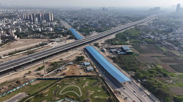
As Noida positions itself to become a major transit and commercial hub in the Delhi NCR, a comprehensive urban mobility upgrade is underway.
With traffic volumes expected to surge once the Noida International Airport becomes operational, city planners have set in motion a significant infrastructure intervention that includes the construction of interconnected elevated roads to ensure seamless movement across Delhi, Haryana, and Uttar Pradesh. At the centre of this development is the proposed integration of two major elevated corridors—one beginning at Chilla and another running from Sector 94 to the Yamuna Expressway. A traffic interchange, modelled after the one near AIIMS in Delhi, will link the two routes, enabling vehicles from Delhi and Haryana to bypass bottlenecked stretches and head directly towards Agra, Lucknow, and the new international airport. This strategic linkage is designed not only to reduce journey times but also to alleviate pressure on the Noida Expressway, which currently handles substantial intercity traffic.
The Chilla elevated road, estimated at ₹892 crore, will stretch approximately 5.9 kilometres, creating a high-capacity transit route capable of absorbing peak-hour pressure. Simultaneously, a six-lane elevated corridor and an eight-lane expressway are being conceptualised to connect Sector 94 directly with the Yamuna Expressway. This extensive network is aimed at supporting a zero-congestion framework for future traffic, especially as Noida scales up residential, industrial, and commercial activities. According to senior officials from the development authority, the process to appoint a project consultant is currently being initiated. This firm will be responsible for finalising the design and technical architecture of the upcoming network. Once operational, the upgraded corridor system is expected to benefit lakhs of commuters, reducing average travel times and enhancing connectivity across regional nodes.
The project also aims to decongest the current Noida entry points, often jammed due to inadequate feeder infrastructure for long-haul vehicles. Officials highlighted that this step is a critical pre-emptive measure, given the anticipated rise in vehicular density after the airport becomes operational. In addition to regional connectivity, the infrastructure plan aligns with broader goals of building equitable and sustainable urban systems. Experts emphasise that intelligent road planning—particularly through grade-separated corridors—can significantly reduce fuel consumption and vehicular emissions, in turn improving the region’s air quality. This is particularly relevant for the Delhi NCR, where transport emissions form a sizeable portion of urban pollution.
Officials working on the project have stated that once the new network is functional, vehicles from Lucknow, Agra, and Greater Noida heading to Delhi and Haryana will no longer need to rely on internal city roads or overburdened highways. This will not only reduce congestion within Noida city but also minimise travel stress, making road-based intercity logistics and commuting more efficient. Moreover, the initiative is expected to ease freight movement, making Noida more attractive for industrial and warehousing sectors that are highly sensitive to logistics delays. Infrastructure planners are optimistic that these improvements will contribute to the city’s economic growth and help it emerge as a future-ready, sustainable urban node.
Urban transport experts have welcomed the move, noting that such connectivity improvements must be accompanied by strict zoning enforcement, eco-sensitive construction standards, and parallel investments in public transit to avoid an overreliance on private vehicles. They also stressed the need for ensuring barrier-free pedestrian and non-motorised access in the design phase, particularly around major junctions and interchanges. The project is likely to be implemented in phases over the coming years. Given the scale and investment involved, citizen engagement and regular updates from authorities will be key to managing expectations and disruptions during the construction phase. Transparency in environmental clearances, tendering, and land acquisition will further determine the project’s long-term impact.
As Noida continues to evolve, the emphasis on strategic mobility planning reflects a growing understanding that sustainable cities are not merely built on roads and bridges, but on how well those roads connect people, livelihoods, and opportunities with minimal friction and maximum efficiency. If executed efficiently, the elevated corridor project has the potential to not only address Noida’s present traffic woes but to future-proof the region’s urban infrastructure against the mobility challenges of a rapidly urbanising India.
Also Read : https://urbanacres.in/greater-noida-unveils-1-5km-road-to-ease-pari-chowk-congestion/


