


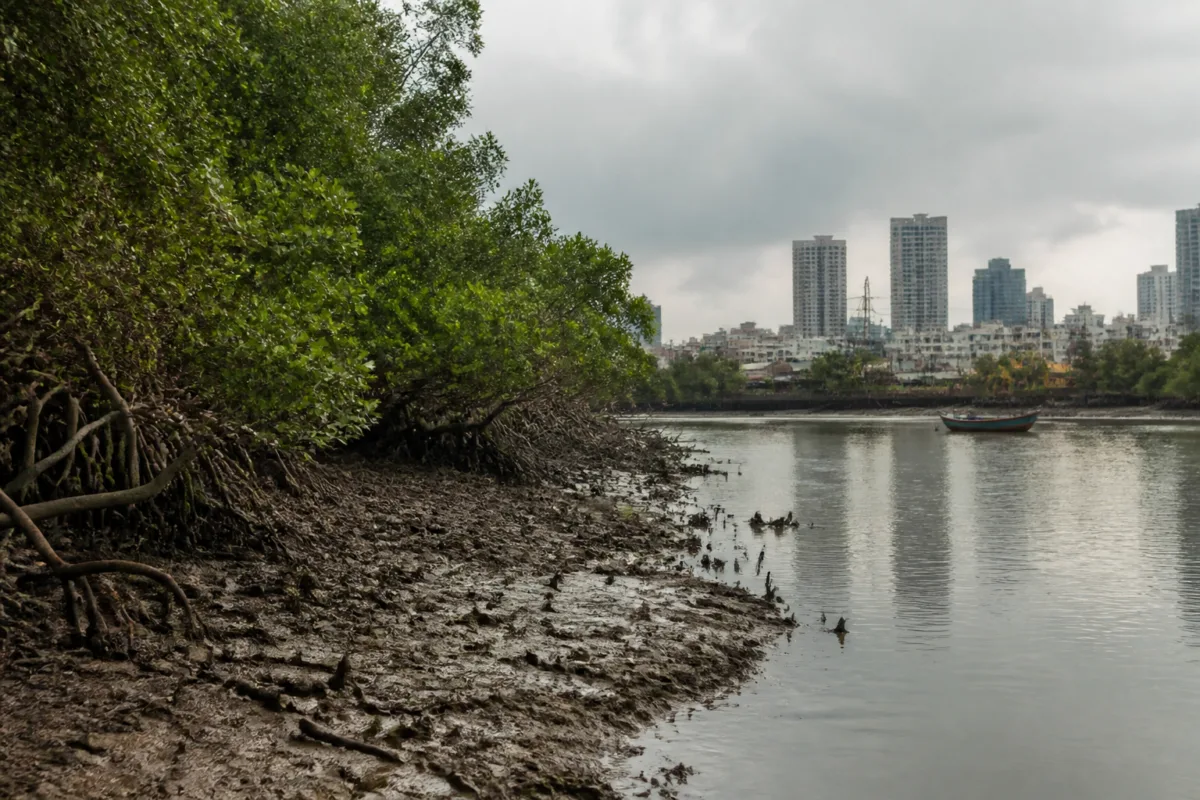
Mumbai mangrove loss has reached a scale that changes the city’s coastal risk conversation. A study published in the Elsevier journal Total Environment Advances found that the city’s mapped mangrove area declined from 75.07 sq km in 2006 to 61.99 sq km in 2024, a net reduction of 18.89 sq km. The findings point to more than the disappearance of green cover: they show pressure on an ecosystem that supports aquatic life, stabilises shorelines and reduces the force of waves and storm surges.
The study, by Vinod Kumar Yadav and Durgesh Kumar Jha, examined four coastal sectors: Versova-Madh Island-Malad, Gorai Creek, Thane Creek and Sewri-Chembur-Trombay. Researchers used satellite images from 2006, 2012, 2018 and 2024, along with four machine-learning methods, to classify mangrove cover and identify changes over time.
The headline figure is a 17.41% decline over 18 years. The transition analysis recorded 30.20 sq km of mangrove loss against 11.32 sq km of new growth. The difference produced a net reduction of 18.89 sq km. The largest net decline occurred between 2012 and 2018, while the more recent assessment also indicated that the downward trend had continued.
The numbers vary depending on how the satellite imagery is processed. Between 2018 and 2024, the estimated decline was 5.03% at Sentinel-2’s native 10-metre resolution and 6.75% after the imagery was aggregated to a common 30-metre resolution. That difference reflects a technical limitation in comparing spatial data, but it does not change the direction of the finding: both approaches showed continuing loss.
This distinction matters because mangrove change is not only about the total area visible on a map. The study also found that open mangrove cover declined by 76.8%, while sparse mangrove cover fell by 19.28%. These changes suggest that the remaining ecosystem has altered in density and structure. A mangrove forest’s ecological value depends on whether it remains sufficiently continuous and healthy to support the processes that sustain it, not simply on whether some vegetation remains within a mapped boundary.
That is particularly important for Mumbai’s creeks. Mangrove roots provide shelter, food and nursery habitat for juvenile fish, prawns, crabs and other aquatic organisms. These habitats support the early life stages of species that form part of coastal biodiversity and are relevant to fishing communities. The study, however, did not measure fish populations, species diversity or fishing catches. It therefore establishes the scale and geography of mangrove change, but not the exact effect of that change on fish stocks or fishing yields.
That gap is central to understanding what the research does and does not prove. A decline in suitable nursery habitat can raise questions about recruitment into adult fish populations, but the connection must be tested through independent fisheries surveys. Without that additional evidence, the impact on catches cannot be quantified from the satellite assessment alone. The study is best read as a mapping of ecological pressure and a basis for examining its consequences, rather than as a direct measurement of fisheries decline.
The coastal protection function is clearer. Mangroves stabilise shorelines, trap sediments, regulate nutrient cycles and reduce the force of waves and storm surges. When these systems degrade, coastal stretches can become more exposed to erosion and flooding. For a densely built coastal city, the loss of this natural buffer adds pressure to engineered drainage, embankments and flood-management systems, although the study does not calculate how much additional flooding or erosion is attributable to the mangrove decline.
The significance lies in how the city accounts for protection. Conventional infrastructure is usually recorded through projects, tenders, construction costs and maintenance budgets. Mangroves do not fit neatly into that accounting system, even though they perform protective functions without being built as conventional infrastructure. Their decline can therefore remain less visible than the failure of a road drain or the deterioration of a seawall, despite its implications for the same coastal risk landscape.
The four study sectors also show why Mumbai’s mangroves should not be treated as one uniform patch of green. Versova-Madh Island-Malad, Gorai Creek, Thane Creek and Sewri-Chembur-Trombay have different shorelines, tidal conditions, levels of urbanisation and patterns of ecological disturbance. A citywide percentage can establish the overall direction, but management responses require attention to where loss has occurred, whether remaining patches are connected, and whether local conditions allow natural regeneration.
Restoration adds another layer to the policy challenge. The article cites an earlier assessment in which 13 of 25 mangrove restoration sites examined in Mumbai showed no growth between the start of restoration and 2022. That finding questions a narrow approach based mainly on counting planted saplings. Mangroves require suitable tidal connectivity, sediment conditions and ecological processes to survive. A restoration site can therefore appear active in project records without producing a functioning ecosystem.
This is an institutional issue as much as an ecological one. Conservation success cannot be measured only by the number of sites announced, saplings planted or interventions completed. It must also be assessed through survival, changes in density, continuity of habitat and the return of ecological functions. The available study does not identify responsibility for each mapped loss or evaluate individual government programmes. It does, however, provide evidence that management interventions have not yet prevented an overall decline across the areas examined.
The policy landscape is consequently divided between prevention and restoration. Preventing the destruction or degradation of existing mangrove forests protects mature ecological systems that have already developed. Restoration is slower and more uncertain because it depends on site conditions and natural processes. The study’s findings indicate that both tasks are necessary, but they should not be treated as interchangeable. New growth recorded in satellite imagery does not automatically compensate for the loss of older, denser or more connected mangrove areas.
The research also illustrates the importance of consistent monitoring. Differences between estimates at 10-metre and 30-metre resolution show why long-term comparisons need common methods as well as repeated observations. Satellite analysis can reveal the scale and spatial pattern of change across a large coastline, while field surveys are needed to establish ecological health, species composition and fisheries consequences. Neither form of evidence can replace the other.
Nehru Prabakaran, a scientist at the Wildlife Institute of India and an expert on mangrove ecosystems, said mangroves near densely populated urban centres continue to experience degradation despite management interventions. He described addressing the factors influencing the decline as urgent for safeguarding coastal ecosystems and the services they provide.
The larger urban question is whether Mumbai treats its coastal ecosystems as peripheral environmental assets or as part of its core infrastructure. The study does not provide a complete account of the causes of mangrove loss, and it does not quantify future flood risk, fisheries losses or the performance of every restoration project. It does establish that the city’s mangrove cover has declined substantially since 2006, that surviving vegetation has changed in composition, and that recent assessments still indicate a downward trend.
The next stage of scrutiny must therefore connect three forms of evidence: satellite maps showing where mangroves are changing, field assessments showing whether the remaining forests are functioning, and fisheries and coastal-risk data showing how those changes affect people and the shoreline. Until those links are measured, Mumbai will know the scale of its mangrove loss more clearly than it knows the full cost of losing the protection and habitats those ecosystems provide.

