


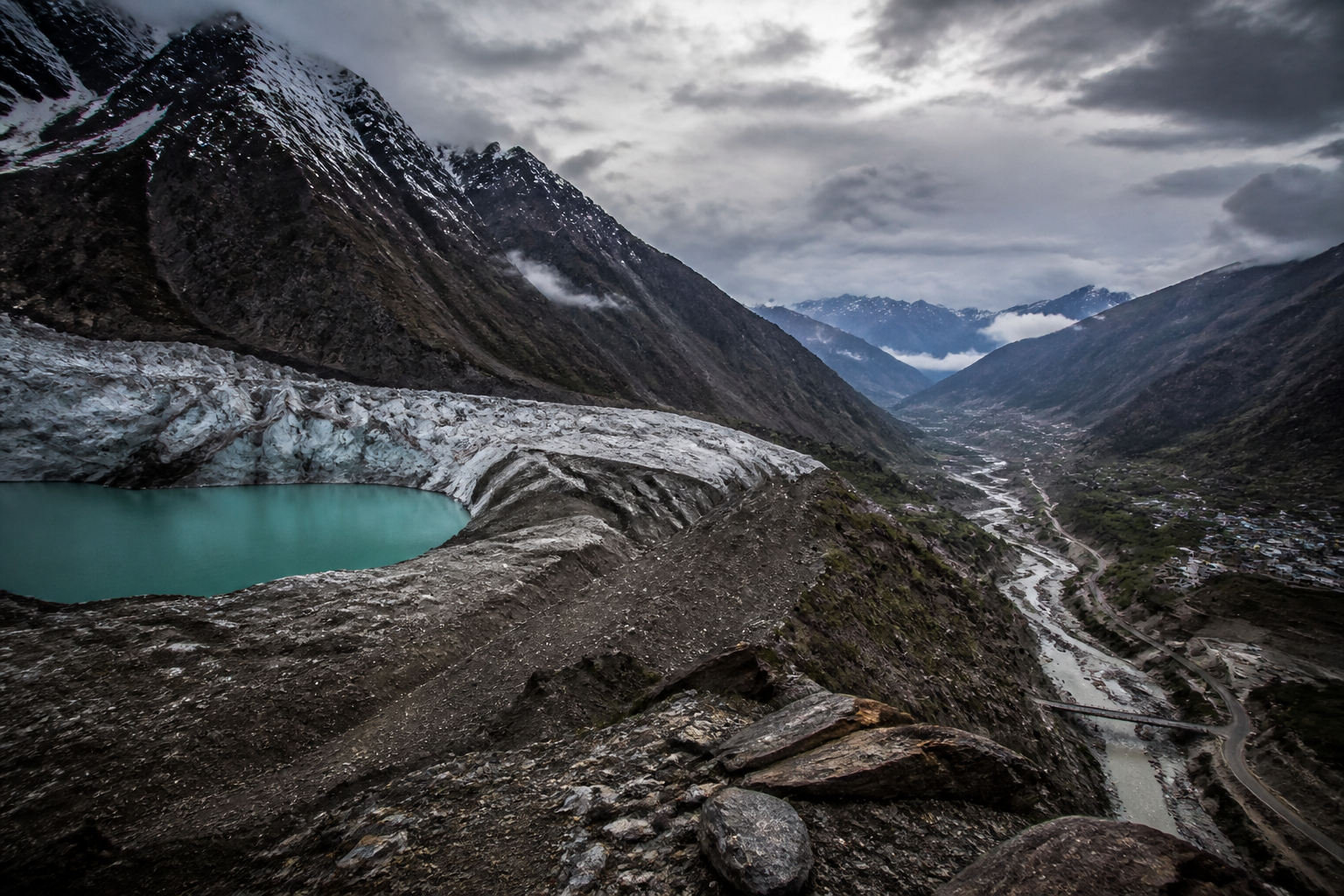
The Himalayas are moving towards a more dangerous phase of climate risk: glaciers are melting faster, unstable glacial lakes are expanding above populated valleys, and river flows could eventually begin to decline after reaching “peak water”. A study released this month says the consequences will extend well beyond mountain communities, placing water security, disaster management and a significant part of India’s economic infrastructure under pressure.
The findings, reported by Reuters and published by Deccan Chronicle, come after the collapse of a Himalayan glacier in late August along the Nepal-Tibet border. The incident triggered cascading landslides and flash floods in valleys below. At least 1,300 people have been confirmed dead and more than 5,300 remain missing across Nepal and China’s Tibet region, according to the report.
The immediate disaster is significant, but the study points to a broader institutional challenge. Glacier retreat is not only changing the volume and timing of water flowing through Himalayan river systems. It is also leaving behind glacial lakes held back by loose rock and ice. These natural barriers can become sources of sudden flooding, placing downstream settlements and infrastructure at risk.
The study was produced by Systemiq, a sustainability advisory firm, with the Integrated Mountain Initiative, the International Centre for Integrated Mountain Development and India’s G.B. Pant National Institute of Himalayan Environment. Its central warning is that the Hindu Kush-Himalaya region is approaching a tipping point in which the hydrological benefits of accelerated melting begin to reverse.
That transition is described through the idea of “peak water”. In the early stages of glacier melt, additional meltwater can increase river flows. But once glaciers lose sufficient mass, the amount of water released begins to decline. The report says the region is approaching this point by the middle of the century. For communities, farms, towns and cities that depend on Himalayan rivers, the risk is therefore not limited to a single flood event. It also concerns the longer-term reliability of water supplies.
This makes glacier monitoring an essential part of urban and regional infrastructure planning. The study found that Himalayan glacier mass loss has accelerated in recent decades, but only 21 glaciers are currently monitored on the ground out of an estimated 40,000 glaciers across the Hindu Kush-Himalaya region. The mountain system spans eight countries, from Afghanistan to Myanmar.
The monitoring gap is not a minor technical limitation. It affects the ability of authorities to identify changing risks before they become emergencies. If only a small fraction of glaciers are observed directly, the condition of many water sources and glacial lakes must remain uncertain. That uncertainty is especially consequential where settlements, roads, bridges, hydropower facilities and other infrastructure occupy narrow valleys downstream.
The report identifies close to 200 glacial lakes in India as high risk, including 56 classified as “very high risk”. Millions of people living downstream are potentially exposed. The figures indicate that the hazard is distributed across a large geography rather than concentrated around one isolated site. They also show why disaster preparedness cannot be based only on responding after a lake breach, landslide or flash flood has occurred.
For cities and towns in the Himalayan region, the physical geography sharply limits the margin for error. Settlements and transport links are often located along river corridors because these provide relatively accessible routes through mountainous terrain. The same valleys can also channel floodwater, debris and landslides. A failure in an upstream glacial lake or glacier system can therefore affect communities and infrastructure far from the original point of instability.
The urban consequences extend beyond the immediate flood zone. Damage to roads, bridges and other links can isolate settlements and disrupt the movement of people, food and essential supplies. Water systems can be affected by sudden changes in river conditions or by debris entering downstream channels. The supplied report does not provide a detailed assessment of individual infrastructure failures, but its account of cascading landslides and flash floods demonstrates how a mountain event can rapidly become a regional service and connectivity crisis.
The economic scale adds another layer to the risk. The report says the Himalayas underpin more than 20 per cent of India’s gross domestic product and that hundreds of millions of people depend on the region as part of the country’s economic infrastructure. The Himalayan region accounts for around 18 per cent of India’s land but roughly 35 per cent of the country’s natural disasters, according to the study cited by Reuters.
These figures place the mountain system within the national planning framework rather than treating it as a remote environmental zone. The Himalayas support ecological and economic functions that connect mountain districts with plains-based cities and wider markets. Water availability, transport routes, energy systems and livelihoods are linked across this geography. A disruption in the mountains can therefore transmit risk through administrative boundaries and into urban economies.
The study also raises a question about how responsibility is distributed. The Hindu Kush-Himalaya region spans eight countries, while the risks identified in the report are experienced at local, national and transboundary levels. A glacial lake may lie in one jurisdiction, a river may cross several others, and the downstream population exposed to flooding may live far from the source of the hazard.
That structure makes information-sharing and coordinated monitoring important, although the supplied report does not specify a new regional mechanism or a particular funding arrangement. It does establish that the present level of ground monitoring is limited in relation to the estimated number of glaciers. The institutional problem is therefore clear even where the report does not prescribe a complete policy response: authorities are planning for a changing mountain system with incomplete observation of the underlying risks.
The distinction between sudden and gradual hazards is also important. Flash floods and landslides create immediate emergencies, while peak water represents a slower change in the reliability of river flows. Both require different forms of administrative attention. Emergency services and local authorities must be able to respond to rapid events, while water managers and urban planners must also account for possible long-term changes in supply.
For downstream cities, this means that water security cannot be understood only through local reservoirs, pipelines or treatment capacity. The condition of upstream glaciers and river basins is part of the same infrastructure system. The study’s warning broadens the definition of water infrastructure from engineered assets within city boundaries to the natural systems that regulate water before it reaches them.
The evidence supplied in the report does not establish how quickly individual Indian cities will experience reduced water availability, nor does it identify which urban systems are most exposed. It also does not provide a city-by-city inventory of vulnerable infrastructure or a timetable for specific glacial-lake interventions. Those remain important areas for further verification and reporting.
What the evidence does confirm is a combination of accelerating glacier mass loss, limited ground monitoring, a substantial number of high-risk glacial lakes in India and the possibility of declining river flows after peak water. Together, these factors turn Himalayan climate risk into a governance issue involving disaster preparedness, water planning, infrastructure protection and economic continuity.
The next phase of public policy will depend on how these risks are translated into monitoring, warnings and planning decisions. For now, the study’s most significant message is that the Himalayas are not only a landscape affected by climate change. They are a critical part of the water and economic systems on which India’s cities and millions of residents depend.

