


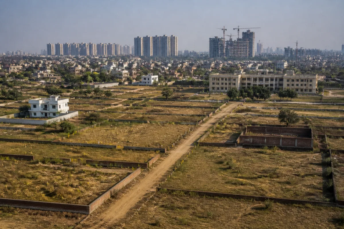
Greater Noida’s land acquisition system is facing a basic records problem with potentially serious consequences for the city’s planned growth: land bought by the development authority from farmers is reportedly not being consistently recorded in the authority’s name in revenue documents. That gap can make public land appear private and create space for unauthorised plotting, leaving homebuyers exposed to fraud and prolonged legal disputes.
The issue, reported by Navbharat Times – Noida, concerns land acquired through consent-based purchases for Greater Noida’s industrial, residential and institutional plans, as well as for expanding basic infrastructure. Farmers are compensated for the land, but the authority’s ownership is not always reflected in the revenue record after the transaction. In land administration, that step is not a clerical formality. It is what connects a completed purchase with the official record used to identify ownership and possession.
The process of recording a change in ownership is known as mutation, or दाखिल-खारिज in the source report. Once land is purchased, the authority is expected to have its name entered in the khatauni and other revenue records. These records establish the official identity of a parcel and help distinguish land held by the authority from land that remains in private ownership. When that chain is incomplete, the transaction may exist in documents held by one institution while the public-facing land record continues to show an earlier owner.
According to the report, the mutation process has slowed considerably since 2015. The source does not provide a verified total for the land affected or the number of individual parcels awaiting mutation. It says the Greater Noida Authority itself is not reported to have a definitive figure for how many purchased properties have not yet been entered in its name. That absence of a consolidated number is central to the problem because the authority cannot effectively identify, protect or monitor a land bank that it has not fully mapped in its own records.
The administrative gap also exposes a weakness in the way urban development is translated from acquisition into implementation. A development authority may purchase land for a defined public purpose, but the city’s physical expansion depends on several linked systems working together: compensation, registration, mutation, boundary identification, planning, possession and enforcement. If one of those links remains incomplete, land can become vulnerable even when the broader acquisition process has been completed.
The reported risk is not limited to an internal dispute between the authority and the revenue administration. The source describes colonisers allegedly presenting such parcels as farmers’ land, undertaking plotting and selling plots to unsuspecting buyers. The central danger for buyers is that a sale transaction can appear plausible at street level while the seller may not have the legal right to transfer the land. Buyers who invest their life savings in such plots may then face competing ownership claims, cancellation risks, construction restrictions or court proceedings.
The report does not establish how many buyers have already been affected, how much land has allegedly been plotted or whether specific colonisers have been prosecuted. Those details remain unreported in the supplied material. But the mechanism described is clear: unclear records create uncertainty over who owns a parcel, and that uncertainty can be exploited by those seeking to market land before its legal status is resolved.
This is particularly consequential in Greater Noida because the authority is not acquiring land for a single isolated project. The report says its purchases support industrial, residential and institutional schemes and the expansion of basic facilities. That means the same record-keeping weakness can affect different parts of the urban system, from planned development sites to land needed for roads and other infrastructure. It can also make future planning more difficult if the authority lacks a reliable parcel-level account of land already acquired.
The reported slowdown after 2015 points to a long-running administrative issue rather than a short-term transaction error. However, the available report does not identify the exact cause of the delay. It does not say whether the bottleneck lies in the authority’s documentation, the revenue department’s processing, disputes over boundaries or compensation, incomplete registration records, or coordination between institutions. Establishing that cause would require access to official mutation registers, acquisition files and parcel-level data, none of which is included in the supplied material.
That limitation matters because land records are maintained through an institutional chain. The development authority may hold purchase and compensation documents, while revenue authorities maintain the records used for mutation and land identity. If the information does not move reliably between these systems, the authority’s legal and planning position can remain weaker than its financial position. It may have paid compensation and planned to use the land, yet still face difficulty demonstrating ownership through the record most commonly consulted for land transactions.
A reliable land inventory would therefore need to answer more than the total area acquired. It would need to identify each parcel, the original owner, the acquisition or purchase document, compensation status, registration status, mutation status, present land use and any pending objection or litigation. The source does not say that such a system exists or that the authority has published one. Its reported inability to provide a firm count suggests that the first administrative task is establishing the scale of the unresolved record.
The issue also shows why land governance cannot be separated from consumer protection. Prospective buyers often assess a plot through brochures, site visits and documents presented by sellers. If the underlying government record has not been updated, buyers may not be able to distinguish an authorised transaction from a private claim over land already purchased for public development. The burden then shifts to individual purchasers to navigate a dispute that originates in an institutional records gap.
For the authority, the immediate public-interest question is not only how much land remains unmapped in revenue records, but also whether the vulnerable parcels have been identified and secured. The supplied report does not mention a public list, warning system, enforcement drive or deadline for completing mutations. It also does not record a response from the authority explaining the delay, confirming the number of pending cases or detailing action against alleged unauthorised plotting.
What the report establishes is narrower but significant. Greater Noida Authority has been acquiring land from farmers for more than a decade, compensation has been paid, and the authority’s name has reportedly not been entered in all relevant revenue records. The mutation process is described as having slowed after 2015, while the authority is not reported to have a definitive count of affected parcels. This creates a documented administrative vulnerability that can be exploited through unauthorised plotting and can expose buyers to legal disputes.
The next step in understanding the scale of the problem is official disclosure: the number of consent-based acquisitions completed, the number of mutations pending, the land area involved, the reasons for delay and the status of parcels where plotting has been reported. Until those records are reconciled, Greater Noida’s planned land bank remains vulnerable to a gap between what the authority has acquired and what the public revenue record says it owns.

