


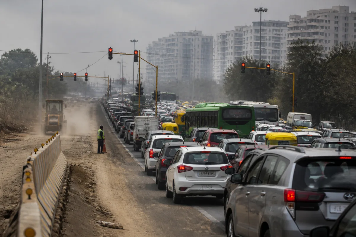
Delhi’s pollution hotspots are increasingly being shaped not only by emissions, but by the way the city manages roads, junctions, construction activity and industrial land. A field assessment reported by Jagran identified traffic congestion at ITO, JLN Stadium, Siri Fort, Mathura Road and around Jawaharlal Nehru University, while road bottlenecks, construction dust and industrial smoke were reported across outer Delhi and the trans-Yamuna area.
The significance of the findings lies in the interaction between these sources. Vehicles caught in long queues continue emitting at junctions where traffic movement is already constrained. Broken roads and unpaved stretches allow dust to rise under moving traffic. Construction material is transported through areas with weak road surfaces, while industrial units operate close to residential and transport corridors. The result is not a single pollution source but an urban system in which mobility and land-use problems reinforce one another.
The Jagran report was based on a field assessment conducted on Friday and identified ITO as one of the new hotspots in central Delhi. The junction connects traffic moving towards Vikas Marg, Bahadur Shah Zafar Marg, Deen Dayal Upadhyay Marg, Tilak Marg and Mathura Road. According to the report, the intersection faces vehicle pressure throughout the day and has four traffic signals. Signal operations are handled manually, while evening peak hours bring congestion on surrounding roads.
This makes ITO an example of how junction management can influence pollution exposure. The report points to relatively narrow roads, multiple signals and instances of signal jumping when traffic pressure rises. It suggests shorter signal cycles during peak periods and the deployment of traffic police to ensure compliance. A proposal for a flyover has also been mentioned in connection with the pressure at the junction, although the supplied report does not establish an implementation timeline or confirm that construction has been sanctioned.
A similar pattern appears on August Kranti Marg, which links Hauz Khas, Green Park, Khel Gaon and Andrews Ganj. The report describes heavy evening traffic caused by office commuters, around half a dozen cuts and several traffic lights. Its suggested traffic-management response is to separate lanes for left turns, right turns and through traffic at important cuts and signals, with traffic personnel deployed to maintain the arrangement. The details indicate that congestion is being created not only by the number of vehicles but also by conflict between different movements at the same junctions.
The Ashram–Badarpur stretch presents a more complex infrastructure problem. The report describes the corridor as approximately eight kilometres long and identifies incorrect road engineering and numerous cuts as causes of vehicles travelling from Noida and Faridabad crossing each other on the main routes. Work to extend the Modi Mill flyover towards the Kalkaji flyover has created another bottleneck, with congestion extending towards the Mathura Road side. The road, previously under the Public Works Department, has been handed over to the National Highways Authority of India, according to the report. A proposal has been mentioned to widen the corridor and construct a flyover to make it signal-free.
The same corridor also shows how one intervention can remain dependent on another. The removal of the Kalkaji foot overbridge has been proposed to reduce bottlenecks on the Outer Ring Road, but the report says the proposal is stalled because of the implementation of Graded Response Action Plan rules. The supplied material does not specify which GRAP restriction is applicable or when the work could resume. That uncertainty matters because road redesign, pedestrian infrastructure and pollution-control restrictions can affect one another when they are planned separately.
Traffic congestion is also reported around the JNU Ring Road, New Mehrauli Road and Munirka, particularly during morning and evening peak periods. Traffic and security checks are described as additional causes of delay. The report suggests speeding up security checks during peak periods so that their effect on traffic remains limited. It does not provide traffic-volume data or measurements of emissions at these locations, but it places security operations within the wider congestion problem rather than treating them as an isolated issue.
In northern and outer Delhi, the pollution pattern shifts from signal congestion to road condition, construction and industrial activity. The report identifies stretches near Shalimar Bagh, Burari, Nangloi, Mangolpuri, Bawana and Kanjhawala where broken roads and construction activity are allowing dust to spread. It also names Bawana, Narela and Mangolpuri as industrial areas where smoke from factories is reported to be worsening pollution. Construction in unauthorised colonies and trucks carrying building materials are identified as further sources of dust.
The findings underline the importance of distinguishing between a road that is merely congested and one that generates multiple forms of exposure. A traffic jam can increase vehicle emissions, but when it occurs beside an unpaved shoulder, a construction site or a material-handling route, dust becomes part of the same street-level problem. The report’s observations do not quantify the contribution of each source, so they cannot establish which source is dominant at any particular hotspot. They do, however, show why a single response focused only on vehicle restrictions may not address all the conditions reported at street level.
The Mukarba Chowk railway overbridge and the Ashok Vihar underpass are described as bottlenecks during morning and evening periods. At Mukarba Chowk, the report says a proposal to widen the road is awaiting approval from the railway authorities. At Ashok Vihar, the narrow underpass and a traffic signal immediately after its exit are identified as causes of congestion. These examples point to the administrative complexity of urban road management: a junction may depend on coordination between road agencies, railway authorities, traffic police and local bodies before a physical constraint can be altered.
Dwarka provides another illustration of how incomplete road surfaces can sit alongside traffic congestion. Near NSUT in Dwarka Sector 3 and Dwarka Mor, queues during busy periods are reported to extend towards the university’s main gate. A significant portion of the road on the opposite side is described as unpaved because of an Indian Oil pipeline, creating dust when vehicles pass. The area also has numerous motor garages, which the report identifies as an additional source of pollution. The account connects a major institutional destination, a busy junction, utility-related land constraints and roadside activity within one local pollution pattern.
The report identifies Sonia Vihar and Vivek Vihar as new pollution hotspots in east Delhi. Around Sonia Vihar, ready-mix plants and trucks carrying construction material are cited as sources of dust. Around Vivek Vihar, smoke from factories in Jhilmil, Friends Colony and Damodar Park is reported to be contributing to pollution. The area’s proximity to Anand Vihar is also associated with high vehicle pressure and dust during traffic jams. These locations demonstrate the overlap between industrial estates, freight movement and residential or high-traffic areas.
The institutional challenge is therefore divided across several responsibilities. Traffic police can manage signal compliance, lane discipline and junction deployment. Road-owning agencies must address widening, surface quality, bottlenecks and engineering design. Railway authorities may be required for changes near railway structures. Industrial regulators and local administrations are responsible for monitoring factories, ready-mix plants and construction-related activity. Utility agencies can affect whether roads remain paved or are reopened for pipelines and other infrastructure. The report’s central implication is that these responsibilities have to operate together if hotspot conditions are to improve.
The evidence available in the report is observational rather than a citywide emissions inventory. It provides no pollutant concentration readings, traffic counts, factory inspection results or before-and-after assessments. It therefore cannot rank ITO, Sonia Vihar, Vivek Vihar or the other locations by measured pollution severity. What it does establish is a broad geographic spread of reported problem areas and a recurring connection between congestion, dust, industrial smoke and weak road management.
That connection raises a larger urban question: whether pollution hotspots should be treated as air-quality locations alone or as failures of everyday city operations. At ITO, signal management and junction capacity are central. On the Ashram–Badarpur corridor, road geometry and construction-linked bottlenecks matter. In Bawana, Narela and Mangolpuri, industrial monitoring and road conditions are part of the problem. In Sonia Vihar and Vivek Vihar, construction logistics and industrial land uses sit close to heavily trafficked neighbourhoods.
For Delhi, the next step is not established by the supplied report as a single citywide programme. The developments to monitor are the proposed road widening at Mukarba Chowk, the Ashram–Badarpur corridor changes, the Modi Mill–Kalkaji flyover extension, traffic-management measures at major junctions and enforcement around industrial and construction-related sources. Until those actions are linked to measurable pollution and traffic outcomes, the city will know where its hotspots are being reported but not yet which interventions are reducing the exposure they represent.

