


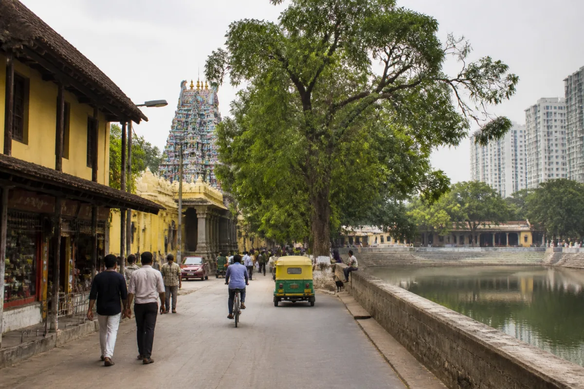
Bengaluru’s neighbourhood names are more than labels on road signs. They preserve traces of the city’s older water systems, trading communities, military camps, religious institutions, landscape and planned expansion. As the city has grown from a historic settlement into a technology and innovation centre, these names have continued to mark the layers through which Bengaluru was built.
The city is commonly associated with its transformation from the “City of Lakes” and “Garden City” into India’s Silicon Valley. However, the source history cited by Prajavani places Bengaluru’s origins much earlier than its modern technology economy. An inscription at Begur, dating to 890 CE, contains a reference to a battle associated with the city. The better-known foundation date is 1537, when Kempe Gowda, a feudatory ruler of the Vijayanagara Empire and a member of the Yelahanka Nadaprabhu lineage, established the foundations of the city.
The popular story behind the name Bengaluru itself connects the city to a Kannada expression associated with boiled beans. According to the legend, a local king who had lost his way was offered cooked beans by an elderly woman at a house. The place came to be known as “benda-kaalu-ooru”, or the settlement of boiled beans, which later evolved into Bengaluru. The account is a popular legend rather than a documented explanation, but its continued presence shows how oral history remains part of the city’s identity.
The structure of Bengaluru’s older settlement pattern can also be read in the suffixes used in neighbourhood names. Prajavani’s account, citing historians, says that more than 200 settlements ending in “ooru” and around 450 smaller settlements known as “halli” came together to form the wider city. Names such as Domlur and Marathahalli retain this settlement history. The words point to a city that expanded by absorbing villages and local settlements rather than emerging as a single, uniformly planned urban form.
That distinction matters because Bengaluru’s present geography is often understood through its large technology campuses, ring roads and expanding residential districts. Yet many of the city’s neighbourhood names indicate a much older pattern: urban growth through the incorporation of communities, occupations and ecological features. The names are evidence of how the city was organised before the contemporary metropolitan system took shape.
Some of the explanations are linked to local languages and remembered environmental conditions. Domlur, where Telugu-speaking communities have historically lived, is associated in the source with the Telugu word “domalu”, meaning mosquitoes. Local recollections connect the name to the area’s earlier reputation for mosquito nuisance. The account of Marathahalli is less settled: some people associate it with “Marut”, the fighter aircraft designed at Hindustan Aeronautics Limited nearby. The different explanations show that place names can carry multiple interpretations, especially when oral memory, industrial history and linguistic change overlap.
The older market districts provide a clearer record of economic activity. The suffix “pete” identifies areas that functioned as trading centres. Chikkapete, for example, is described as a small market. Other neighbourhoods were associated with the occupations that dominated them: Kumbarapete with potters, Cottonpete with cotton, Upparapete with salt sellers and Ganigarapete with oil pressers. These names preserve the contribution of workers and traders to Bengaluru’s formation, challenging the idea that the city was created only by rulers or administrative decisions.
In this sense, the old market names are an informal economic map. They indicate how production, exchange and specialised labour were arranged within the historic city. The neighbourhood was not merely a residential unit; it could also be a workplace, a market and a community organised around a particular trade. Even when those economic functions have changed, the names retain a record of the occupational geography that once shaped everyday movement and commerce.
Military history appears in another group of neighbourhoods ending in “palya”. During the rule of Hyder Ali and Tipu Sultan in the 18th century, areas used as military camps acquired names associated with army settlements. Sultanpalya is linked to the location of a royal military unit, while Kalasipalya is associated with “kalasis”, people who put up tents and supported travelling forces. These names show how military infrastructure influenced the city’s spatial development and how camps could become lasting urban districts.
Other names indicate the role of education and religious institutions. Areas called “agrahara” and “mangala” are described as former centres of learning. Koramangala and Rupena Agrahara are associated in the source with important medieval educational settlements. Malleshwaram and Basavanagudi, meanwhile, are linked to prominent temples in those areas. Such names suggest that institutional life—learning, worship and community activity—was central to the formation of neighbourhoods well before the arrival of modern civic agencies and private real estate development.
Water is another major layer in Bengaluru’s urban vocabulary. The city’s historical relationship with tanks and irrigation appears in names containing “kere”, meaning a water body or irrigation tank. Mattikere and Tavarekere are examples. The word “godi” referred to places where water from a filled tank overflowed and collected; Adugodi and Kadugodi are cited as examples. Smaller ponds were known as “kunte”. Konanakunte is associated with a pond where buffaloes were washed.
These names are particularly significant in a city historically known for its interconnected lakes and tanks. They suggest that water was not an incidental feature but a defining part of settlement and land use. The names preserve clues about where water was stored, where it moved and how local communities used it. They also provide a reminder that the contemporary metropolitan landscape rests on an older water-management geography, even when many of the original features are no longer visible in everyday life.
Bengaluru’s physical geography is reflected in another set of place names. The city stands at an elevation of about 900 metres above sea level, higher than Dehradun at the foothills of the Himalayas, according to the source. Names containing references to hills and elevated land include Ragigudda and Bannerghatta. These names connect neighbourhood identity to terrain rather than to administrative boundaries alone.
The city’s planned expansion after Independence produced a different naming pattern. Jayanagar was established on 20 August 1948, a year after Independence, and was named in memory of the Mysuru Maharaja Jayachamarajendra Wadiyar. Prajavani describes it as the country’s first planned neighbourhood. Its origin marks a transition from organically accumulated settlements to deliberately laid-out urban development.
Other neighbourhoods commemorate public figures. J.P. Nagar honours Jayaprakash Narayan. Rajajinagar was named after C. Rajagopalachari, India’s last Governor-General. Sadashivanagar, formerly known as Palace Orchards, commemorates freedom fighter Karnad Sadashiva Rao. These names show how the city’s map also became a record of political memory and public recognition.
Some names capture older land uses and colonial-era changes. Halsuru is associated with the jackfruit groves that once occupied the area. Nagarabhavi is linked in local explanation to the presence of snakes, while Madiwala is associated with washer communities. Mahatma Gandhi Road, now one of Bengaluru’s best-known commercial corridors, was earlier called South Parade Road because it lay south of a parade ground used by the British army.
Taken together, these histories reveal that Bengaluru was not built through one continuous plan. It developed through overlapping systems: village settlements, markets, tanks, military camps, temples, educational institutions, planned layouts and commemorative naming. The modern city’s growth has not erased those layers. Instead, they remain embedded in the vocabulary used by residents, transport systems, property markets and public administration.
The evidence presented in the source does not establish every etymology with equal certainty. Some explanations are explicitly described as legends, local memories or claims made by some people. Others are connected to recognisable institutions, occupations or geographic features. That distinction is important because place-name histories are often assembled from inscriptions, language, oral traditions and later interpretations rather than from a single definitive record.
The larger urban question is what happens when a rapidly expanding metropolis loses the context behind its names. A neighbourhood name can function as a small historical archive, retaining information about water, work, mobility, ecology and settlement even after the original landscape has changed. Reading Bengaluru through these names makes its expansion visible as a process of accumulation, absorption and adaptation.
Bengaluru’s technology economy may define its present image, but the city’s neighbourhoods show that its urban foundations are older and more diverse. Its names record the work of rulers, traders, soldiers, teachers, religious institutions, craftspeople and local communities. The contemporary metropolis is therefore not separate from its past; it is built on the traces that remain in the city’s streets and neighbourhoods.

