


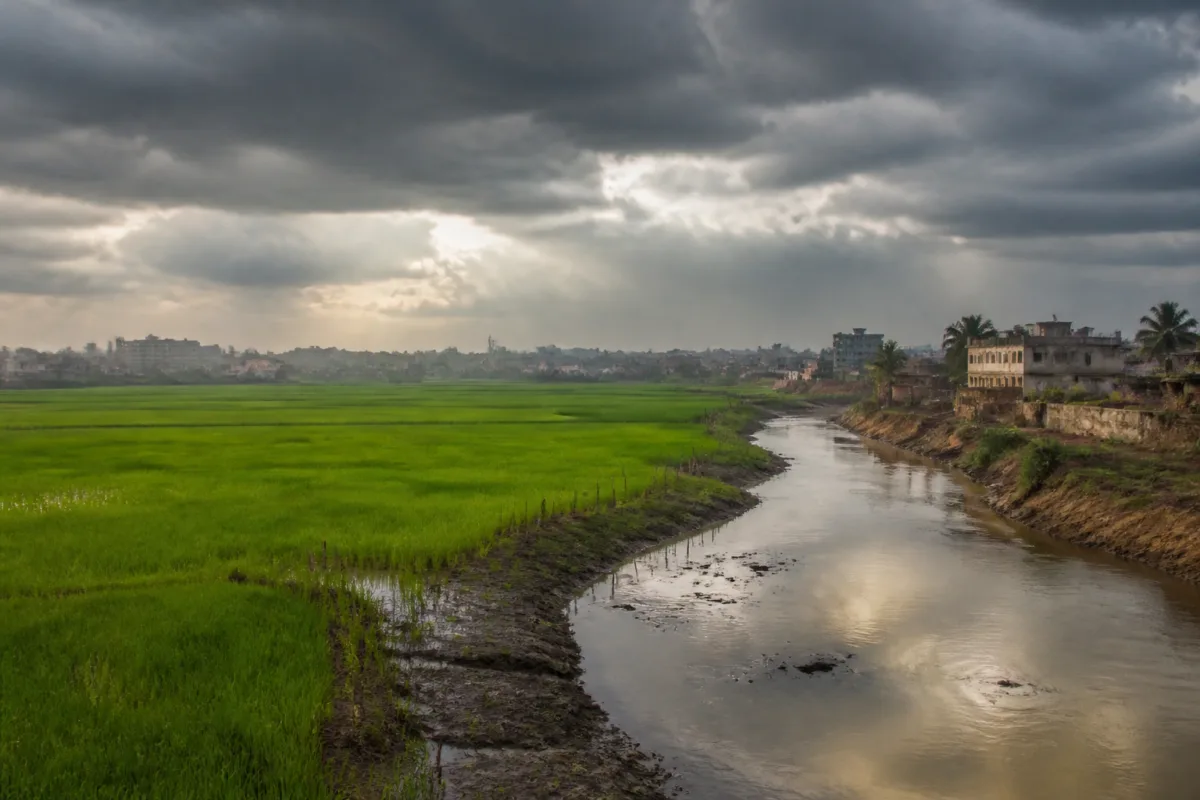
Bengal’s climate shift is not a story about the region becoming cooler. It is a story about temperature and rainfall patterns changing together over decades, altering the climatic conditions on which farming, water management and food security depend. A new study by scientists from the India Meteorological Department and the Indian Institute of Tropical Meteorology, Pune, finds that Gangetic Bengal and parts of northeast India have moved from the tropical savannah climate zone towards a temperate classification since 1951.
Published in the October 2026 issue of IMD’s peer-reviewed journal Mausam, the study analysed rainfall and temperature records across successive 30-year periods from 1951 to 2020. Its central finding is that the climatic character of the region has changed progressively, rather than through a single abnormal season. That distinction matters for cities, farmers and public agencies because infrastructure and agricultural planning are generally built around historical expectations of heat, rain and seasonal water availability.
The study’s classification does not mean that Bengal is becoming colder. The researchers found that the shift reflects a changing combination of temperature and seasonal rainfall, including rising maximum temperatures. In other words, a region may move into a different climate category even while experiencing more intense heat at particular times. The classification captures the relationship between temperature and rainfall, not a simple cooling trend.
The findings also point to the importance of looking beyond annual averages. Rainfall over Gangetic West Bengal and Bihar declined between 1981 and 2020, according to the study. For a region whose agriculture and settlements depend heavily on seasonal rainfall, a long-term decline can create pressure even when individual years bring heavy rain or remain close to normal. The evidence presented by the researchers suggests that the question is not only how much rain falls, but when it arrives, how reliably it arrives and whether water is available during the periods when crops and communities need it.
The northeast shows a related but broader change in climate classification. The share of the region classified as tropical savannah fell from 18% during 1951-1980 to 12% during 1991-2020. Over the same periods, the temperate category expanded from roughly three-fourths of the region to more than four-fifths. These changes were identified through the study’s analysis of IMD temperature and rainfall data, which showed a progressive expansion of the temperate classification across the northeast.
That pattern is important because climate categories are often treated as technical descriptions, while their consequences are experienced through ordinary systems. Farmers plan sowing and harvesting around seasonal conditions. Water agencies estimate supply and demand using rainfall patterns. Food systems depend on crop output from regions where rainfall variability can affect production. The study explicitly links the observed changes to agriculture, water security and food security, making the findings relevant to public administration as well as climate science.
The rainfall trend identified for Gangetic West Bengal and Bihar is connected in the study to a climate pattern known as the Victoria Mode. This refers to recurring variations in sea-surface temperatures in the North Pacific. During its negative phase, changes in atmospheric circulation can reduce moisture transport towards the Indo-Gangetic plains and suppress rainfall over Bengal and neighbouring regions.
The significance of this finding is institutional as much as meteorological. It indicates that rainfall conditions over eastern India cannot be assessed only through local observations or by tracking El Niño. Rajib Chattopadhyay of IITM Pune, a co-author of the study, said East and northeast India had recorded the largest rainfall shortfall of any of India’s four broad meteorological regions during the 2026 monsoon. He also said the analysis showed that rainfall over Gangetic West Bengal and Bihar had already been declining for four decades in step with the distant ocean-temperature pattern, making it important to track the Victoria Mode alongside El Niño for the region’s rice farmers.
The 2026 monsoon figures provide a recent illustration of the pressure described in the longer record. East and northeast India recorded a rainfall deficit of 25.6%, the largest among India’s four broad meteorological regions. Meghalaya received 60% less rainfall than normal, Bihar recorded a 32% deficit and Assam a 28% deficit. Bengal ended close to normal, according to the report. The contrast is instructive: a regional climate risk does not necessarily produce the same outcome in every state or every year. A near-normal season in one area does not erase a long-term decline or protect neighbouring regions from severe deficits.
This makes the design of forecasts and advisories especially important. IMD director general Mrutyunjay Mohapatra, also a co-author, said seven decades of records showed that the climate of the region had been moving out of the tropical zone, while rainfall over the plains of Bengal and Bihar had declined. He said both seasonal and long-term changes should be considered in forecasts and advisories to farmers.
The distinction between seasonal forecasting and long-term climate assessment is central to understanding the study. Seasonal forecasts help public agencies and farmers prepare for conditions in a particular monsoon or crop cycle. Long-term records reveal whether the assumptions underlying those forecasts are themselves changing. If rainfall baselines shift over several decades, older averages may no longer describe the conditions that farmers, water managers and local administrations are likely to face.
For urban areas, the study raises questions about how water security is assessed. The supplied findings do not establish a direct link between the climate classification change and any specific city’s water supply, flooding or groundwater levels. They do, however, identify a regional decline in rainfall over Gangetic West Bengal and Bihar and connect that decline to wider atmospheric and oceanic patterns. That evidence makes rainfall reliability a planning concern for urban and rural systems alike, even though the precise city-level consequences require separate assessment.
The same caution applies to infrastructure. The study does not quantify damage to roads, drainage systems, reservoirs or buildings, nor does it prescribe a specific adaptation programme. Its contribution is to establish that the climate conditions used to understand the region have changed over time. Public agencies responsible for agriculture, water and food security will therefore need to interpret infrastructure and advisory needs against both recent seasonal conditions and the longer record documented by IMD and IITM.
The findings also show why a single annual rainfall number can conceal significant risk. Bengal’s rainfall was close to normal in 2026 even as Meghalaya, Bihar and Assam experienced substantial deficits. At the same time, the study identifies a four-decade decline in rainfall over Gangetic West Bengal and Bihar. These facts are not contradictory. They show that regional averages, state-level outcomes and long-term trends operate at different scales, and that planning based on one measure alone can miss emerging vulnerabilities.
The evidence currently supports three clear conclusions. First, the climatic classification of Gangetic Bengal and parts of northeast India has shifted over the seven decades studied. Second, the shift is associated with changes in temperature and rainfall, not with a simple cooling of Bengal. Third, rainfall decline over Gangetic West Bengal and Bihar has persisted over four decades and may be influenced by climate patterns beyond the region, including the Victoria Mode.
What remains unresolved in the supplied study summary is how these changes are translating into crop-level impacts, groundwater conditions, reservoir operations, urban water demand and local heat exposure. Those questions require more detailed local evidence. The immediate institutional task identified by the researchers is clearer: forecasts and farmer advisories must account for both seasonal variability and long-term changes, while policymakers monitor the climate signals that influence rainfall over eastern India. The region’s changing climate classification is therefore not merely a scientific label; it is a warning that historical assumptions about water and agricultural reliability are becoming less secure.

