


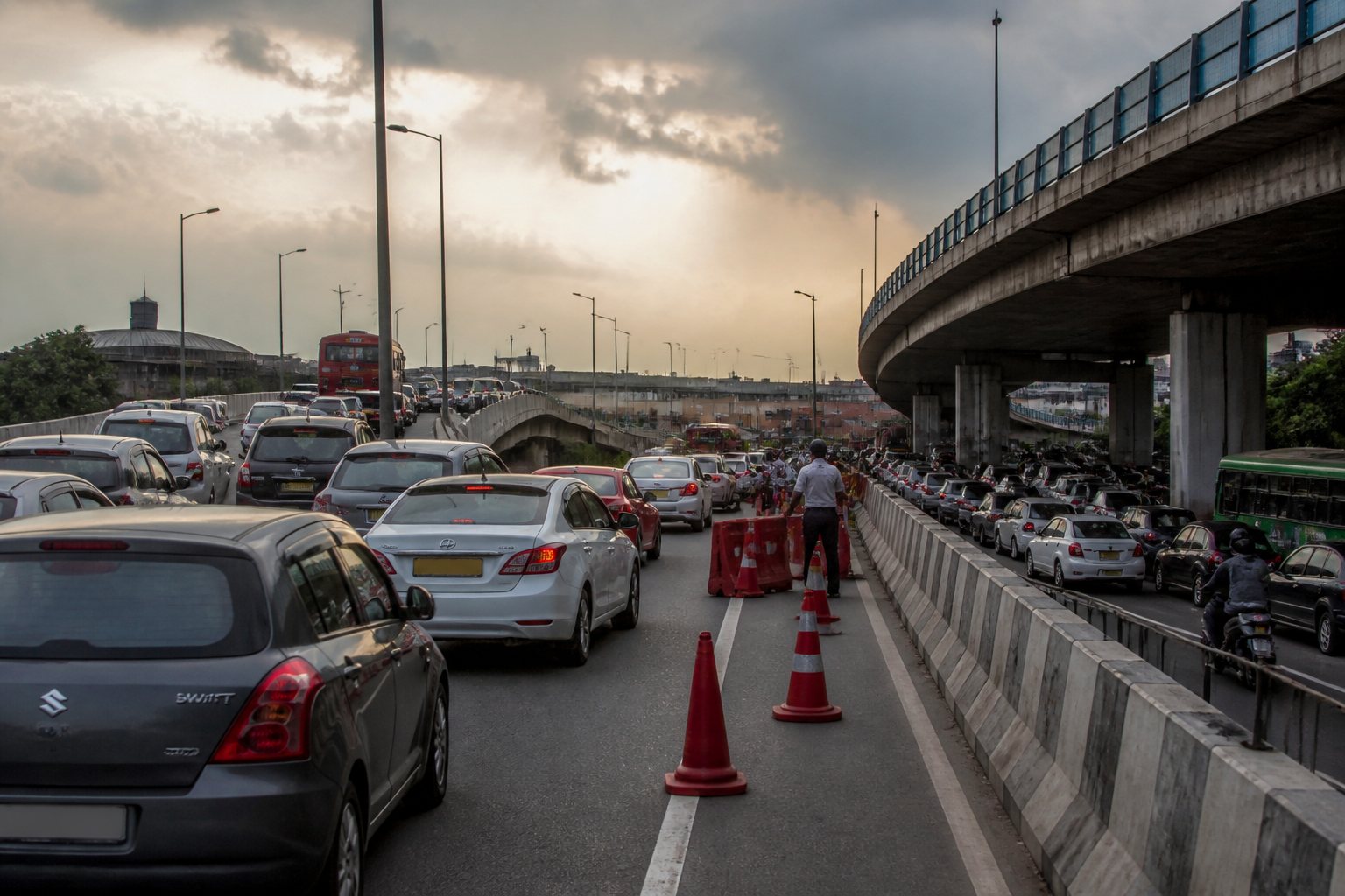
Barapullah Phase III was opened to shorten the journey between Mayur Vihar and INA, but within two days the corridor had produced traffic jams lasting two hours or more. The immediate failure was not simply that a new road became crowded. It was that a three-lane corridor was connected to an older two-lane stretch through sharp, abrupt merges, while navigation software directed large numbers of motorists towards infrastructure that had not yet adjusted to real traffic conditions.
The episode has pushed Delhi Traffic Police and the Public Works Department to examine the design and operation of the wider Barapullah corridor. A drone survey and a joint meeting have identified lane configuration, merging points and traffic flow as areas requiring intervention. The first response is not another major construction project but a series of operational changes: barricades or cones to create smoother merges, manual traffic regulation, possible diversions towards NH-24 and corrections to navigation-app routing.
That sequence is important because it shows how the performance of urban infrastructure depends on more than the physical completion of a flyover. A corridor can be built, inaugurated and shown as a continuous route on a map, yet still fail at the points where different road sections, traffic streams and institutional decisions meet. In Barapullah’s case, the new stretch appears to have increased the amount of traffic reaching older infrastructure without resolving the older section’s capacity constraints.
The corridor’s promise was straightforward: a faster connection between Mayur Vihar and INA. But the traffic pattern after opening demonstrated that travel time is determined by the weakest link in a connected road system. The new section has three lanes, while the existing Barapullah stretch narrows to two. When traffic volumes rise, vehicles are funnelled from a higher-capacity section into a lower-capacity one. The result is not merely slower movement at the point of narrowing; queues can extend backwards and disrupt the entire route.
This is a familiar problem in road engineering, but the Barapullah case makes the institutional consequences visible. The project took 12 years to complete, according to the supplied report, yet the corridor’s operational weaknesses became apparent almost immediately after opening. The distinction between construction completion and transport readiness is therefore central. A road may be physically ready for vehicles while its lane transitions, traffic controls, diversion arrangements and digital routing systems remain untested under actual demand.
The most significant bottleneck identified by officials is near Sarai Kale Khan, close to the loop around Sundial Park. Traffic from the loop joins the new elevated Barapullah stretch at a point where the two streams meet abruptly rather than blending gradually into the main carriageway. Officials said the sharp geometry of this merge creates a bottleneck, particularly when traffic volumes are high.
The proposed remedy—using barricades or cones to create a tapered and smoother merge—may appear modest compared with infrastructure reportedly costing more than Rs 1,000 crore. Yet it reflects a basic operational reality: the capacity of a road is shaped by how vehicles enter and leave it. A physical bottleneck does not always require immediate reconstruction, but it does require traffic engineers to understand where drivers are forced to brake, change lanes or compete for limited road space.
A second problem has been identified in the older section, where traffic from the Guru Harkrishan Medical Institute side merges with Barapullah. Traffic personnel have been asked to remain deployed at crucial times to regulate vehicles and facilitate stop-and-go movement. Officials are also examining whether traffic can be regulated or diverted towards NH-24 wherever feasible, reducing pressure on the corridor.
These measures show that the corridor is being managed as a live traffic system rather than as a standalone road. Manual regulation can address peak-period conflicts, while diversion can distribute demand across available routes. But both measures also indicate that the new infrastructure has not yet delivered a self-regulating flow. Its performance currently depends on traffic personnel, physical channelisation and the availability of alternative routes.
The Barapullah Phase III problem also exposes the growing influence of navigation platforms on urban traffic. Google Maps reportedly displayed the newly opened corridor as a smooth and shorter route, directing motorists towards it. Because the road had just opened, the platform did not yet have enough real-time traffic data to accurately reflect the congestion. Traffic police raised the issue with Google, which, according to the report, said its system needs a few days of actual traffic data after a new road opens.
This creates a temporary but consequential mismatch between digital guidance and physical conditions. A newly opened road can attract traffic rapidly because the map presents it as an efficient alternative. That additional demand can overwhelm a merge or downstream section before the platform has enough data to recalibrate. The road is therefore not only carrying vehicles; it is also being assigned vehicles by a digital system that learns from the traffic it helps create.
The episode underlines a coordination challenge that is increasingly important for large cities. Road agencies are responsible for design and construction, traffic police manage movement and enforcement, and private technology platforms influence route choice. If these systems are not synchronised before and immediately after an opening, the public experiences the failure as one continuous problem, regardless of which institution controls each part.
The supplied report does not establish whether the design flaws can be resolved entirely through channelisation and traffic management or whether more extensive changes to the corridor will be required. It does, however, identify specific points where the system is failing: the three-lane-to-two-lane transition, the sharp merge near Sarai Kale Khan, the older section near the medical institute, and the initial mismatch between road conditions and navigation-app directions.
That evidence shifts the question away from whether Barapullah Phase III should have been opened and towards how major urban corridors should be tested before they are exposed to full traffic demand. The first days after opening have functioned as an unplanned stress test. Thousands of motorists experienced the consequences, while officials used surveys and on-ground observations to locate the pressure points.
For Delhi, the next stage will be defined by implementation rather than inauguration. Traffic Police and PWD are considering physical channelisation, manual regulation, possible diversion towards NH-24 and changes to digital routing. The corridor’s performance will depend on whether these interventions can make traffic merge gradually, distribute demand more effectively and align route guidance with actual conditions.
