


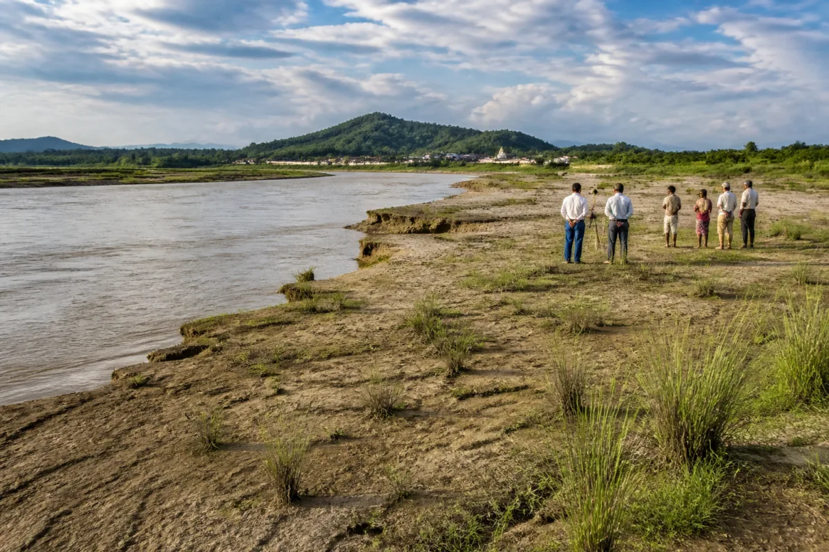
Assam’s plan to reclaim 4,000–5,000 bighas of land exposed by changes in the Brahmaputra’s course is not simply a land-development proposal. It is an attempt to respond to two opposing processes in the river valley: land lost through erosion and new high-lying ground emerging from the riverbed. The state government says any intervention will depend on comprehensive scientific studies, making the project’s first test less about construction and more about whether the newly available land can be safely, legally and productively integrated into the region’s settlement and economic systems.
Chief minister Himanta Biswa Sarma discussed the proposal with ministers and senior officials during visits to proposed sites at Kayantol in Hajo, Kamrup district, and Sonka in Mayong, Morigaon district. According to the report by Times of India – Guwahati, the government is considering a scientific study-based project to reclaim land at multiple locations where the river’s course has changed.
The proposal emerges from Assam’s long-running exposure to riverbank erosion. Sarma said large tracts of land had been lost to erosion, while changes in the Brahmaputra’s course had caused land to emerge from the riverbed. The government’s stated objective is therefore not limited to creating new land. It also seeks to address places where land lost earlier may now have reappeared as higher ground.
That distinction is important. Land visible after a river changes course is not automatically ready for farming, industrial use or settlement. The chief minister said the government would take decisions only after comprehensive scientific studies. The statement indicates that the administration has not yet presented a final land-use plan, construction schedule, financing structure or settlement framework. At this stage, the project is a proposal under consideration, supported by site identification and preliminary discussions rather than an announced implementation programme.
At Kayantol, the government is considering the reclamation of more than 2,000 bighas between Laheshwari Temple and Srihati near Hajo. At Sonka, the proposed works cover about 1,000 bighas between Kachashila and Narasingha Hill and another 1,500 bighas between Narasingha Hill and Ganesh Hill. Sarma also referred to a third project under planning. Together, these locations could account for 4,000–5,000 bighas, while district commissioners have identified other sites with similar potential.
The scale makes the proposal an administrative exercise as much as an engineering one. The government would have to determine the exact extent, physical condition and ownership status of each site before deciding what can be done there. The report does not provide details of the proposed reclamation technology, the agencies responsible for technical assessment, the boundaries of the sites or the legal status of the land. Those details will determine whether the initiative becomes a functioning land-recovery programme or remains a collection of site-level possibilities.
The administration’s emphasis on scientific studies also reflects the instability of riverine landscapes. A site that appears suitable for cultivation or construction may still be exposed to future changes in the river channel, erosion or flooding. The source report does not establish the geological, hydrological or environmental characteristics of the identified locations. It also does not state whether the proposed studies will examine seasonal river behaviour, sediment stability, flood levels or the effect of reclamation on neighbouring land and water flows. These questions remain open and are central to determining what kind of development, if any, is appropriate.
The proposed end uses span three distinct categories: agriculture, industry and human settlement. Each requires a different level of land stability and public infrastructure. Agricultural use may require access roads, irrigation and protection from seasonal flooding. Industrial use would require larger investments in transport, utilities, drainage and environmental safeguards. Human settlement would raise additional questions about housing, public services, access, disaster preparedness and long-term tenure.
Because the same reclaimed tract could be considered for several uses, land-use sequencing will be significant. The chief minister said reclaimed land could be made suitable for agriculture, setting up industries or human settlement, but the report does not indicate which locations would be assigned to which purpose. Nor does it identify whether local communities, displaced households or people affected by earlier erosion would receive priority. Without such information, the project’s social and spatial consequences cannot yet be assessed.
The proposal also places the district administration at the centre of the next phase. District commissioners have identified additional sites, while the chief minister has said that land reclamation will be possible only through a large-scale project. This suggests a process in which local site identification would feed into a broader state-level programme. The state government would then need to consolidate technical findings, estimate costs, secure funding and establish the institutional responsibilities for execution and monitoring.
Funding is already recognised as a constraint. Sarma said the initiative would require substantial funding, but no financial estimate or funding source was provided in the report. That gap matters because reclamation is only one part of the cost. Preparing land for use could require embankments or other protective works, access infrastructure, drainage, utilities and public facilities. If the land is intended for settlement or industry, the cost of connecting it to existing urban and rural networks would also have to be considered.
The proposal therefore sits at the intersection of river management and land development. The state is responding to a physical change in the Brahmaputra, but it is also considering how that change can be converted into productive land. This creates a governance challenge: decisions about land cannot be separated from decisions about river behaviour, flood risk, infrastructure and the rights of people who may already use or claim the affected areas.
The available information confirms the locations under consideration, the approximate scale and the government’s stated requirement for scientific studies. It does not yet confirm that reclamation work has begun, that the land is permanently stable, or that any industrial, agricultural or residential project has received approval. It also does not establish whether the initiative is linked to a wider Brahmaputra management plan or an existing state land policy.
That distinction should guide how the proposal is understood. The government has identified a possible opportunity created by course changes in the river, but the same river processes that expose land can continue to reshape it. The state’s own emphasis on comprehensive scientific assessment acknowledges that the opportunity cannot be evaluated from land area alone.
The next stage will be decisive. Scientific studies must establish the physical suitability of the sites; the administration must clarify land status and proposed uses; and the government must determine how a project of this scale would be financed and implemented. Until those steps are completed, Assam’s Brahmaputra land reclamation plan remains a significant but preliminary attempt to convert a changing river landscape into a managed land resource.

