


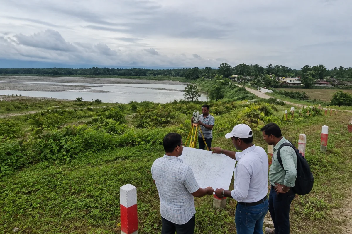
The approval of ₹20 lakh for a comprehensive land-use, development and map register has reopened the possibility of progress for Bhorer Alo, a large tourism project planned at Gajoldoba on the right bank of the Teesta in Jalpaiguri district. But the decision also exposes a basic planning failure: the project was announced before the land needed for its infrastructure had been properly mapped, classified and assigned for use.
The Gajoldoba Development Authority’s proposed survey, scheduled for December and to be conducted by a specialised agency, will cover 22 mouzas, according to information reported by Telegraph India. The exercise is expected to establish the extent, ownership status and existing condition of land within the authority’s area, creating the base document required for development planning and for the preparation of detailed project reports.
That sequence matters. A tourism project may be presented through a vision of visitor facilities, public spaces, roads and supporting services, but each of those components depends on a prior land question: which department controls the site, what legal and physical constraints apply, and whether the parcel is actually available for the proposed use. In Gajoldoba, those questions remained unresolved even as several development plans were announced.
The project was taken up by the erstwhile Trinamool Congress government, and the report describes it as the largest tourism project pursued by that administration at Gajoldoba. Several plans were announced by former chief minister Mamata Banerjee. However, land-related complications prevented the finalisation of detailed project reports for various proposed projects, leaving the development programme without the planning certainty needed to move from announcement to implementation.
The new approval therefore represents more than a routine administrative sanction. It is an attempt to create the missing planning layer. The land survey and map register are intended to give the Gajoldoba Development Authority a consolidated picture of land use, development potential and ownership across a territory that involves multiple panchayats and government departments.
The administrative structure itself helps explain the difficulty. The land initially identified for the tourism hub belonged to the irrigation, fisheries and forest departments. According to a source cited in the report, the exact extent, ownership status and existing condition of that land had not been properly mapped before the tourism hub was announced. Without that information, departments faced difficulties in preparing detailed project reports and identifying suitable locations for infrastructure and other development works.
This is a common institutional problem in large public projects: the announcement of an intended use precedes the creation of a reliable common record. When several departments hold land in the same development area, each may possess information relevant to its own mandate, but the absence of an integrated register makes it difficult to determine which parcels can be developed, which must remain protected or operational, and which require further administrative action.
The proposed survey is expected to cover substantial areas across four panchayats. Jangalmahal mouza under Mantadari panchayat accounts for around 2,900 acres, while around 1,500 acres fall in Sikarpur panchayat, 770 acres in Bagrakote panchayat and 528 acres in Kalaigati panchayat. Parts of Odlabari, Hanskhali, Saogaon, Purba Tatgaon, Gujrimari, Paschim Tatgaon and Sundaribusty in neighbouring blocks are also proposed to come within the planning framework.
These figures show the scale of the exercise. The proposed planning area is not a single development plot that can be cleared and built out through one project approval. It is a large and dispersed territory involving multiple settlements, administrative jurisdictions and land uses. A map register for such an area must do more than identify vacant parcels. It must establish how different pieces of land relate to one another and which development activities can be located without creating conflicts between public infrastructure, departmental functions and existing occupation.
The history of encroachment adds another layer of complexity. Several plots in the Gajoldoba Development Authority area were reportedly encroached upon in the past. Some have since been recovered, but the lack of a clear land-use policy and a long-term development blueprint has left authorities uncertain about how recovered land should be used.
That uncertainty is significant because recovery does not automatically create a development-ready site. A plot may be available in administrative terms but still require a decision on access, servicing, environmental constraints, public use or compatibility with neighbouring land. Until those decisions are recorded in an approved planning framework, recovered land can remain underused or become vulnerable to fresh disputes and competing claims.
The proposed land-use map could help convert separate parcels and departmental records into a shared development framework. It may also establish the basis for deciding where tourism facilities, public infrastructure and other permitted activities can be located. However, the supplied report does not specify the final land-use categories, the planning authority that will approve them, or the implementation timetable for individual projects. Those details will determine whether the survey becomes an operational planning instrument or remains a descriptive record.
The earlier attempt to prepare a land-use map illustrates the administrative gap. The Jalpaiguri district administration had invited expressions of interest through a specialised agency, but the initiative did not progress because approval to prepare the map was not granted by the previous government, according to a source cited in the report. The current financial approval removes that immediate procedural obstacle, but it does not by itself resolve questions of interdepartmental coordination, land rights or project prioritisation.
The Gajoldoba Development Authority will have a central role in the next stage. Its secretary, who is also the sub-divisional officer of Malbazar, said the survey would be conducted in December by a specialised agency. The authority will need to use the resulting information to determine how much land is already used, how much remains available and what forms of development are feasible. An official cited in the report said the exercise could also help attract private investment.
Private investment, however, depends on public clarity. Investors require more than the announcement of a tourism destination. They need certainty about land title or control, permitted uses, access, infrastructure responsibilities and the process for obtaining approvals. A detailed land-use and development register can reduce some of those uncertainties, but only if it is accepted across the departments controlling the land and is translated into project-level decisions.
The numbers in the proposed survey area also indicate why piecemeal project planning has been difficult. With land spread across several panchayats and neighbouring blocks, individual facilities cannot be assessed independently from the larger spatial framework. Roads, utilities, visitor facilities and public amenities would need to be planned in relation to the location and status of each parcel. The report does not establish which facilities will be prioritised, how they will be funded or when construction may begin.
That absence of project-level detail is important. The immediate decision concerns ₹20 lakh for surveying and planning, not a construction package or a confirmed implementation budget for the Bhorer Alo project. The approval can make future development decisions more informed, but it does not amount to a final approval for the tourism hub’s full build-out.
Gajoldoba’s next phase will therefore be judged by the quality and use of the information produced. The key questions are whether the survey will reconcile departmental records, identify the legal and physical status of each parcel, account for encroachments and recovered land, and produce a development framework that can guide detailed project reports. The authority’s ability to convert that information into coordinated decisions will determine whether Bhorer Alo moves beyond a long-stalled proposal.
For now, the land survey is the project’s most concrete new milestone. It addresses the administrative uncertainty that repeatedly blocked detailed planning, while leaving the larger questions of land-use approval, infrastructure delivery, private participation and construction timelines to subsequent decisions.

