


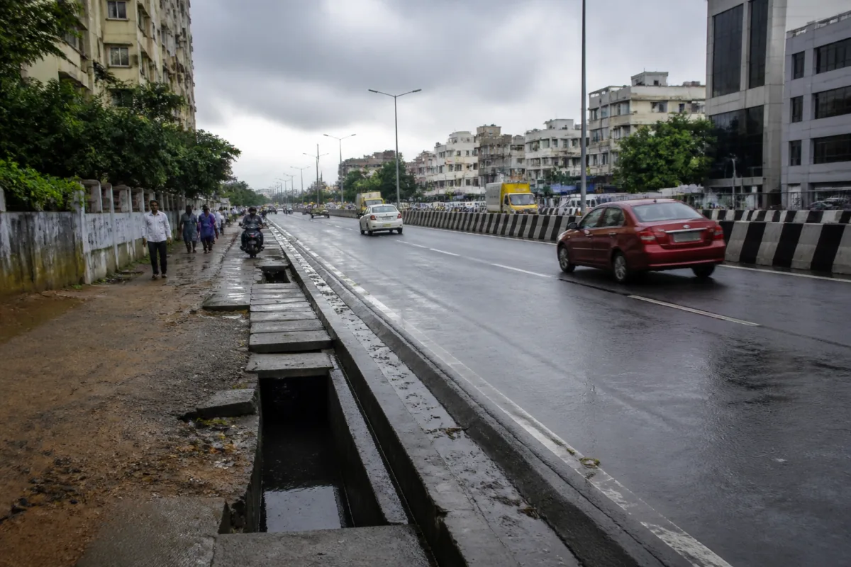
Chennai’s plan to transfer 100km of arterial roads from the Greater Chennai Corporation (GCC) to the Tamil Nadu highways department is being presented as a way to improve maintenance and coordinate flood mitigation. But the administrative rearrangement also exposes a deeper problem: the city’s roads and stormwater systems are divided between agencies whose responsibilities do not always align at street level.
The first phase covers 75km across 38 stretches in eight zones, while the remaining 25km is expected to be transferred later. The roads identified include some of Chennai’s busiest and most visible corridors, including Usman Road, Nelson Manickam Road, Perambur Barracks Road, Venkatanarayana Road, Duraisamy Road, New Avadi Road, Poonamallee High Road and the MGR Road–Arcot Road stretch.
GCC deputy commissioner (works) S Saravanan told the Times of India that the corporation had conveyed its concurrence to the government. A government order is expected before the highways department formally takes over the identified 75km. Until that order is issued, the transfer remains an administrative process rather than a completed change in road control.
The stated rationale is operational. Corporation officials said roads that function as continuous corridors are sometimes split between the GCC and the highways department. One agency may maintain one section while the other maintains the continuation. This can produce different standards of road design and maintenance along the same route, including variations in the width of stormwater drains.
That mismatch is not a minor engineering detail. During heavy rain, a wider drain can narrow where it meets a section maintained by another agency. Such bottlenecks can obstruct the movement of stormwater and increase flood risks. In this sense, the road transfer is also an attempt to address a coordination problem created by fragmented authority.
Yet the same move could create a different form of fragmentation for citizens: responsibility may become more difficult to identify. An urban road is experienced as one continuous public asset by people who use it, regardless of which department controls each section. When a road fails, water accumulates or a drain is blocked, residents generally need a clear answer about which authority is responsible and how quickly it will respond.
### A city divided by maintenance jurisdictions
The scale of the institutional division is visible in the road network figures cited in the report. The GCC currently maintains 488 bus route roads covering 418.56km, along with 35,978 interior roads spanning 5,653.89km. The bus route roads have widths ranging from 50 feet to 150 feet, while the interior roads range from 15 feet to 40 feet.
The highways department maintains 60 roads within the city, covering 270km. These roads range from 50 feet to 225 feet in width. The figures show that Chennai’s road system is not managed through one unified municipal network. It is distributed across agencies with different scales of responsibility, road categories and administrative structures.
That distribution may be manageable when boundaries are clear and technical standards are coordinated. It becomes more difficult when a corridor crosses those boundaries repeatedly or when road engineering is linked to drainage, flood management and traffic movement. A road is not only a surface for vehicles. Its levels, edges, drains, culverts and connections determine how water moves through the city.
The transfer proposal therefore raises a question larger than who repairs potholes. It asks whether Chennai’s road administration is organised around the way the city actually functions. Residents and vehicles move across departmental boundaries without noticing them. Rainwater does the same. If the agencies responsible for adjoining sections do not plan and maintain them as one system, the city can inherit weak points at every interface.
The report attributes the drainage concerns to corporation officials, who said inconsistent drain widths have affected rainwater flow. This provides a specific institutional explanation for why a change in road ownership is being considered. It also indicates that maintenance responsibility and flood mitigation cannot be treated as separate administrative tasks on major corridors.
### The accountability trade-off
The proposed transfer may simplify responsibility inside the government if one department takes charge of an entire road or a larger continuous stretch. However, it may make accountability less direct outside the government. Urban planner and retired Anna University professor of urban engineering K P Subramanian warned that residents may find it easier to hold elected representatives such as councillors and the mayor accountable when roads remain under the corporation.
His argument rests on the difference between political and bureaucratic accountability. The GCC is a local civic body whose elected representatives are directly associated with neighbourhood-level concerns. The highways department, by contrast, is largely managed by bureaucrats. If a road is transferred, a resident’s familiar route for raising a complaint or seeking an explanation may change, even if the physical road remains the same.
This does not establish that the highways department will necessarily maintain the roads poorly. The evidence supplied in the report does not assess the comparative performance of either agency, nor does it provide response-time data, maintenance expenditure or flood records for the identified stretches. What it does establish is that the transfer changes the institutional route through which residents engage with road management.
That distinction matters because the stated purpose of the transfer is better coordination. Coordination can improve when one agency has clearer control, but it can also weaken if the public is not given a clear system for complaints, monitoring and follow-up. The change in ownership will therefore need to be understood not only through the engineering standards applied to the roads, but also through the transparency of the new responsibility structure.
The concern is particularly important for arterial roads. These routes carry large volumes of traffic and often connect neighbourhoods across administrative zones. A maintenance failure on such a corridor can affect more than the immediate frontage. A blocked drain, damaged carriageway or delayed repair can disrupt movement and intensify the consequences of heavy rain across connected areas.
### Chennai’s transfer history shows an evolving network
The current proposal is not the first change in road ownership between the two agencies. In 2023, 19 roads spanning 35km across seven zones were transferred from the highways department to the corporation. In return, six bus route roads covering 7.5km in three zones were handed over to the highways department.
That earlier exchange suggests that responsibility for important roads in Chennai is being adjusted over time rather than fixed through a single, permanent allocation. It also raises the question of whether repeated transfers address the underlying coordination problem or simply move administrative boundaries from one agency to another.
The supplied material does not provide an evaluation of the 2023 transfer. There is no information on whether the roads involved saw improved maintenance, better drainage performance, faster repairs or clearer public accountability after the change. Without such an assessment, the present transfer is supported mainly by the operational problem identified by officials, rather than by a documented comparison of outcomes from the earlier exercise.
That missing evaluation is significant. If transfers are used as a recurring solution, the city needs to know what success means. The evidence in the report points to several possible measures: continuity in drain design, reduction of flood bottlenecks, consistent road quality, clarity over maintenance responsibility and the ability of residents to obtain responses. None of these outcomes is yet established for the proposed 100km transfer.
The immediate administrative milestone is the government order. Once issued, it will determine the formal handover of the first 75km and clarify when the highways department assumes responsibility. The remaining 25km is planned for a later phase, making the process sequential rather than instantaneous.
### The larger urban question
Chennai’s road transfer is ultimately a case study in how cities manage infrastructure that operates as a network but is governed in pieces. Road construction, drainage and flood mitigation are closely connected on the ground. Yet the institutions responsible for them may have separate jurisdictions, budgets and chains of accountability.
The proposed handover recognises one part of that problem: split control can produce inconsistent engineering outcomes. The accountability concern identified by the urban planner highlights another: a technically clearer chain of control may not automatically create a more accessible public system.
The available evidence confirms that the transfer is intended to improve road quality, maintenance and flood coordination, and that the first phase covers 75km across 38 stretches. It also confirms that officials have identified drainage discontinuities as a source of concern and that the move has attracted criticism over public accountability. What remains unestablished is whether the new arrangement will deliver better maintenance and flood outcomes than the existing system.
The next decisive step is the government order authorising the handover. Its contents, together with the implementation process for the 75km first phase and the later 25km transfer, will determine whether Chennai gains a more coherent road network or simply a new division of responsibility.

