


Nagpur’s recent tremors have not altered its formal classification as a low-risk seismic area, but they have exposed a more important urban question: whether broad regional zoning is enough to guide construction and emergency planning within a growing city. The Geological Survey of India (GSI) director general, Dinesh Ganvir, has said Nagpur falls under Seismic Zone II and that only an earthquake measuring 6 or above on the Richter scale is likely to cause significant damage. At the same time, a microzonation study under way with the state government is expected to identify localised vulnerabilities that the broader classification cannot show.
The distinction matters because seismic safety is not determined only by a city’s position on a national map. Local geology, soil conditions, depth of an earthquake and the quality of buildings can influence how ground motion is experienced. The material supplied in the report does not establish that Nagpur faces an immediate high-risk situation. It does, however, document a cluster of low-intensity events, rising public concern and a government-backed effort to produce more detailed information for infrastructure planning.
The immediate trigger was a series of earthquakes recorded in Nagpur and neighbouring Yavatmal district. A 2.6-magnitude earthquake occurred near Paradgaon lake, close to Umred, at 2.17pm on October 8, at a depth of 5 km. On October 9, a 3.0-magnitude earthquake was recorded near Kalamb in Yavatmal district at around 3pm. Another tremor, measuring 1.9, was recorded near Soholi, close to Khaparkheda, at 3.28pm, originating at a depth of around 4 km. The report also refers to an earlier 3.0-magnitude event near Haldgaon and Dawaha in Umred tehsil on October 27.
These events were small in magnitude, but their occurrence across multiple locations renewed attention on the region’s geological activity. According to the report, the region recorded two seismic events in 2023 and 11 in 2024. Those figures do not by themselves demonstrate a change in seismic risk, and the supplied material does not provide a longer historical series or a comparison with other regions. Their significance lies in the way they have prompted renewed monitoring and a more detailed examination of local conditions.
## What the Nagpur seismic zone classification shows—and does not show
Ganvir’s statement provides reassurance at the level of the national seismic zoning framework. Nagpur is in Zone II, described in the report as the country’s lowest-risk seismic category. The GSI chief said there was no immediate cause for concern and that a quake of magnitude 6 or above would be the level likely to cause significant damage. His comments were made while addressing the media at the GSI office in Nagpur.
A zone classification is useful because it provides a broad basis for understanding regional hazard. It cannot, on its own, describe every neighbourhood’s ground conditions or identify which parts of a city may experience stronger effects during the same earthquake. That is the purpose of the microzonation exercise now being conducted by a GSI team with assistance from the state government.
The report does not provide the study’s methodology, the precise areas being surveyed or the parameters that will determine local vulnerability. It does state that the exercise is intended to identify localised seismic vulnerabilities and provide scientific inputs for disaster preparedness and infrastructure planning. The expected completion date is January.
That makes the study an important institutional step even though its conclusions are not yet available. Until the findings are released, there is no basis in the supplied material for identifying specific neighbourhoods, building types or infrastructure assets as more vulnerable than others. The study’s value will depend on whether its findings are translated into planning and construction decisions after completion.
## From tremor detection to urban decision-making
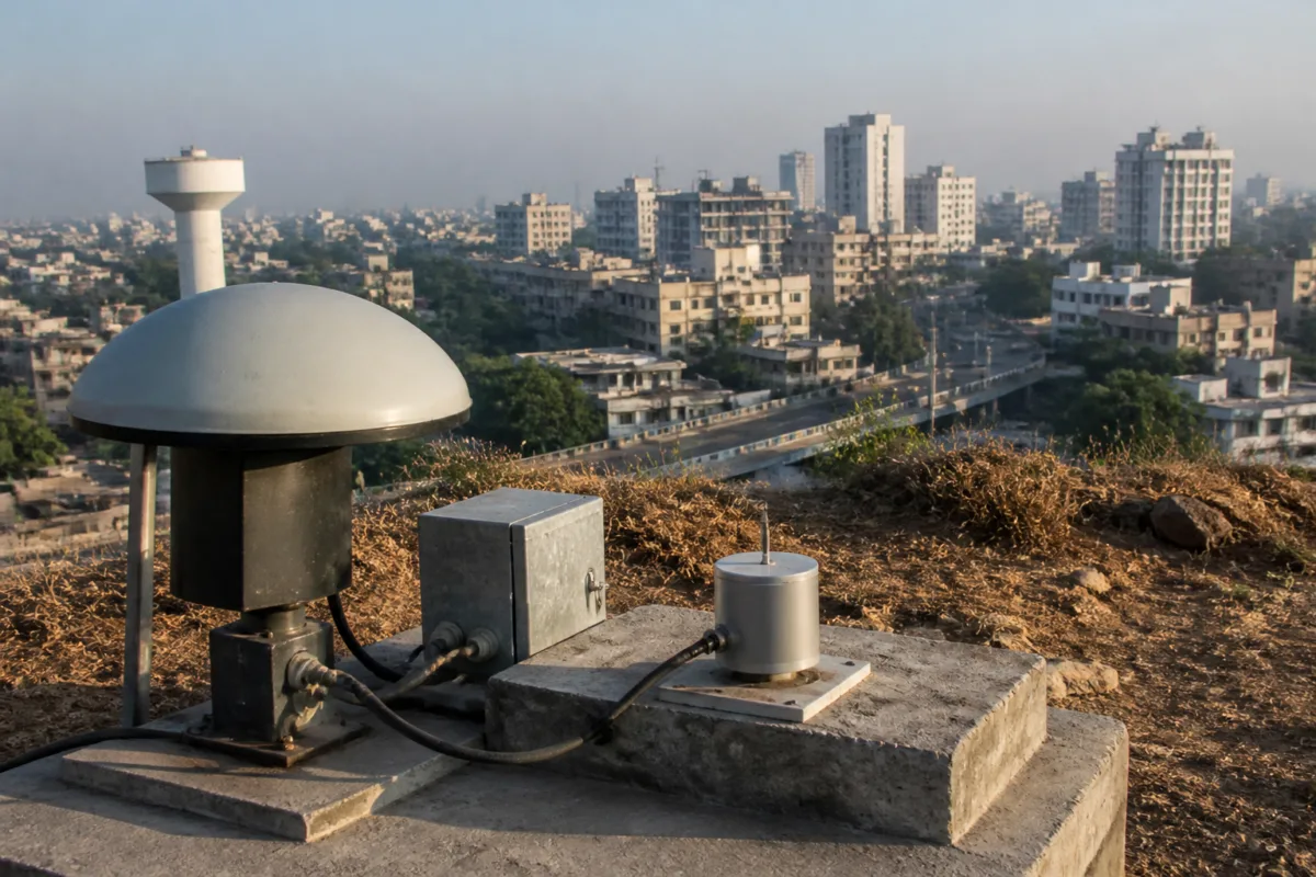
The GSI’s account describes a monitoring chain in which its observatory transmits earthquake data to the agency’s head office in Kolkata. The data is then processed and forwarded to the government. This establishes an administrative pathway for recording and communicating seismic events, but the report does not explain the time taken at each stage or how the information reaches municipal agencies and residents.
That gap between scientific observation and local implementation is central to urban resilience. A tremor can be detected by a technical agency, but its implications for buildings, roads, utilities and emergency response must be handled through multiple institutions. The supplied report does not identify the specific municipal or state planning instruments that will be amended on the basis of the microzonation study. It also does not state whether existing building approvals or public infrastructure projects are being reviewed in response to the recent events.
GSI had already conducted field investigations in the Umred region after tremors reported last year. The team spent nearly two months studying geological conditions and submitted a report examining possible causes of the seismic activity. The existence of that earlier investigation indicates that the current exercise is part of a continuing scientific response rather than a reaction limited to the latest tremors. However, the findings of the Umred report are not included in the supplied material, so its conclusions cannot be assessed here.
Ganvir attributed the tremors to the continuing collision between the Indian Plate and the Eurasian Plate along the Main Himalayan Thrust. He said the northward movement of the Indian Plate builds tectonic pressure across the landmass. While that friction drives earthquakes along the Himalayan boundary, he explained, the resulting stress can travel inward and periodically trigger minor to moderate seismic activity across fault lines in Central India.
This explanation places Nagpur’s tremors within a wider geological system rather than treating them as isolated local events. It also underlines why the existence of small earthquakes should not automatically be interpreted either as evidence of imminent major damage or as evidence that the region requires no further investigation. The available evidence supports continued observation and local study, not a definitive conclusion about a changing hazard profile.
## Why microzonation matters for a growing city
For urban planning, the difference between a broad seismic zone and a localised seismic map is practical. A citywide classification can establish the overall level of hazard, while microzonation can potentially provide more detailed information for decisions about land use, infrastructure and preparedness. The report specifically links the current study to infrastructure planning, making it relevant beyond geological research.
The study could become particularly significant as Nagpur’s authorities plan and approve new construction, although the supplied material does not provide details of the city’s current development pipeline or building stock. It also does not state whether the results will be advisory or linked to mandatory building rules. Those institutional details will determine how much influence the study has on the built environment.
The same issue applies to public assets. Roads, bridges, water systems, power infrastructure and public buildings have different structural functions and different consequences if they are damaged. The report does not identify any asset-specific assessment under way. It only establishes that the GSI’s study is intended to provide scientific inputs for preparedness and infrastructure planning.
That limitation is important. A scientific map does not automatically create safer buildings or faster emergency response. It becomes useful when responsible agencies have a process for incorporating its findings into approvals, design requirements, inspections, retrofits and contingency planning. None of those implementation mechanisms is described in the supplied report, and they remain matters to monitor when the study is completed.
The article also reports that GSI is conducting geological investigations in Trimbakeshwar and surrounding areas of Nashik district ahead of the forthcoming Kumbh Mela. That parallel work shows the agency applying geological assessment to a location expected to experience a large concentration of people. The report does not connect the Nashik investigation to Nagpur’s seismic assessment, but both illustrate the importance of location-specific scientific inputs when public safety and infrastructure planning intersect.
## The evidence and the remaining uncertainty
The available evidence supports four conclusions. First, Nagpur remains classified in Seismic Zone II, the lowest-risk category described in the report. Second, several low-intensity earthquakes have been recorded in and around the region, including events in October and a reported increase from two seismic events in 2023 to 11 in 2024. Third, the GSI has investigated the Umred area and maintains a system for transmitting and processing earthquake data. Fourth, a separate microzonation study is under way and is expected to be completed by January.
The evidence does not establish that Nagpur’s seismic risk has materially increased. It does not provide the results of the microzonation study, a detailed history of seismic events, an assessment of building vulnerability or a review of the city’s emergency capacity. It also does not establish whether the recent tremors are connected through a single local fault system or whether they represent separate events within the broader geological setting described by Ganvir.
These uncertainties do not reduce the public value of the study. They define the information that is still needed before urban agencies and residents can make more detailed judgments about local risk. The next important development is therefore not another general reassurance or isolated tremor report, but the release of the microzonation findings and a clear account of how the state and city authorities intend to use them.
Nagpur’s current classification indicates low regional seismic risk, while the continuing monitoring and microzonation work acknowledge that city-level planning requires more detail. The central urban challenge is to ensure that scientific information moves from observatories and technical reports into infrastructure decisions and disaster preparedness. The January completion target will provide the next test of whether the city’s seismic safety conversation can move from broad reassurance to evidence-based local planning.

