


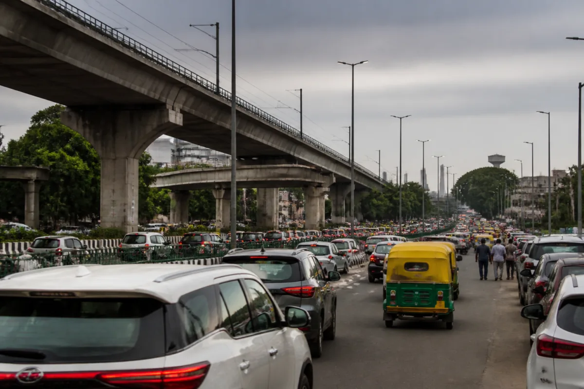
The Delhi Public Works Department’s plan for a 2.2-km elevated corridor on Shivaji Marg is presented as a congestion solution, but its larger significance lies in how the city is trying to move traffic through one of its most difficult urban interfaces. The proposed four-lane structure would connect the Zakhira crossing with the Karampura flyover, allowing vehicles to bypass signals, a rotary, roadside parking, market activity and industrial establishments at ground level.
The corridor is intended to provide a signal-free connection between the Zakhira flyover on Rohtak Road and the Karampura flyover on Patel Road. According to the report, the project would improve movement between parts of west Delhi, including Janakpuri and Uttam Nagar, and central and New Delhi. It is also expected to reduce traffic pressure at the nearby Punjabi Bagh intersection.
That objective places the project within a familiar pattern in Delhi’s road planning: existing flyovers and grade-separated links are extended or connected to remove interruptions from busy junctions. The immediate problem is slow movement caused by multiple signals and competing roadside uses. The institutional challenge is more complicated. A structure passing above an active road must be designed around traffic diversions, utilities, junction operations, approvals and construction activity that can temporarily make the original congestion worse.
The project has been under consideration for some time. PWD had earlier undertaken feasibility-related work and appointed a consultant to prepare a detailed project report. The department has now finalised the blueprint, according to the Times of India report, opening the way for tendering. That means the proposal has moved beyond an initial concept, but it has not yet reached construction.
This distinction matters. Finalising a blueprint is an important administrative milestone, but it does not establish a construction start date, a completion deadline or a final project cost. The next stages include inviting and evaluating bids, selecting a construction agency, awarding the work, completing pre-construction formalities and mobilising resources at the site. The report says officials have not announced when construction will begin or when the corridor will be completed.
Sources cited in the report indicated that the project could enter the execution stage in 2027 if the tendering and approval process proceeds as planned. That is not a confirmed construction schedule. The actual start will depend on the time taken to award the contract and complete the required formalities. For residents and commuters, the difference between an approved plan and an operational corridor may therefore be measured not only in construction time but also in the sequence of administrative decisions that precedes work on site.
The proposed alignment also reveals the corridor’s intended operating logic. Vehicles travelling between the two existing flyovers would bypass signals and junctions on the ground-level road. PWD officials said this is expected to reduce travel time and improve traffic movement on adjoining roads. The project is therefore not simply a standalone flyover; it is designed as a link between two pieces of existing grade-separated infrastructure.
That approach can reduce interruptions for through traffic, but it also concentrates attention on what happens at the ends of the elevated section. The supplied report does not provide traffic-volume figures, junction designs, lane arrangements or modelling results, so it does not establish how traffic will redistribute once the corridor is operational. It does establish that the project is being planned to address congestion created by signals, a rotary, parking, market traffic and industrial activity along the existing route.
Those ground-level conditions are central to understanding the corridor. Shivaji Marg, identified in the report as Najafgarh Road, is not described as an empty right-of-way reserved only for fast-moving vehicles. It is a working urban road used by commuters and shaped by roadside commerce, parking and industrial establishments. An elevated structure may allow through traffic to bypass those frictions, while the surface road continues to serve local access and adjoining activities.
This creates a two-level management problem. The upper level must maintain uninterrupted movement between Zakhira and Karampura. The lower level must continue functioning during and after construction for local traffic, businesses and properties along the road. The source material does not specify how access, parking or pedestrian movement will be managed after completion. Those details will be significant because solving through-traffic delay does not automatically resolve the conditions that generate surface-level congestion.
The construction phase presents an even more immediate coordination test. Officials said the project would be submitted to traffic authorities and the Unified Traffic and Transportation Infrastructure (Planning and Engineering) Centre, or UTTIPEC. Construction is likely to require traffic-management arrangements on the existing road so that movement is not severely disrupted. PWD will also need to coordinate with relevant agencies over utilities and other road-related infrastructure along the stretch.
This process places the corridor within Delhi’s wider multi-agency infrastructure system. PWD may lead the road project, but traffic arrangements, planning review, utility coordination and construction-stage permissions involve other institutional responsibilities. The project cannot move from blueprint to site merely through an engineering decision. Its delivery will depend on whether the agencies can align their approvals and site requirements without creating prolonged disruption on the existing corridor.
The need for such coordination is especially important on a route already affected by bottlenecks. A temporary reduction in road capacity, poorly sequenced utility work or an unclear diversion plan could shift congestion to adjoining roads. The report does not provide a traffic diversion plan or identify the utilities present along the alignment. Those details remain to be worked out through the traffic and pre-construction processes described by officials.
The corridor’s claimed benefits are also geographically wider than the 2.2-km structure itself. The proposal is expected to improve connectivity between west Delhi areas and central and New Delhi, while reducing pressure near Punjabi Bagh. This means the project is being justified as a network intervention rather than only a local junction improvement. Yet the available information does not include travel-time estimates, projected traffic volumes or a quantified assessment of the expected reduction at Punjabi Bagh.
That absence does not invalidate the proposal, but it limits what can currently be concluded about its performance. At this stage, the evidence supports the existence of a defined alignment, a four-lane elevated concept, a connection between two existing flyovers and a set of stated congestion objectives. It does not establish the eventual cost, construction duration, land or property implications, detailed junction treatment, or measured benefits after opening.
The project also highlights the difference between expanding road capacity and managing urban access. The stated problem includes traffic signals and junctions, but it also includes roadside parking, markets and industrial establishments. An elevated bypass can separate through movement from some local activity. It cannot, by itself, determine how the surface road will be used, where vehicles will park, how goods movement will operate or how pedestrians will cross the corridor. The supplied report does not say whether those issues are included in the project’s scope.
For PWD, the immediate administrative task is to convert the finalised blueprint into a tenderable project and then into an executable contract. For traffic authorities and UTTIPEC, the task will involve reviewing how construction affects existing movement and how the completed corridor fits into the surrounding network. For utility agencies, the issue will be the location and protection or relocation of infrastructure below and alongside the road. Each stage can alter the timing of the next.
The project’s stated 2027 execution possibility therefore should be read as a conditional milestone, not a firm promise. It depends on tendering, bid evaluation, contract award, approvals and pre-construction work. The report gives no confirmed date for any of those steps. Monitoring the tender notice, the final approvals, the traffic-management plan and the eventual construction contract will provide a clearer measure of whether the corridor is moving from planning into delivery.
What is established so far is that Delhi has finalised a plan to connect the Zakhira and Karampura flyovers through a 2.2-km elevated link on Shivaji Marg. What remains unresolved in the supplied material is how the project will be priced, built, staged and assessed, and how the surface road will function during and after construction. Those unanswered questions will determine whether the corridor becomes a useful network connection or merely shifts pressure between nearby junctions.

