


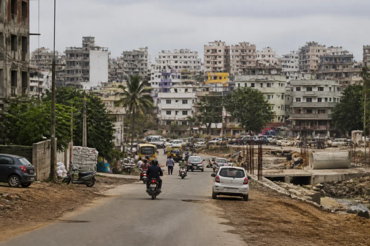
Pune’s revised Development Plan for nine villages has moved closer to final approval, but the scale and composition of the proposed changes show how difficult it is to bring rapidly urbanising areas within a workable civic planning framework. The Pune Municipal Corporation’s Town Planning Department has proposed 143 modifications after examining 7,590 suggestions and objections, with roads accounting for nearly three-fifths of the changes.
The revisions cover Lohgaon, Mundhwa-Keshavnagar, Hadapsar’s Sadesatra Nali area, Undri, Ambegaon Budruk, Ambegaon Khurd, Dhayari, Shivane and Uttamnagar. These villages were merged into the PMC limits in 2017 and are now moving towards receiving their first officially sanctioned Development Plan. Until final approval, the revised proposals remain part of a statutory process rather than a completed planning framework.
The revised modifications have been published in the Maharashtra Government Gazette under Section 28(4) of the Maharashtra Regional and Town Planning Act, 1966. The process began with publication of the draft DP under Section 26 in October 2025. A planning committee comprising government-appointed expert members then conducted public hearings between March and April 2026 and submitted its report in July.
The sequence matters because a Development Plan is not simply a map of proposed roads and reserved plots. It is the mechanism through which a city identifies future infrastructure needs, public facilities and land reservations. For villages absorbed into a municipal corporation after urban growth has already accelerated, the plan also becomes an attempt to align formal planning with conditions that may already exist on the ground.
According to information released by the civic administration, approximately 70 to 75 per cent of the suggestions and objections were considered positively. The resulting 143 modifications are therefore a response to a substantial public consultation exercise, although the material supplied does not specify the individual proposals accepted or rejected in each locality.
Roads form the largest component of the revision. Of the 143 proposed changes, 84, or around 59 per cent, relate to the road network. The PMC has said these changes are intended to improve connectivity and create a more practical road layout to address future traffic requirements. This concentration indicates that movement and access are the most prominent planning concerns emerging from the consultation process.
The road-related changes also point to the limitations of planning an urbanising area without a settled, locally responsive network. A proposed road on a plan may encounter existing buildings, established settlements or other physical constraints by the time objections are heard. The civic administration’s description of a more practical layout suggests that the revisions seek to bring the statutory network closer to existing conditions while retaining capacity for future traffic.
Public reservations account for another 28 changes, or 20 per cent of the total. A further 30 changes, representing 21 per cent, concern amenity spaces. The PMC has said these modifications were made to align proposed reservations and facilities with ground realities and existing structures. Together, these categories show that the review is not limited to transport infrastructure. It also concerns the location and feasibility of land intended for public use.
The distinction between reservations and amenity spaces is important to the functioning of newly incorporated urban areas. Roads determine how residents, emergency services and municipal vehicles move through neighbourhoods, while public reservations and amenity spaces determine where civic facilities and shared urban uses can be accommodated. The supplied information does not identify the specific facilities involved, but the revisions place all three elements within the same planning exercise.
Lohgaon has the highest number of proposed changes, with 31 modifications, accounting for approximately 22 per cent of the total. Dhayari and Undri are also identified as areas with significant modifications, while Ambegaon Khurd has the lowest number, at around five per cent. The distribution indicates that the impact of the draft plan has not been uniform across the nine villages.
Lohgaon’s position at the top of the list makes it the clearest example of how a draft plan can require substantial adjustment during public review. However, the number of modifications alone does not establish which locality has the greatest infrastructure deficit. It shows only where the revised plan contains the highest number of proposed changes after the consultation and expert review process.
The 7,590 suggestions and objections provide the strongest indication of public engagement in the process. Their volume suggests that the draft DP affected a large range of landowners, residents and other local stakeholders. It also demonstrates that statutory publication and public hearings can bring local knowledge into a planning process that might otherwise remain largely map-based.
At the same time, the information released by the PMC does not provide a detailed breakdown of the objections by subject, locality or stakeholder group. It is therefore not possible from the available material to determine whether the largest concerns involved road alignments, land reservations, amenity spaces, existing structures or other planning provisions. That detail would be necessary to assess how closely the accepted modifications correspond to the issues raised by citizens.
The next stage is a 30-day public inspection period. The proposed modifications and revised maps will be available on the PMC’s official website and for inspection at the Town Planning Office opposite Vidhan Bhavan and at the PMC headquarters. This period provides another formal opportunity for affected parties to examine the revised proposals before they move to the state government.
After the inspection period, the revised modifications will be forwarded to the Maharashtra Government for final approval under Section 30 of the MRTP Act. The PMC has not stated in the supplied material when the state government is expected to complete that approval. Until the government grants approval, the plan remains subject to the statutory process.
The institutional structure explains why the plan has taken several stages. The PMC prepared the revised modifications through its Town Planning Department, while a committee of government-appointed expert members conducted hearings and submitted a report. The state government retains the final approval role under the Act. Planning authority is therefore distributed across the municipal and state levels rather than resting entirely with the local civic body.
This arrangement creates a formal chain of review, but it also means that planning outcomes depend on coordination between local mapping, public objections, expert examination and state-level approval. The current stage is significant because the nine villages are approaching their first officially sanctioned DP, yet the final legal and administrative step is still pending.
The revisions also reveal a broader urban planning challenge. Villages merged into municipal limits do not automatically acquire the infrastructure, street hierarchy or public facilities associated with established urban neighbourhoods. A Development Plan can establish reservations and future road connections, but the supplied material does not indicate the funding, acquisition process, construction schedule or agency responsibility for implementing the proposed changes.
That distinction between planning and delivery is central to understanding what the revised DP can achieve. The plan can create a statutory framework for roads, amenities and public reservations. It does not, by itself, establish when those projects will be built or how land and construction costs will be managed. Those implementation details are not provided in the current announcement.
The available evidence confirms three things: the nine villages have undergone a substantial public review; the revised plan contains 143 proposed modifications; and roads, public reservations and amenity spaces account for almost all of the identified changes. It also confirms that Lohgaon has the largest number of revisions and that final approval rests with the Maharashtra Government.
The immediate developments to monitor are the 30-day public inspection period, the publication of any further modifications and the state government’s decision under Section 30. The more consequential question will come after approval: how the statutory road network, reservations and amenity spaces are translated into funded and functioning infrastructure across the nine merged villages.

