


The Telangana government’s plan to examine land auctions across Hyderabad’s expanding metropolitan region is not only a revenue mobilisation exercise. It is also a test of how public land is identified, prepared, valued and transferred in a city where development is rapidly spreading towards Medchal and Rangareddy districts. Deputy Chief Minister Bhatti Vikramarka has asked officials to prepare a phased action plan covering land under the Hyderabad Metropolitan Development Authority (HMDA) and the Telangana State Industrial Infrastructure Corporation (TGIIC), while also proposing a digital dashboard to track the process.
The review, conducted by a cabinet sub-committee on revenue mobilisation, brings several land-related functions into one administrative frame. These include land pooling, industrial land regularisation, the development and auction of government land, the utilisation of government assets and the management of land obtained as the government’s share through pooling. The breadth of the agenda is significant because each activity involves different legal, planning and administrative conditions, even when they are ultimately expected to generate revenue.
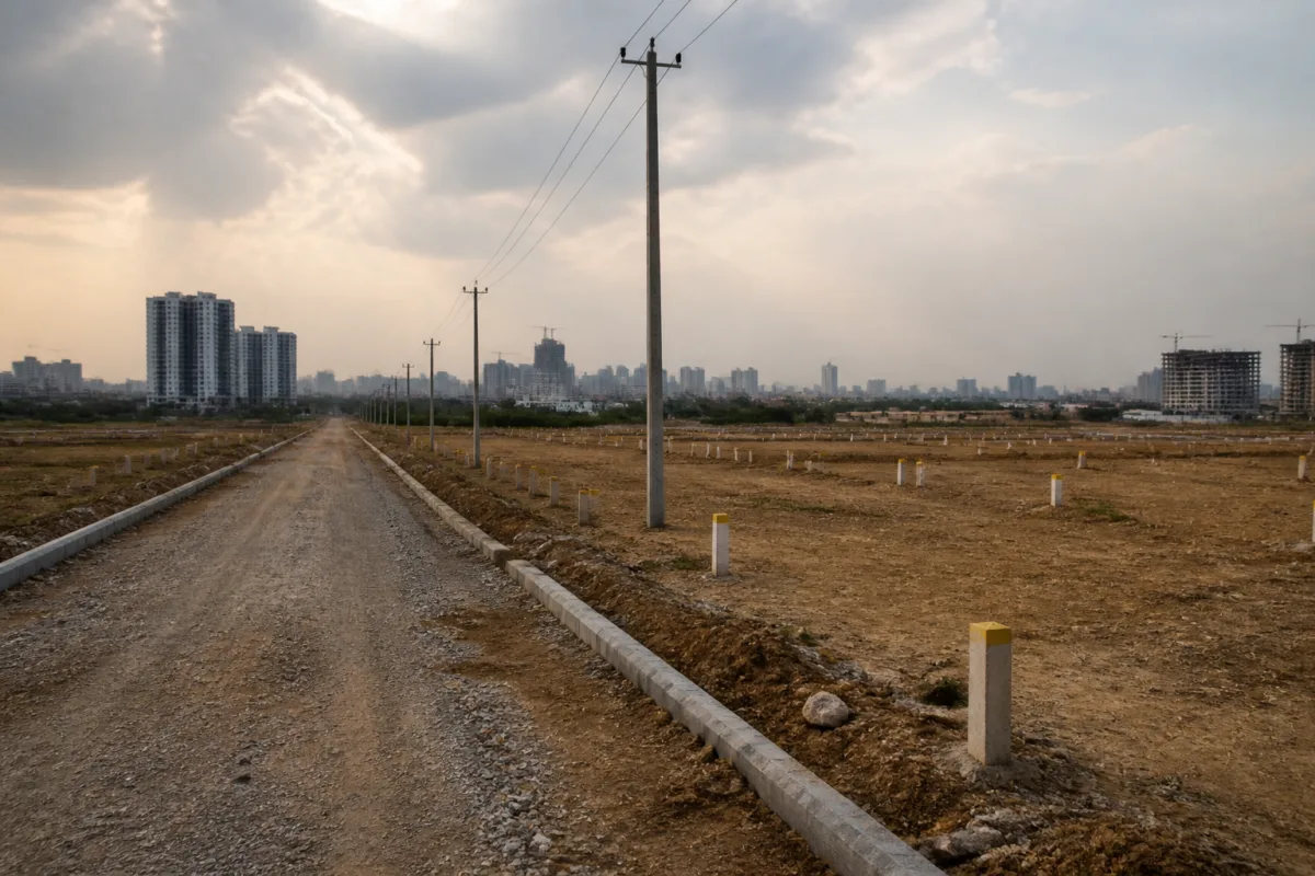
According to the report, Vikramarka directed officials to identify layouts suitable for auction, with priority given to locations that have good connectivity to major roads and development potential. The proposed process is to be implemented in phases. Officials have also been asked to submit a clear action plan covering the details of the land parcels, the status of layouts, plots ready for auction and preparatory work already completed.
That instruction points to the first institutional challenge: government land cannot be treated as an immediately saleable asset simply because it appears on an inventory. A plot’s auction readiness depends on the status of its layout, approvals, access, infrastructure and legal position. The government’s decision to seek parcel-level information and layout status before proceeding suggests that the administration is attempting to create a more structured pipeline rather than announce auctions without a consolidated account of what is actually available.
The proposed digital dashboard is therefore more than a technology addition. The government wants a single platform to show land details, layout status, plots ready for auction and the progress of related initiatives. It also expects the system to improve coordination between departments, speed up decisions and enhance transparency. For a public land programme, these functions are important because the credibility of an auction depends not only on the final bid but also on the quality and accessibility of information available before the sale.
The source report does not specify the total area of land under consideration, the reserve prices, the expected revenue or the dates of individual auctions. It also does not establish whether all identified parcels have completed planning and legal clearances. Those details will determine whether the proposal remains an administrative review or develops into a concrete land monetisation programme. For now, the government has directed departments to prepare the information needed for that next stage.
The review also covers industrial land in areas including Azamabad, Balanagar and Hafeezpet. Vikramarka directed officials to expedite unit-wise regularisation and approval processes in these industrial areas. Proposals involving B-category and micro industrial units are to be examined comprehensively, with the stated objective of supporting industrial entrepreneurs while generating additional revenue for the government.
This creates a second, more complex policy balance. Regularisation can provide industrial units with greater clarity over their status and allow the government to resolve long-pending administrative issues. At the same time, the process must distinguish between different categories of units and remain consistent with applicable rules. The meeting’s emphasis on timely application processing indicates that the government is linking revenue mobilisation with a business-facing administrative reform rather than relying only on outright land sales.
The distinction matters for Hyderabad’s industrial geography. Older industrial estates are embedded within a metropolitan region that has changed substantially over time. Areas once located on the urban periphery may now be surrounded by residential, commercial and transport infrastructure. Decisions about regularisation, land use and government revenue in such locations can therefore affect not only industrial occupants but also the future pattern of development around them. The report, however, does not provide details of proposed land-use changes or specific redevelopment plans for these estates.
Land pooling is the third major component of the government’s approach. The cabinet sub-committee discussed the availability of land for future requirements and the mobilisation of land resources in rapidly developing areas surrounding Hyderabad, particularly Medchal and Rangareddy districts. The deputy chief minister also asked officials to formulate a clear policy for using the government’s share of pooled land for specific public purposes.
That direction raises the question of how pooled land is to be connected to public infrastructure and other government objectives. Land pooling is not simply a method of assembling parcels. It requires clarity about the land contributed, the share returned or retained, the purpose for which the government’s portion is held and the process through which that share is eventually used. By calling for a policy on the government’s share, the review acknowledges that the administrative question continues after land has been pooled.
The emphasis on Medchal and Rangareddy reflects the outward expansion of Hyderabad described in the report. These districts are identified as areas where development is proceeding rapidly and where land resources may be required for future needs. Yet the source does not provide figures on population growth, infrastructure capacity, land values or the scale of development in these districts. Any assessment of the financial potential of land auctions, or their effect on urban planning, will require that information to be made public.
Assigned lands form another sensitive part of the review. Vikramarka directed officials to examine related issues in accordance with legal provisions and public interest, with appropriate proposals to be placed before the Cabinet. This indicates that not all land considered for revenue mobilisation can be handled through the same process. Legal status and existing rights remain central to determining what action is permissible.
The government’s decision to retain such matters for further examination is important because land monetisation can involve competing administrative, legal and social claims. The report does not identify specific assigned land parcels or disclose the proposals that may be taken to the Cabinet. It therefore supports only a limited conclusion at this stage: the state is seeking a consolidated policy response, but the legal and operational framework for individual categories of land is still being worked out.
The institutional structure described in the meeting places responsibility across the government, HMDA, TGIIC and departments handling industrial approvals, land administration and revenue mobilisation. The cabinet sub-committee, chaired by Vikramarka and attended by D Sridhar Babu and Jupally Krishna Rao, is intended to coordinate these strands. The direction to set clear targets and ensure interdepartmental coordination suggests that fragmented ownership of land records, approvals and development processes is recognised as an obstacle to faster decisions.
For the public, the most consequential part of the proposal may be the information architecture rather than the auction calendar. A dashboard that shows which land parcels are government-owned, which layouts are approved, which plots are auction-ready and what preparatory work remains could make the process easier to follow. However, the report does not state what information will be publicly accessible, how frequently it will be updated, whether documents will be downloadable or how disputes and corrections will be handled.
Those operational details will shape whether the dashboard functions as a transparency tool or merely as an internal monitoring system. A digital platform can improve coordination, but it cannot resolve unclear land titles, incomplete layouts or conflicting legal claims by itself. Its value will depend on the quality of the underlying records and the extent to which departments use a common, current set of data.
The government’s revenue strategy consequently rests on several linked steps: identifying suitable land, confirming its legal and planning status, completing layouts and approvals, deciding the purpose of pooled land, processing industrial regularisation and publishing progress through a common platform. The proposal is ambitious in scope, but the available information remains at the planning and review stage. No auction schedule, parcel list, financial target or detailed policy document has been announced in the supplied report.
The next test will be the action plan officials were asked to prepare by the following week. Its contents should clarify the land parcels under consideration, the status of layouts, the plots that can actually proceed to auction and the responsibilities of each department. It should also show how industrial regularisation, assigned lands and pooled land will be handled under their respective legal frameworks. Until those details emerge, the review confirms the direction of Telangana’s revenue policy but not yet the scale or implementation outcomes of Hyderabad’s proposed land auctions.

