


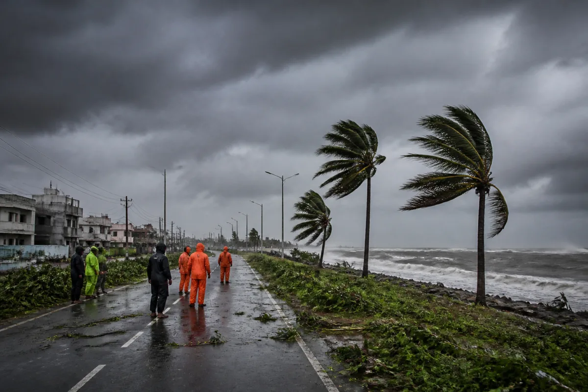
Cyclone Murasu’s landfall in Andhra Pradesh, only six days after Cyclone Arnab struck the same state, has revived an important question for coastal India: how prepared are cities and infrastructure systems when hazards arrive before recovery from the previous event is complete? The two cyclones formed over different parts of the Bay of Bengal and followed different tracks, but both reached the Andhra coast within less than a week. That makes the episode more than a sequence of two weather alerts. It is a test of whether coastal preparedness is designed for individual storms or for repeated shocks.
According to the report by Telegraph India, Cyclone Arnab made landfall in Andhra Pradesh between 2am and 8am on October 28 as a very severe cyclonic storm. Winds gusted up to 150kmph and the system brought torrential rain. Severe Cyclonic Storm Murasu followed on November 3, making landfall along the south Andhra Pradesh coast close to Ongole in Prakasam district. The report describes the interval between the two landfalls as relatively uncommon, with the last comparable sequence occurring in 2013.
That earlier episode involved Cyclone Helen, which made landfall at Machilipatnam on November 22, 2013, as a severe cyclonic storm. Six days later, Cyclone Lehar hit the coast in the same district. Lehar had intensified into a very severe cyclonic storm over the Bay of Bengal but weakened before landfall. The parallel is useful because it shows that the risk is not confined to one unusual year. Similar timing has occurred before, even if it remains uncommon.
The immediate significance of back-to-back landfalls is operational. A cyclone does not end when the centre crosses the coast. Rainfall, strong winds, damaged roads, power failures, blocked drainage channels and disrupted communications can continue to affect communities after landfall. When another system follows within days, agencies may have less time to inspect damaged infrastructure, restore services, clear debris, replenish emergency supplies and move personnel back into routine operations.
The supplied report does not provide a damage assessment for Arnab or Murasu, nor does it establish whether the second storm affected areas still recovering from the first. Those limits matter. The central evidence is about timing, formation areas, tracks and landfall intensity, not about the scale of disruption on the ground. Even so, the sequence highlights a planning problem for coastal districts: preparedness must account not only for the intensity of one storm but also for the possibility that the next emergency arrives before the first response cycle has closed.
H.R. Biswas, head of the forecasting section at the Regional Meteorological Centre in Alipore, said that October, November and December are favourable months for tropical weather systems to intensify over the Bay of Bengal. Between 1999 and 2026, these three months saw around 50 cyclones in the Bay of Bengal, he said. Biswas added that an average of four to five cyclones form every year over the North Indian Ocean, including the Arabian Sea and the Bay of Bengal. The Bay generally sees more cyclones than the Arabian Sea.
His breakdown also shows why the post-monsoon period is particularly important for urban and coastal planning. One or two cyclones form on average during the pre-monsoon season of April and May, while three to four develop during the post-monsoon period from October to December. This concentration creates a recurring seasonal exposure window. Municipalities, port-linked settlements, coastal industries and transport networks face their highest cyclone-related planning demands during a period when weather systems can develop and strengthen over a relatively short timeframe.
The report says several years over the past two decades have seen three or even four cyclones over the Bay of Bengal. However, two cyclones forming and making landfall within less than a week is relatively uncommon. That distinction is important for interpreting the present episode. The available evidence does not show that back-to-back landfalls are becoming routine. It does show that they are a credible contingency for which response systems must remain capable, particularly during the October-December period.
The two systems also demonstrate why a single regional risk map may not be enough for operational decision-making. Arnab formed over the east-central Bay, while Murasu originated over the southeastern Bay. A meteorological official quoted in the report said their genesis and tracks were different, although both made landfall in Andhra Pradesh. Separate formation areas and tracks mean that a warning system cannot rely only on the experience of the preceding storm. The next system may approach from a different direction, affect a different stretch of coast or place pressure on different districts.
For cities, this has implications beyond evacuation notices. Coastal resilience depends on the condition and redundancy of basic systems: roads that connect settlements to hospitals and relief centres, electricity networks needed for communications and pumping, drainage infrastructure, public buildings used for shelter, and communications systems that carry warnings to residents. The article does not provide data on the performance of these systems during Arnab or Murasu, so it is not possible to conclude from the supplied evidence which assets failed or held up. But the short interval between landfalls makes the continuity of those systems a central planning question.
It also changes the meaning of recovery. A conventional response cycle assumes that authorities can move from warning and evacuation to rescue, restoration and reconstruction. A second storm can interrupt that sequence. Equipment may still be deployed, roads may remain obstructed, and public agencies may be managing outstanding relief work when another warning is issued. In such circumstances, the ability to maintain records, communicate clearly and prioritise essential services becomes as important as the first evacuation operation.
The institutional structure visible in the report is primarily meteorological: forecasting officials identify seasonal conditions, formation areas, storm tracks and likely landfall. The next layer lies with state and district administrations, which translate forecasts into decisions about warnings, movement, shelter and service restoration. The supplied material does not specify the measures taken by Andhra Pradesh authorities for either cyclone, nor does it identify the funding arrangements or administrative protocols used for consecutive storms. Those details would be necessary to assess whether existing disaster-management systems are designed for compound or sequential events.
The evidence does, however, support a clear distinction between frequency and preparedness. An event can be uncommon and still require planning. The 2013 Helen-Lehar sequence and the 2026 Arnab-Murasu sequence show that a six-day gap between landfalls has occurred more than once. The pattern is not frequent enough, on the information available, to be treated as the normal seasonal condition. It is sufficiently established as a possibility to be included in contingency planning for the Bay of Bengal’s post-monsoon cyclone season.
Kolkata’s immediate weather outlook in the report is different. The city was expected to remain relatively dry until November 10, potentially allowing a rain-free Kali Puja, although a westerly trough could bring rain on November 9 and 10. This local forecast illustrates another feature of cyclone reporting: a storm’s presence in the wider Bay does not automatically translate into the same level of impact for every city. Risk is shaped by the storm’s track, intensity, landfall location and local weather conditions. The same regional system can produce a severe coastal emergency while leaving another urban area comparatively dry.
That distinction is important for urban communication. Broad warnings can create confusion if they do not explain the difference between formation, landfall, rainfall and local impact. At the same time, a relatively dry forecast in one city should not obscure the pressure faced by districts closer to the landfall zone. Effective public information must therefore connect regional meteorological developments to location-specific instructions and service conditions.
The larger urban question raised by Arnab and Murasu is whether resilience is being measured only by the ability to avoid casualties during a single cyclone, or also by the ability to sustain essential services through repeated disturbances. The supplied report cannot answer that question for Andhra Pradesh. It establishes the meteorological sequence and places it within the Bay of Bengal’s seasonal pattern. The next evidence to watch is the documented impact on roads, power, drainage, communications, public facilities and recovery operations, along with the preparedness measures adopted after the two storms.
What the episode confirms is that the Bay of Bengal’s post-monsoon season remains a concentrated period of cyclone risk, and that rare back-to-back landfalls have precedent. What it does not establish is whether such sequences are increasing, whether urban damage was compounded in this case, or whether existing response systems were overwhelmed. Those questions require official damage reports, service-restoration records and district-level assessments. Until that evidence is available, the most defensible conclusion is narrower but significant: coastal resilience planning must retain capacity for a second storm even when the first remains the dominant public emergency.

