


Pune’s water management history reveals a city that once treated storage, gravity and local distribution as one connected system. A report published by Sakal – Pune traces that evolution from ancient rainwater harvesting and drainage systems to the Peshwa-era Katraj network and the modern chain of dams supplying the Mutha basin. Together, these examples show that urban water security has never depended on a single reservoir or technology. It has depended on matching infrastructure to geography, rainfall and demand.
That distinction matters as Pune expands over a larger and increasingly paved urban area. The source report describes water scarcity not as a new problem, but as a recurring challenge that earlier settlements addressed through reservoirs, wells, channels, tanks and carefully managed drainage. Their systems varied greatly in scale, but shared a common principle: water had to be captured when available, moved with minimal energy and stored close enough to where it was needed.
The most important lesson in this history is institutional rather than nostalgic. Ancient and medieval systems were not simply collections of impressive structures. They linked catchments, storage, filtration, public access and maintenance. Pune’s present water system, by contrast, is largely understood through its major dams and treatment infrastructure. The historical record presented in the report suggests that resilience requires both large regional infrastructure and smaller local systems that reduce pressure on the main supply.
The report begins with the Indus civilisation, where cities including Mohenjo-daro and Harappa used wells, bathing areas, covered drains and storage structures. It describes household wastewater moving through smaller channels into larger public drains, while wells served individual homes and communities. At Dholavira, in present-day Gujarat, rainwater was directed through channels into reservoirs and underground storage. The report identifies at least 16 reservoirs within the fortified settlement and notes that rainwater collection and wastewater drainage were treated as separate functions.
These examples are significant because they show that water management was embedded in urban design. Water supply, sanitation and settlement layout operated together. The systems did not rely only on bringing water from distant sources; they also controlled how water moved through the city after it arrived. That principle remains relevant to contemporary urban planning, where rainwater runoff, groundwater recharge, sewage and potable supply are often managed through separate administrative and physical systems.
The report also refers to water infrastructure at Lothal, where wells, bathing platforms, covered drains and soakage arrangements were part of the settlement. At Buddhist cave complexes such as Kanheri and Ajanta, rainwater was collected from rock surfaces, slopes and cave roofs, then directed into tanks. The account describes gravity-based distribution, sediment settling and storage designs intended to reduce evaporation. These systems were shaped by difficult terrain and seasonal rainfall rather than by access to a continuous natural water source.
Hampi provides another example of water being treated as a citywide network. According to the report, the historic settlement used tanks, canals and stone channels connected to the Tungabhadra River and the Kamalapura reservoir. Water moved through channels designed with appropriate gradients towards tanks and ceremonial structures. At Mandu, the report describes rooftop collection, filtration through layers of sand, charcoal, stone, limestone and grass, and channels that slowed water before it reached storage areas.
The precise performance of these historic systems cannot be assumed from their surviving remains alone. However, the infrastructure described in the report establishes a clear design pattern: collect runoff, remove sediment, slow the flow, store water and distribute it through gravity wherever possible. This reduced dependence on external energy and created multiple points at which water could be inspected, maintained or reused.
Pune’s own historic water network is the strongest local example. The report states that a system initiated under Peshwa rule in 1749 used the elevation difference between Katraj and the city to move water without electric motors. Two reservoirs at Katraj were designed to settle silt before water entered the lower storage area. The lower reservoir, described as being at about 723 metres above sea level, supplied water towards Shaniwar Wada, at about 540 metres, using the natural gradient.
The system then carried water through underground channels built with brick and lime. The report gives the original channels a width of roughly two to three feet, a height of six to seven feet and a length that may have extended between eight and 15 kilometres, later forming part of a network of about 20 kilometres. Vertical shafts, known as uchchhwas or oswas, were placed at intervals of about 30 to 100 metres. These shafts helped release trapped air, regulate pressure, settle fine sediment and provide access for maintenance.
The network was not limited to a single delivery line. Once water entered the city, it was distributed through numerous routes to public tanks, or hauds, serving different peths. The report names Kala Haud, Budhwar Haud, Phadke Haud and Badami Haud among the public water points. Separate channels also supplied Shaniwar Wada and its gardens. Additional lines associated with Nana Phadnavis, Sardar Raste and Ruparam Chaudhary expanded the network as the city grew.
The reported figure of approximately 3.8 million litres of daily supply illustrates the scale of the system, although the source does not provide a contemporary technical assessment of its capacity or water quality. Its significance lies less in comparing historic volumes with present demand than in understanding the operating model. Pune’s older network combined source protection, sediment control, underground conveyance, pressure management, public distribution and maintenance access in one design.
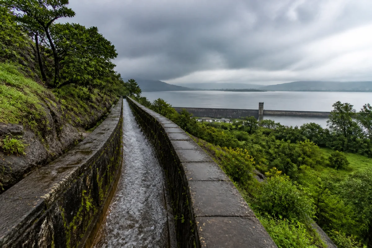
The city’s modern water infrastructure developed along a different path. After British control of Pune expanded following 1817, the report says that water supply shifted towards larger external reservoirs to serve military establishments, public-health requirements and a growing population. Khadakwasla dam, built in 1879, became part of a larger chain that later included Panshet, Varasgaon and Temghar. Water stored in these reservoirs is moved through the Mutha basin system and used for agriculture and, as required, the city’s water supply.
This dam chain provides scale and seasonal storage that local tanks and historic channels could not deliver to a much larger urban population. It also links Pune’s water security to rainfall across the wider catchment, reservoir operations and the competing requirements of domestic supply and agriculture. The report notes that the dams help store monsoon water, reduce summer scarcity, support irrigation and assist water-availability planning. Their role demonstrates the continuing importance of regional infrastructure.
At the same time, dependence on a dam chain creates a different kind of exposure. A city supplied primarily through distant reservoirs is affected by rainfall variability, catchment degradation, transmission losses, treatment capacity and distribution inequities. Local rainwater harvesting cannot replace the dams, but it can reduce the volume of runoff lost from built-up areas and supplement non-potable demand. Recharge measures, revived lakes and ponds, efficient irrigation and treated wastewater reuse can also reduce pressure on freshwater sources.
The report’s central argument is therefore not that Pune should return to an old water system. It is that the city can combine the strengths of different eras. Large dams provide regional storage. Local reservoirs, lakes and recharge structures retain water closer to neighbourhoods. Buildings can harvest rooftop runoff. Separate drainage and wastewater systems can reduce contamination. Gravity-based distribution, wherever topography permits, can lower energy requirements. Public tanks and decentralised facilities can improve access and provide redundancy during disruptions.
This is also a governance question. Water infrastructure crosses municipal boundaries, irrigation administration, urban planning, building regulation and public health. A reservoir may be operated at the regional level, while a stormwater drain, building rainwater system or local pond falls under a different agency. Without coordination, investment in one part of the system may fail to improve overall resilience. The historical systems described in the report worked because collection, movement, storage and distribution were designed as connected functions.
For Pune, the larger urban question is whether growth will continue to increase demand while reducing the land available for water to infiltrate and be stored. The report warns that expanding concrete surfaces leave the ground less able to absorb rain. That observation is straightforward but important: urbanisation changes not only how much water a city needs, but also how quickly rainfall leaves the city and how much of it can replenish local sources.
The evidence presented in the report confirms that Pune has inherited several layers of water infrastructure: historic gravity-fed channels, public tanks, river-basin dams, canals and modern supply systems. What remains less clear from the supplied material is the current operational condition, capacity and contribution of each layer. Those questions require engineering assessments, official water budgets and updated data. The enduring lesson, however, is established by the systems themselves: water security depends on treating the city, its catchment and its drainage landscape as one connected urban system.

