


Bengaluru’s water and road plan is being framed as a response to a city that is growing faster than its infrastructure systems can be coordinated. At the fourth executive committee meeting of the Greater Bengaluru Authority, Greater Bengaluru Minister Krishna Byre Gowda directed officials to prepare a phased, comprehensive plan for drinking water, roads, connectivity and drainage across Bengaluru city district. The directive also covered treated wastewater reuse, fire safety, the mapping of residential and hazardous areas, and the restoration of roads damaged by public works.
The significance of the instruction lies less in the announcement of another infrastructure plan than in the administrative problem it acknowledges. Urban expansion is not confined to the formal boundary of a civic body. New housing, commercial activity and transport demand can spread into areas where responsibilities for water supply, roads, sewerage, fire response and land-use management are divided among several institutions. The report specifically refers to identifying actual growth outside the Greater Bengaluru Authority’s jurisdiction and providing the infrastructure required by that urbanisation.
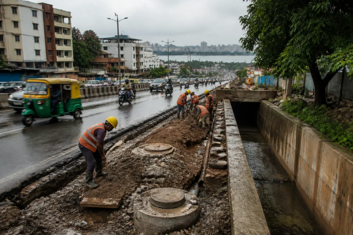
That is a planning challenge with direct consequences for residents. A road can be widened without adequate drainage, a new settlement can receive buildings before a dependable water system, and a utility excavation can leave a carriageway unsafe even after the original work is complete. The minister’s directions bring these separate failures into one administrative frame, although the report does not specify the boundaries, budget, agency-wise responsibilities or deadlines of the proposed comprehensive plan.
Water is central to the approach outlined at the meeting. The government is prioritising the treatment and reuse of the city’s sewage, according to the minister. The report cites three existing valley-based initiatives. Under the KC Valley project, treated water from the Koramangala-Challaghatta valley is being sent to lakes in Kolar and Chikkaballapur districts. The HN Valley project carries water from the Hebbal-Nagavara valley to selected areas of Chikkaballapur, Bengaluru Rural and Bengaluru Urban districts. The Vrishabhavathi Valley project sends water to lakes in Ramanagara and Tumakuru districts.
These projects show that Bengaluru’s wastewater system is connected to a wider regional water landscape. Sewage treatment is not being presented only as a disposal function within the city. Treated water is also being used to replenish lakes beyond the core urban area. The minister referred to the replenishment of Yelahanka and Jakkur lakes as evidence that local groundwater levels have increased significantly. Based on that experience, officials were instructed to develop and implement additional long-term plans for treating the city’s sewage.
The report, however, does not provide the volume of sewage being treated, the capacity of the treatment facilities, the quantity of water being reused, or independent measurements of the reported groundwater increase. Those details matter because the effectiveness of a reuse system depends not only on the existence of treatment projects but also on reliable operations, water quality, conveyance infrastructure and monitoring. The meeting’s direction establishes a policy priority; it does not yet establish the performance of the entire system.
The road-restoration instruction addresses another familiar weakness in urban infrastructure delivery. According to the report, the Bengaluru Water Supply and Sewerage Board and other departments and institutions excavate roads for their works but do not always reconstruct them properly afterwards. Byre Gowda directed that the institution which digs up a road should also bear full responsibility for restoring it.
This proposal places accountability closer to the source of disruption. In practice, however, such a rule requires a clear record of who approved the excavation, which agency is responsible for reinstatement, what technical standard must be followed, and how the work will be inspected before the road is reopened. The source does not state whether the Greater Bengaluru Authority plans to introduce a common road-cutting register, restoration guarantee, penalty system or inspection mechanism. The institutional principle is clear, but the enforcement framework remains unspecified.
The same coordination issue appears in fire safety. The minister said approval had been given to start nine new fire stations across five municipal corporations within the Greater Bengaluru Authority’s area, based on need and the city’s safety requirements. Officials were also instructed to identify and map residential, commercial and hazardous areas and submit proposals for additional fire stations required in the future.
This links emergency response capacity to the geography of urban growth. A city’s fire risk is not determined only by the number of stations already operating. It is also shaped by the location and concentration of housing, commercial premises, industrial or hazardous uses, road access and the time required for emergency vehicles to reach an incident. The instruction to map these areas suggests that the government wants future fire-station planning to follow urban development patterns rather than rely solely on existing administrative arrangements.
The report names senior officials from several agencies who attended the meeting, including the Greater Bengaluru Authority, Bengaluru Metropolitan Region Development Authority, Bengaluru Water Supply and Sewerage Board, Bengaluru city administration, Bengaluru Metropolitan Transport Corporation and Bengaluru Solid Waste Management Limited. Their presence reflects the breadth of the challenge, but it also highlights the number of institutions involved in managing the metropolitan area. Water, transport, solid waste, roads, fire response and regional planning cannot be delivered through isolated departmental decisions if growth crosses institutional boundaries.
The creation and operation of the Greater Bengaluru Authority is therefore an important part of the story’s institutional context. The report presents the authority as a platform through which the city’s wider infrastructure needs can be considered across five municipal corporations. Yet it does not explain how the authority’s decisions will interact with the powers, budgets and operating responsibilities of the individual corporations or specialised agencies. That missing information will determine whether the comprehensive plan becomes a coordinating instrument or remains a set of parallel departmental proposals.
The proposed phased approach is also significant. A rapidly expanding urban area cannot be served by treating each road, lake, sewer or fire station as a separate project. Phasing can help match infrastructure provision with the sequence of development, provided the plan identifies priority areas, sets measurable milestones and assigns responsibility for delivery. The source confirms that officials were asked to prepare time-bound plans, but it does not provide the phases, dates, financing structure or criteria that will be used to decide which areas are addressed first.
The immediate evidence therefore points to a shift in emphasis: from individual works to a city-district-wide infrastructure framework. Water supply, treated wastewater, roads, drainage and fire safety are being discussed together because failures in one system can intensify pressure on another. Poor drainage can damage roads; road cuts can disrupt water and sewerage services; unplanned expansion can increase fire risk; and insufficient wastewater treatment can weaken the city’s water resilience.
For residents, the value of the announcement will ultimately be judged through basic service outcomes rather than the number of agencies represented in a meeting. The relevant questions are whether new growth areas receive dependable drinking water and sewerage, whether treated wastewater is safely reused, whether roads are restored after excavation, whether drainage is integrated into road works, and whether fire stations are located where expanding risk requires them. The supplied report does not yet answer those questions, but it identifies them as parts of one urban management problem.
The next stage is consequently administrative and measurable. Officials must translate the minister’s directions into a plan covering the areas outside the authority’s current jurisdiction, the infrastructure required there, the institutions responsible, the funding arrangements and the deadlines for implementation. The approval of nine new fire stations, the mapping of residential and hazardous areas, the development of further sewage-treatment projects and the assignment of road-restoration responsibility are the specific actions that will show whether Bengaluru’s new planning approach can move from coordination at the meeting table to coordinated delivery on the ground.

