


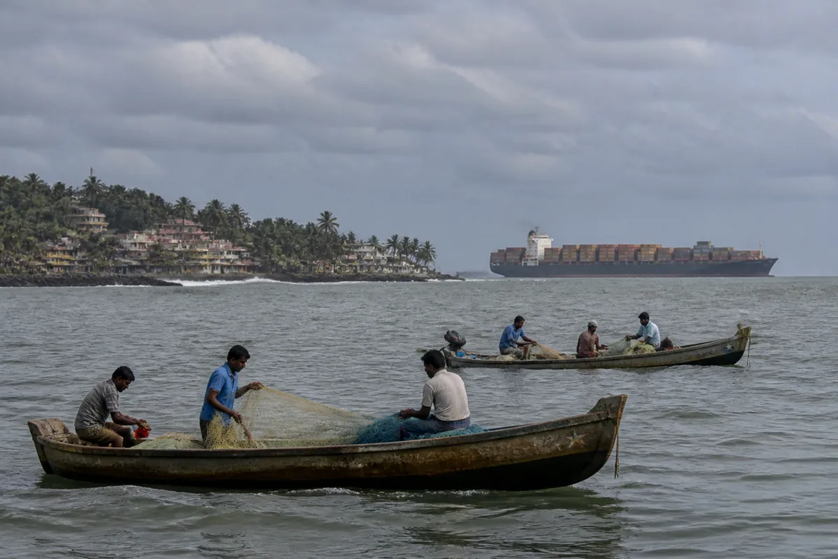
The Kerala Maritime Amendment Act has triggered a conflict that goes beyond a proposed protest. The Kerala Fish Workers United Forum says the law and related coastal development plans threaten the safety, livelihoods and housing rights of traditional fishing communities, raising a larger question about who gets to shape the state’s coastline: the people who depend on the sea daily, or institutions planning shipping, ports and industrial infrastructure around it.
In a statement reported by the Times of India, the forum announced protests against the Act and alleged that it was being implemented without consultations with fisherfolk or labour organisations. The forum’s state president, Charles George, said nearly two lakh active fish workers depend on the sea for their livelihoods in Kerala. He also cited around 43,000 vessels, ranging from country crafts to deep-sea trawlers, as evidence of the scale and diversity of activity that maritime regulation must accommodate.
The central dispute is over the relationship between commercial shipping routes and fishing grounds. According to the forum, the designation of a shipping lane within 30 nautical miles of the Kollam coast places the route through Quilon Bank, also known as Kollam Parappu. The fishing zone extends for about 85 kilometres from Varkala to Ambalapuzha, the forum said. It is demanding that shipping routes be moved at least 50 nautical miles west of the fishing ground.
These distances are not a technical detail alone. They determine how commercial vessels and fishing boats share the same operating space, how far smaller vessels must travel to reach fishing grounds, and how much room exists for avoiding collisions. The forum’s argument is that a route designed primarily around shipping efficiency can impose direct safety costs on fishing communities if it cuts through an economically important fishing area.
The forum linked its concerns to previous maritime accidents, including the Enrica Lexie–Prabhu Daya incident. George alleged that eight ship collisions had damaged fishing boats and caused the deaths of fishermen. He also alleged that vessels involved in such incidents often failed to stop. The supplied report does not provide official accident records, findings from investigations, or details of the individual cases, so these claims remain the forum’s account of the safety problem rather than independently established findings in the material available.
That limitation is important because maritime safety disputes are shaped by evidence that is often distributed across several institutions. Collision reports, vessel tracking records, navigational rules, port authorities, the Coast Guard, shipping operators and state agencies may each hold part of the picture. Without a publicly available account of how the proposed shipping lane was selected, what risk assessment was conducted, and how fisherfolk were consulted, the public cannot easily evaluate whether the proposed alignment adequately accounts for fishing activity.
The forum said the Kerala government had earlier supported moving the shipping route but that the Centre had not accepted the demand. The report does not identify the relevant government communication, the date of the state’s position, or the Union authority responsible for the final decision. Those institutional details matter because the dispute appears to involve overlapping responsibilities: the state government represents coastal communities and manages several aspects of development, while maritime routes and shipping regulation may involve central authorities and national commercial interests.
The disagreement also illustrates how coastal governance can become fragmented. A fishing community may experience the sea as a workplace, a transport space, a source of food and an extension of its settlement. Government and industry projects may divide the same coastline into shipping corridors, ports, tourism areas, industrial zones and conservation or regulatory categories. Each project can be assessed separately, while the combined effect on access to fishing grounds, housing and local employment remains less visible.
The forum described the government’s approach as an “anti-fisher” blue economy policy, an allegation that reflects its opposition to the direction of coastal development. It cited a proposed 2,000-kilometre coastal road, coastal zone development areas, tourism circuits, port cities, container freight stations, shipbuilding yards and ship-breaking units. It alleged that these projects could displace fishing communities and that project documents did not adequately address rehabilitation and compensation for affected fish workers.
The report does not establish that all the projects cited are approved, under construction or located in the same affected settlements. Nor does it provide the rehabilitation provisions in the relevant project documents. But the list is significant because it shows that the forum is not opposing only one amendment or one shipping lane. Its protest is directed at a wider development model in which coastal land and waters are treated as sites for multiple infrastructure and industrial uses.
The concern over housing rights adds a land-side dimension to what might otherwise be seen as a maritime safety dispute. Fishing communities require proximity to the coast not only to launch boats but also to store equipment, handle catches and maintain established social and economic networks. If coastal projects alter access to the shore or raise the value of land without secure rehabilitation, the effect can be displacement even when a project does not formally remove an entire settlement.
Compensation, therefore, is only one part of the institutional question. The forum’s allegation that project documents do not adequately address rehabilitation suggests a concern about whether affected fish workers will be recognised as project-affected people, how livelihood losses will be measured, and whether replacement housing will preserve access to the sea. The supplied material does not contain the government’s position on these questions, nor does it specify the legal safeguards attached to each project.
The economic scale cited by the forum helps explain why the conflict has broad public significance. Nearly two lakh active fish workers and around 43,000 vessels represent a large coastal livelihood system, not a marginal activity. The figures also point to a regulatory challenge: country crafts and deep-sea trawlers have different sizes, operating patterns and safety requirements. A single maritime planning decision can therefore affect different categories of fish workers in unequal ways.
The geography of Quilon Bank makes the issue more concrete. A fishing ground extending for about 85 kilometres between Varkala and Ambalapuzha is not a small local site. If the forum’s description is accurate, the proposed shipping alignment intersects an area with significance across multiple coastal districts and communities. At the same time, the report does not provide catch data, vessel movement data or an official map comparing the shipping lane with fishing activity. Those missing details are necessary for a full assessment of the competing claims.
The forum also opposed offshore sand mining and mineral sand extraction projects, alleging that initiatives resisted through protests lasting more than a year were being revived under a proposed mineral corridor plan. It identified the Ocean Mission and corridor projects as part of wider development plans affecting Kerala. The report does not state the current approval status of these projects or identify the agencies responsible for them. That uncertainty reinforces the need to distinguish between announced plans, proposals under consideration and projects with statutory approvals.
The dispute thus reveals a recurring problem in coastal administration: consultation often occurs project by project, while communities experience cumulative change. A coastal road can affect access; a port can alter traffic and land use; a shipping route can change safety conditions; sand mining can affect the marine environment; and tourism or industrial development can place pressure on housing. Even where each intervention has a separate approval process, their combined effects may not be visible in a single consultation.
The immediate political response will be the forum’s proposed protests and its call for fisher organisations and public-interest groups to join a united campaign. The immediate administrative questions are more specific. Authorities would need to clarify the legal provisions of the Kerala Maritime Amendment Act, publish the basis for the proposed shipping-lane alignment, state how collision risks were assessed, and explain what consultation took place with fishing communities and labour organisations.
The supplied report contains no response from the Kerala government, the Union government, maritime regulators, shipping operators or project authorities. It also does not include the text of the amendment, an official notification, a consultation record or a rehabilitation framework. Those omissions do not erase the forum’s concerns, but they limit what can be concluded about the law’s actual provisions and the status of the wider projects it named.
What the evidence presently confirms is the existence of a serious and organised dispute over maritime safety, fishing access, coastal housing and the direction of development in Kerala. What remains unresolved is whether the proposed shipping lane and coastal projects have been assessed cumulatively, whether affected fish workers have been formally identified for rehabilitation, and how state and central authorities will respond to the demand for routes farther offshore. Those questions will determine whether the conflict remains a protest over one amendment or becomes a wider test of coastal governance in the state.

