


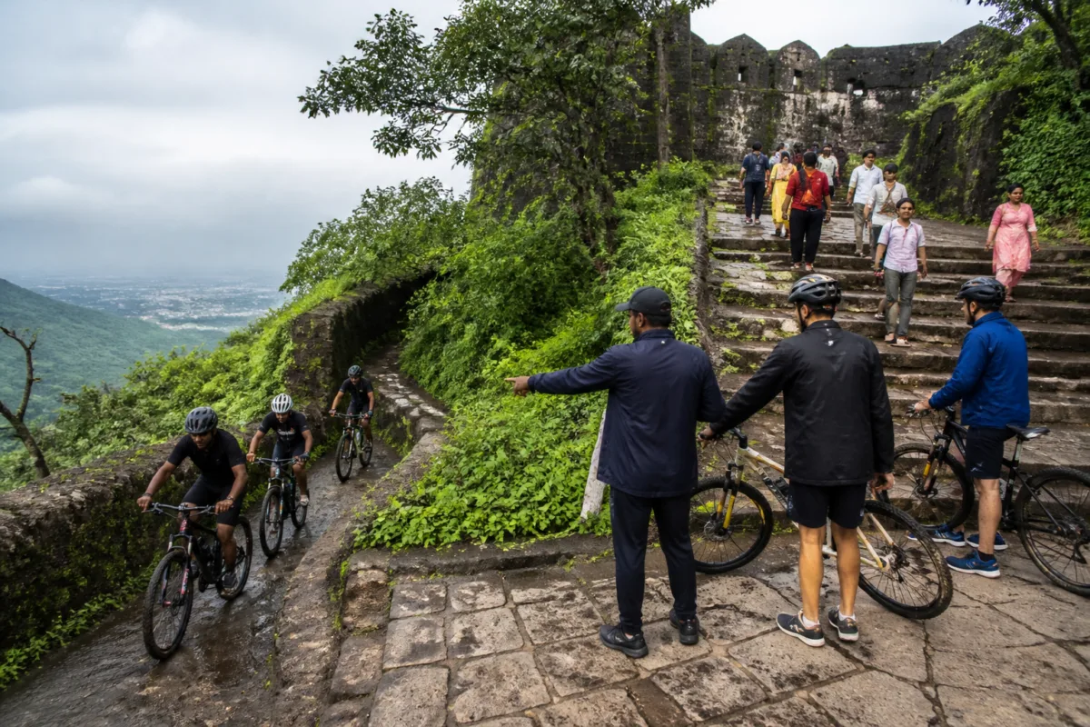
A cycle race held at Sinhagad Fort between 22 and 25 October has exposed a permissions gap between two government jurisdictions that manage different parts of the same visitor landscape. The Forest Department allowed the event on a trail within its boundary, but the organisers did not obtain clearance for the Pune Darwaza and an adjoining section of steps that fall within the Archaeology Department’s protected area.
The issue is not simply whether a private sporting event took place at a historic fort. It is that the race route crossed a boundary that was apparently not treated as an operational boundary by the event organisers. The Forest Department’s permission covered only the portion under its control, while the starting point and part of the approach route lay within the Archaeology Department’s jurisdiction. The reported episode shows how a single public destination can be governed through separate permissions, each covering only part of the ground that visitors experience as one continuous route.
According to the report by Sakal – Pune, the final round of the ZLS Pune downhill cycling race began near the second Pune Darwaza and proceeded towards Atkarwadi. The Forest Department had permitted the competition on a trail below the fort’s ramparts. However, the starting point was near the Pune Darwaza, where the organisers erected a wooden platform approximately half a foot to one foot high. The steps after the starting point, the first gate and an estimated 50 to 100 metres of steps below it were reported to be within the Archaeology Department’s area.
That distinction became central after the race was held. The Archaeology Department had not granted permission for a competition on the fort, and its officials said the organisers had not obtained approval for the section within its protected area. The department also said that, by the end of Monday, it had not received official information about the event from either the organisers or the Forest Department.
The Forest Department’s approval, as described by Pune Deputy Conservator of Forests Abhijit Vaikos, was issued after an application by Gautam Tawde and a report from the Bhamburda forest-range officer. It was granted subject to conditions and placed responsibility on the organisers and competitors. The approval was limited to the Forest Department’s boundary and did not authorise use of the area controlled by the Archaeology Department.
This is the first institutional lesson from the episode: a permission is not necessarily a permission for the entire route. For events that move across trails, gates, steps and fort structures, the relevant administrative unit is not just the organisation seeking approval but the full physical course. If the course crosses boundaries, the approval process must account for every section. In this case, the reported approvals appear to have been treated as sufficient for only one part of the route, while the competition began in another.
The second issue concerns the difference between protecting a structure and managing a living visitor site. Sinhagad is described in the report as a protected historic fort, but its paths are also used by tourists and residents who come for exercise. The Forest Department had instructed that the route should not be closed on Saturday and Sunday because of the expected visitor crowd. It also placed responsibility on the organisers to ensure that tourists were not obstructed.
The report says the route was nevertheless kept closed during the competition, inconveniencing visitors. That detail matters because access management is not a secondary concern at a site where sporting activity and everyday public use occupy the same narrow paths. The event did not take place in an isolated sporting facility with a dedicated course. It used a route that visitors and local residents regularly use to reach and move around the fort.
The resulting conflict was therefore between an organised event and the ordinary functioning of a public heritage destination. The Forest Department’s condition recognised the presence of visitors, but the reported closure indicates that the condition required active supervision on the ground. A written condition can assign responsibility; it cannot by itself manage crowds, control access or resolve confusion over which authority has control of a particular step or gate.
The third issue is public communication. The Forest Department said that, because the competition was private, the responsibility for informing local people rested with the concerned organisation. The report states that local residents should have been informed in advance about the four-day event. This points to a wider administrative weakness: event approval and public notification are being treated as separate responsibilities, even when the event affects the movement of people through a heavily used destination.
For visitors, the practical question is not which department approved which stretch. They need to know whether a route will be closed, when the closure will occur, and whether an alternative path is available. For residents who use the fort’s trails for exercise, advance notice is equally important. Without that information, even an event that has obtained a valid partial permission can appear unauthorised, disruptive or unsafe at the point of use.
The reported geography makes coordination more difficult. The race began near the Pune Darwaza, used steps and passed towards Atkarwadi, while the Forest Department permission applied to a trail below the ramparts. A course that crosses from a forest-managed trail into a protected archaeological area cannot be evaluated only as a sporting activity. It must also be evaluated as an intervention in a historic structure, its access routes and the movement patterns of visitors.
The evidence supplied in the report does not establish whether the organisers deliberately used the Archaeology Department’s area without approval or whether the route was planned without accurately mapping the jurisdictional boundary. It does establish that approval for the Forest Department’s area did not extend to the Archaeology Department’s area. That distinction is important. The administrative failure can be identified without assigning intent that has not been established.
The episode also illustrates why protected sites require route-level scrutiny rather than event-level scrutiny. The name of a venue can conceal multiple land and asset managers. An event described as being at Sinhagad Fort may involve the Forest Department, the Archaeology Department, local officials, organisers, competitors and visitors. Each may have a different responsibility. Unless the route is physically marked and jointly cleared, the organiser may hold one permission while operating beyond its scope.
The Archaeology Department’s response was that a notice would be issued to the organisers and that a fine would be imposed. The department also said strict action would be taken against people who cycled or performed stunts illegally on the fort, and that information would be sought from the Forest Department. The Forest Department, meanwhile, said action would follow if the organisers had violated the conditions attached to its permission.
Those proposed actions reveal two separate enforcement questions. The first is whether the organisers used an area without the permission of the authority responsible for it. The second is whether they breached the conditions of the permission they did receive, including the instruction not to obstruct tourists. Both questions require the departments to compare the approved route with the route actually used and to examine how the event was conducted.
The report does not provide the text of the permission, a route map, the number of participants, the number of visitors affected or details of any accident. Those gaps limit what can be concluded about the scale of the disruption or the physical impact on the fort. The available evidence is sufficient to establish the jurisdictional mismatch and reported visitor inconvenience, but not to measure broader damage or safety consequences.
That limitation is significant because protected heritage sites are vulnerable to administrative simplification. A route may look continuous to a cyclist or visitor while being divided in official records. A starting platform, a series of steps or a gate can fall under a different authority from the trail immediately beyond it. In such settings, the absence of a complete route map is not a minor paperwork problem; it can determine whether an event is permitted at all.
Sinhagad’s cycle-race controversy therefore raises a structural question for the management of urban-edge destinations: who is responsible for coordinating permissions when public access, forest land and protected heritage infrastructure overlap? The supplied report does not identify a joint clearance system or a single nodal authority for such events. Instead, it records separate permissions, separate boundaries and separate post-event responses.
The next steps announced by the authorities will determine how the incident is formally classified. The Archaeology Department said it would issue a notice and impose a fine, while the Forest Department said it would seek information and examine any breach of its conditions. Until those processes are completed, the confirmed facts remain that the race used a route crossing different administrative boundaries, that Forest Department approval was limited to its own area, that Archaeology Department clearance was not obtained for the reported fort section, and that visitors faced inconvenience when the path was closed.

