


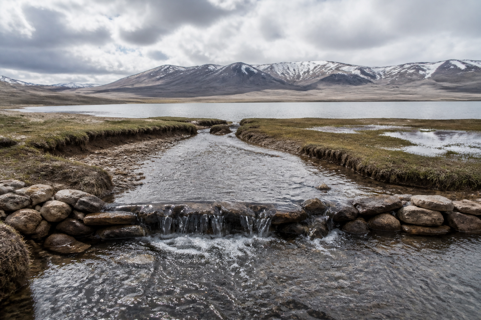
Ladakh’s plan to revive the shrinking Tso Kar Lake by redirecting glacier meltwater is more than a water-transfer project. It is an attempt to repair a damaged high-altitude ecosystem while restoring grazing grounds and livelihoods that have weakened as the lake and surrounding grasslands contracted. The project also places a difficult question at the centre of climate adaptation in the Himalayas: can engineering help recover a fragile landscape without imposing a new, harder infrastructure burden on it?
The initiative will channel water from the Rupshu Kharnak stream in Changthang, about 11 kilometres from Tso Kar, into the lake. The stream is located at an altitude of around 18,000 feet, while the lake sits at nearly 15,000 feet. Officials estimate that an average of 132 cusecs, or approximately 320 million litres a day, can be redirected through gravity flow and low-cost earthworks. The water currently runs unused into the Sindhu River.
The scale of the ecological decline explains the urgency. Tso Kar once spread across nearly 11,000 acres, but now occupies barely 3,200 acres, according to the official statement cited in the report. That represents a contraction of almost 70 per cent over the past decade. The retreat has reduced habitat for migratory birds, while the black-necked crane, once a prominent symbol of the region’s biodiversity, has become a rare sight.
The lake’s decline has also altered the working geography of local communities. Villagers told Lieutenant Governor Vinai Kumar Saxena during his visit on August 10 that the loss of grasslands and grazing grounds had forced Pashmina herders to travel between 50 and 75 kilometres from their homes. This detail is important because it shows that the lake is not an isolated environmental asset. Its water and surrounding grasslands support a linked system of pastoral livelihoods, biodiversity and local tourism.
The restoration design is notable for what it does not propose. The Public Health Engineering department initially suggested an 11-kilometre reinforced cement concrete channel. Saxena rejected that approach on ecological grounds and favoured natural channels that would blend into the landscape. Instead of relying on a continuous concrete corridor, the project will use gravity flow, earthen channels and three natural depressions along the stream’s descent.
These depressions cover approximately 270 acres, 24 acres and 10 acres. They are being developed as cascading freshwater wetlands. Check dams fitted with reinforced concrete cement pipes will slow the flow and allow sediment to settle before water reaches Tso Kar. Together, the three water bodies are expected to hold nearly 1.23 billion litres of freshwater.
This arrangement gives the project two linked objectives. The first is to deliver cleaner, less sediment-heavy water to Tso Kar. The second is to create additional wetland ecosystems along the route. If the system functions as planned, water will not simply be moved from one point to another; it will pass through a chain of intermediate habitats that can retain water, support vegetation and potentially attract migratory birds.
The distinction matters in a cold desert such as Ladakh, where water is scarce, seasonal and highly sensitive to temperature. A conventional channel may move water efficiently, but it can also separate the flow from the terrain and reduce opportunities for natural retention. The proposed cascading system attempts to use the topography itself as part of the infrastructure. In institutional terms, it is a shift from building a single engineered asset to managing a connected landscape of streams, depressions, wetlands, grasslands and lake margins.
The project’s first implementation signals came quickly. Work began on September 2, ahead of the severe winter season, when temperatures can fall to between minus 20 and minus 30 degrees Celsius. By September 9, engineers had diverted 20 cusecs of glacier water into the first depression through earthen channels and a long-defunct concrete canal built in 1995. The official statement said nearly 20 per cent of that depression had filled within four days.
That early result demonstrates that the project is already operational at a limited scale, but it does not yet establish whether the full system can restore Tso Kar to its earlier extent. Officials estimate that effective channelisation could return the lake to its original expanse within a year. The supplied material does not provide independent measurements of inflow, evaporation, seepage, seasonal variation or the lake’s current water balance. Those factors will determine whether the proposed volume is sufficient not only to fill the lake but also to sustain it.
The numbers show both the ambition and the uncertainty of the plan. The source stream is expected to provide about 320 million litres a day, while the three intermediate wetlands are designed to store around 1.23 billion litres. The difference between daily flow and storage capacity indicates that the depressions are intended to moderate the movement of water rather than function only as temporary holding ponds. Their performance will depend on the check dams, the earthen channels and the ability of the ground to retain water under high-altitude conditions.
The project also follows an earlier intervention near Leh. Earlier this year, 90 million litres of Stok Glacier water were diverted to parched farmlands. That experience appears to have encouraged officials to apply a similar water-management approach in Changthang, but with a different ecological purpose. Near Leh, the reported objective was to supply farmland. At Tso Kar, the aim is to restore a lake, wetlands, grasslands and associated livelihoods.
This difference highlights the policy challenge facing high-altitude regions. Glacier meltwater can be seen as an immediate resource for agriculture, settlement and ecological restoration, but each intervention changes the timing and location of water in a landscape where natural systems are tightly connected. The source material presents the Tso Kar project as a climate-resilience measure, but it does not establish how the diversion will affect downstream flows in the Sindhu River or other users of the Rupshu Kharnak stream. That remains an issue requiring continued monitoring.
The administrative pathway behind the project is also revealing. The initiative emerged after villagers raised concerns during the Lieutenant Governor’s visit. A rapid survey was ordered, followed by a proposal from the Public Health Engineering department and a change in design direction. This sequence shows how local testimony, administrative inspection and departmental engineering can combine to produce a public-works project. It also shows the importance of design review: the choice between an RCC channel and natural earthworks was treated as an ecological decision, not merely a construction decision.
The project’s success will therefore depend on more than completing the diversion. It will require observation of water levels, sediment movement, wetland formation, grassland recovery and bird return. It will also need to be assessed against the needs of Pashmina herders, whose travel distances have increased as grazing grounds have disappeared. The source material says the revival of surrounding grasslands could support traditional grazing and livelihoods, but it does not yet report a formal livelihood plan, a grazing-management framework or a mechanism for measuring those outcomes.
Tourism is another expected benefit. New wetlands and the restoration of Tso Kar could strengthen the area’s ecological appeal and support the return of migratory birds. Yet tourism is described in the supplied material only as a possible benefit, not as an established outcome. Any increase in visitor activity would create a separate requirement for access management and protection of the recovering ecosystem, but the project details available here do not specify such arrangements.
Saxena has described the Stok Glacier intervention as evidence that large-scale, sustainable water management is feasible in Ladakh’s cold desert using simple engineering. The Tso Kar project extends that proposition from water supply to ecological restoration. Its central institutional choice is to work with gravity and existing landforms rather than create a fully concrete channel. That choice reduces the visible construction footprint, although the long-term environmental performance of the system will have to be demonstrated through monitoring rather than assumed from the design.
The wider urban and regional lesson is that climate resilience is not confined to cities. Ladakh’s settlements, farms, pastoral routes, tourism economy and public infrastructure depend on water systems spread across a vast and fragile landscape. Decisions made in an upstream stream can affect a lake, wetlands, wildlife, grazing grounds and household livelihoods many kilometres away. The Tso Kar intervention treats those relationships as part of one restoration system.
What the evidence confirms is that Tso Kar has undergone a severe contraction, that local pastoralists have lost access to nearby grazing grounds, and that authorities have begun diverting glacier water through a naturalised, cascading design. What remains uncertain is whether the planned volumes will sustain the lake, how the diversion will affect downstream flows, and whether the wetlands and grasslands will recover at the scale expected. The next significant markers will be the completion of the channelisation works, performance through the harsh winter and independent evidence of changes in lake area, wetland health, biodiversity and herder access to grazing grounds.
