


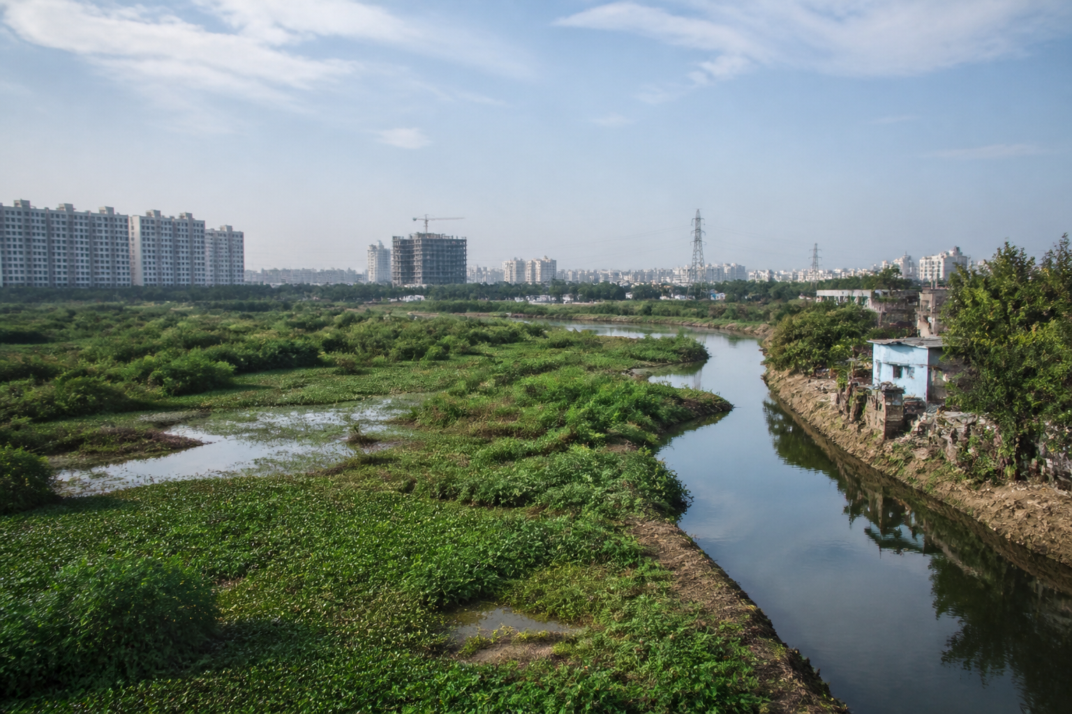
Pallikaranai Watershed Shows Chennai’s Planning Failure
A citizen charter is seeking to replace project-by-project interventions with basin-level management across Chennai’s southern water system.
The call for an integrated plan for the Pallikaranai watershed comes as citizen groups, conservation organisations and experts point to a connected chain of lakes, ponds, canals, floodplains and wetlands being managed as separate assets. Their argument is that the city’s flooding and water-management problems cannot be addressed through isolated lake restoration, individual drainage works or construction decisions taken without regard to downstream consequences.
The Citizen’s Charter for the Pallikaranai Watershed was prepared by the Chennai Wetlands Action Collective and Oorvani Foundation after a consultation at the Indian Institute of Technology Madras Research Park. The consultation brought together resident welfare associations, conservation groups, activists and experts. It also resulted in the formation of the Pallikaranai Collective, a platform for groups working on the watershed’s lakes, ponds, canals and wetlands.
The charter identifies a planning problem that is common to complex urban water systems: administrative boundaries and departmental responsibilities do not necessarily follow the movement of water. The Pallikaranai watershed, part of the Kovalam water basin, contains a cascade of 65 major lakes and hundreds of ponds that drain towards the Pallikaranai marshland, a protected Ramsar wetland. According to the groups, this interconnected structure makes lake-by-lake management inadequate.
“Inter-departmental coordination is critical. Agencies cannot continue to work independently when the entire watershed functions as one connected system,” said S. Janakarajan, former professor at the Madras Institute of Development Studies and a hydrologist, according to the report.
That distinction is central to the charter. A lake may be restored, desilted or beautified, but the intervention may not resolve flooding if the downstream canal is blocked, the outlet lacks capacity, sewage continues to enter the water body or construction has narrowed the natural flow path. The citizen groups are therefore asking for an independent, specialised and inter-departmental committee comprising experts and people’s representatives. Its proposed responsibilities include examining policy gaps, preparing a coordinated implementation plan and fixing departmental responsibilities and timelines.
The charter also calls for wetlands and floodplains to be demarcated and protected under the Wetland (Conservation and Management) Rules, 2017. It seeks implementation of the 2020 guidelines and a Flood Plain Zoning Act in Tamil Nadu. These demands indicate that the dispute is not limited to the condition of individual water bodies. It concerns the legal and planning status of land that performs a wider hydrological function, including storing, conveying and absorbing water.
The groups have raised concerns about encroached infrastructure, illegal construction and proposed projects within the Pallikaranai Ramsar site and its buffer zone. A representative of the Chennai Wetlands Action Collective alleged that the Ramsar site was being occupied by government agencies, including Chennai Metro Rail, and real estate companies. The report attributes to the representative a warning that such activity could worsen flooding in Old Mahabalipuram Road and Semmenchery. The allegations require responses from the agencies and project authorities concerned; the supplied report does not provide those responses.
The Perungudi dumpyard is another part of the charter’s argument. The groups have sought an end to further dumping there and the demarcation of the marsh using 1911 revenue records, referring to an order of the National Green Tribunal cited in the charter. The demand connects land records, waste management and flood resilience. If the boundaries of a wetland are unclear or disputed, enforcement against encroachment and decisions on infrastructure become more difficult. If waste facilities affect drainage channels or water bodies, the resulting problem cannot be treated only as a sanitation issue.
The same pattern appears in the groups’ demands on lake restoration. They have sought a scientific template that covers upstream and downstream canals, storm-water connections and catchment management. They have opposed concretisation and called for audits of restoration works at Navalur, Raman Thangal and Sholinganallur lakes. They have also sought the scrapping of proposed lake-front development at Madambakkam and Sembakkam. The emphasis is on whether restoration improves the functioning of the entire catchment, rather than on whether a lake appears improved within its own boundaries.
The account of Nanmangalam lake illustrates the gap between a water body and its wider drainage system. Sathya Anand of the Saving Nanmangalam Lake group said sewage continued to enter the lake and that its outlet channel disappeared after about a kilometre because of encroachments. The group is seeking clear demarcation of the lake, protection of its boundaries and restoration of the natural outlet.
In Velachery, M. Balakrishnan of the Tansi Nagar Welfare Association said the six-vent watercourse, described as the only outlet for water from a large surrounding area, remained obstructed by debris and encroachments despite court orders and residents’ demands. The claim points to an implementation problem: even where legal directions or public demands exist, the physical obstruction may remain in place if responsibility for clearing and maintaining the watercourse is not effectively assigned.
The southern catchment presents a similar issue. Atish Baisantry of the OMR Gandhinagar Plot Owners Welfare Association said restoration of Navalur lake had not resolved downstream drainage problems. According to his account, the outlet lacked sufficient capacity, while vegetation, sewage, waste, walls and construction obstructed the canal. He said Gandhinagar flooded every monsoon because it lacked proper storm drainage. The report does not include an engineering assessment of the outlet’s capacity, but the account underscores the need to evaluate restoration against downstream performance.
The charter’s proposed response includes desilting the entire 13-kilometre Buckingham Canal, removing construction debris near Sholinganallur-Akkarai Road and the Muttukadu estuary, and preparing a dedicated flood-mitigation plan for Semmenchery and Perumbakkam resettlement areas. These demands broaden the issue beyond the marsh itself. They place roads, canals, estuaries and resettlement neighbourhoods within the same water-management system.
Sewage and solid waste are also treated as watershed-management concerns. The groups have called for decentralised, catchment-based sewage treatment plants, underground drainage systems, strict action against untreated sewage discharge and source-level waste segregation. They have sought the removal of illegal waste transfer stations and dumpyards affecting water bodies including Nanmangalam lake and Pallavaram Periya Eri.
The policy landscape described in the charter is therefore dispersed across wetland rules, floodplain protection, drainage, sewage, solid waste, land records, infrastructure approvals and lake restoration. The citizen groups’ central complaint is that these functions are being handled without a sufficiently integrated institutional framework. Their proposed committee is intended to create that coordination, but the supplied material does not establish whether government agencies have accepted the proposal, assigned responsibilities or committed funding and timelines.
The evidence in the report also shows why visible project completion cannot by itself be used as a measure of watershed health. Navalur lake is described as restored, yet downstream drainage problems are reported to continue. A lake can be desilted while its outlet remains blocked; a canal can exist on a map while its flow is interrupted by debris, sewage or construction; and a protected wetland can retain legal status while facing pressure from infrastructure and urban expansion. The report does not provide a comprehensive performance audit, but its examples point to the need for such assessments.
The larger urban question is whether Chennai’s southern expansion is being planned around the movement of water or around individual parcels, projects and administrative jurisdictions. The Pallikaranai system does not function as a collection of unrelated sites. Water moves between lakes, ponds, canals, floodplains and the marsh. Decisions affecting one part can therefore alter conditions elsewhere, particularly where outlets are constricted or natural channels are encroached upon.
The charter confirms the breadth of the concerns raised by communities working across the watershed. It does not, by itself, establish the legal status of every disputed site, the technical adequacy of every drainage channel or the responsibility of each agency named in the demands. Those questions require documentary, engineering and official verification. The developments to monitor are the government response to the proposed inter-departmental committee, any formal action on wetland and floodplain demarcation, the handling of the Perungudi dumpyard, and whether future lake and drainage projects are assessed at the catchment level rather than as isolated works.
