


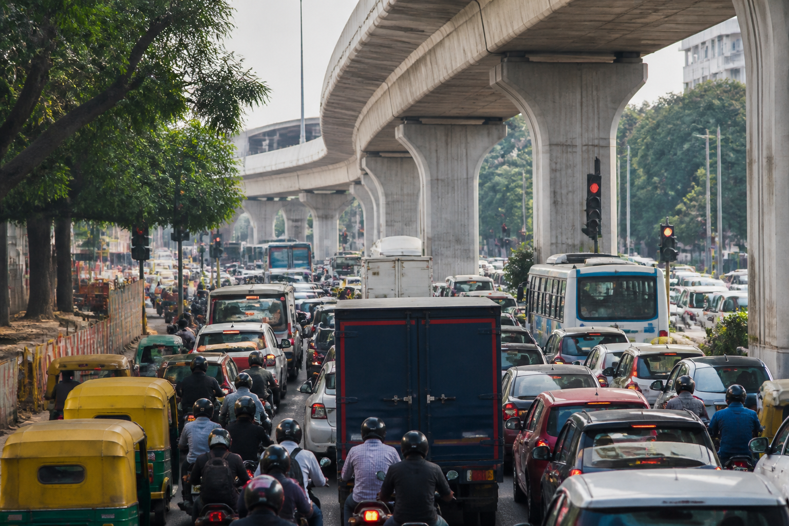
Bengaluru flyover restrictions have turned a narrow road-safety intervention into a broader test of how the city manages traffic across connected corridors. Restrictions on two-wheelers, auto-rickshaws, goods vehicles and some heavy vehicles on selected elevated stretches are intended to prevent accidents, but the resulting diversions are pushing traffic back onto surface roads, signals and junctions that the flyovers were designed to bypass.
A ground report across the International Airport Road, Peenya Elevated Corridor, BGS Flyover on Mysuru Road and the Silk Board-Ragigudda double-decker flyover found that the effects vary by corridor. Traffic personnel said the curbs improved safety on some elevated stretches. At the same time, Airport Road and Peenya experienced traffic accumulation at diversion points, while goods vehicles and autos diverted from BGS Flyover added pressure to multiple signals. The difference between the corridors suggests that the restrictions are not operating as a single citywide traffic measure. Their consequences depend on road design, vehicle composition, signal capacity and the availability of workable alternatives.
The immediate policy question is not simply whether vehicles should be allowed on flyovers. It is whether the wider network can absorb the vehicles removed from them. Bengaluru’s elevated corridors were built to separate traffic from congested surface roads. Once particular vehicle categories are redirected below, the safety and capacity of the surface network become inseparable from the decision taken on the flyover above it.
On the Airport Road corridor between Sanjeevnagar Cross and Vidyashilp Junction, traffic police said diversions could quickly produce gridlock because traffic has to be distributed between the city-bound road and routes towards Hunasamaranahalli and other destinations. Officers reported that traffic from Jakkur begins building from around 8 am on weekdays and can remain heavy until the afternoon. The redirection of two-wheelers and passenger and goods autos to surface roads has led to bottlenecks during peak hours, according to the report.
The enforcement problem is closely tied to the capacity problem. Traffic police said they cannot allow vehicles to continue towards the city without interruption because surface roads and signals, including those near Bettahalsoor and Kudlu junctions, cannot handle the volume. But stopping or redirecting traffic also creates queues and delays. The result is a cycle in which enforcement is necessary to maintain the restriction, while enforcement itself can interrupt the movement of traffic and intensify congestion at the points where vehicles are diverted.
The experiences of commuters and drivers illustrate the operational cost. One commuter, Nawaz, said a journey that previously took about 10 minutes on an elevated stretch now takes more than half an hour extra after passing through the Yelahanka market signal and the Air Force station signal. Another driver, Satish M, supported the restriction, saying his auto begins to swerve when travelling above 50 kmph on the elevated road. The contrasting views reflect the core trade-off identified in the report: the flyover may present a risk for some vehicles, but the alternative route can impose longer and more difficult journeys on the same users.
The Peenya Elevated Corridor presents a similar conflict between safety and traffic flow. Police officers highlighted the physical risks involved in intercepting fast-moving vehicles. Pulling passenger and goods autos from inner lanes and diverting them to surface roads can bring entire streams of traffic to a halt. Enforcement is particularly challenging during evening and night hours, according to traffic personnel. An auto driver, Veeranna, said the surface route normally takes 30 to 35 minutes, compared with about 10 minutes on the flyover.
That gap matters because travel time is not only a commuter inconvenience. For auto-rickshaw and goods-vehicle operators, route length and delay affect operating costs, passenger availability and the number of trips that can be completed. The supplied report does not quantify those economic effects, but the difference in reported travel times shows why some drivers may resist the restrictions even when the safety rationale is accepted. It also explains why enforcement encounters can become tense: the restriction changes the practical value of the route for people whose work depends on moving through the corridor efficiently.
The BGS Flyover on Mysuru Road shows how the same decision can affect a different type of urban network. Officials said goods vehicles diverted to surface roads queue at signals near Market Circle, Mysuru Circle, Reliance Circle and other junctions. A driver, Pooviliraj, said the presence of five signals causes traffic to accumulate and adds about half an hour to the journey. Here, the problem is not described primarily as a confrontation between motorists and police. It is a capacity issue created when commercial traffic is moved into a sequence of signal-controlled intersections.
The Silk Board-Ragigudda double-decker flyover appeared less difficult to manage. A traffic policeman said only a handful of heavy vehicles normally use the stretch and that drivers generally comply when stopped. This difference is important because it indicates that the effects of a restriction depend partly on how many vehicles are affected and whether the alternative road has enough capacity. A rule that produces limited disruption on one corridor may create severe queues on another.
The police response, as described by Bengaluru City Police Commissioner Seemant Kumar Singh, is to treat the restrictions as a pilot rather than a settled long-term policy. Singh said the main goal was public safety and that officers had been asked to study traffic flow, timings and vehicle composition on the affected corridors. The police would consult other stakeholders before deciding whether changes were required.
That proposed assessment points to the evidence needed for a durable decision. Traffic flow must be examined not only on the flyovers but also at diversion points, signals and surface-road junctions. Timing matters because a restriction that is manageable outside peak periods may be disruptive during weekday mornings, afternoons or evenings. Vehicle composition matters because two-wheelers, passenger autos, goods autos and heavy vehicles do not occupy roads or move through intersections in the same way. The report makes clear that each of these variables is already shaping the outcome on the ground.
The current experience also exposes an institutional question. Elevated roads and surface roads are being managed as parts of one traffic system, but restrictions on one layer can have immediate consequences for the other. A safety decision made for a flyover therefore requires coordination among traffic police, road authorities and other stakeholders responsible for the surrounding network. The supplied material does not identify the full institutional arrangement or any published evaluation framework, but the commissioner’s reference to consultation indicates that the police do not regard enforcement alone as sufficient to resolve the issue.
The city’s challenge is particularly visible in the mismatch between the purpose of elevated infrastructure and the routes available below it. Flyovers are intended to reduce conflict and delay by carrying traffic over signals and congested junctions. If a substantial category of vehicles cannot use them, those vehicles return to the very intersections that elevated infrastructure was meant to relieve. The restriction may still be justified where vehicle stability, speed or road geometry creates a safety risk. But its success cannot be measured only by whether fewer vehicles are seen on the elevated stretch. It must also be measured by what happens to the traffic displaced below.
The evidence currently supports a cautious conclusion rather than a citywide verdict. Safety concerns are reported on some elevated corridors, and at least one auto driver said the restriction was justified because of vehicle instability at higher speeds. At the same time, traffic personnel and motorists reported bottlenecks, longer journeys and difficult enforcement on Airport Road, Peenya and Mysuru Road. The Silk Board-Ragigudda experience suggests that the disruption is not uniform. What remains uncertain is the number of vehicles affected, the change in accident or near-miss patterns, the duration of queues and whether specific time-based or vehicle-based adjustments could reduce the pressure on surface roads.
The next stage of the policy will therefore depend on the police assessment of traffic flow, timings and vehicle composition, followed by consultation with other stakeholders. Until that review is completed, Bengaluru’s flyover restrictions remain a live example of a wider urban transport problem: a safety intervention on one piece of infrastructure can alter the performance of the entire road network. The central test is whether the city can protect users on elevated corridors without transferring unmanaged risk and delay to the roads below.
