


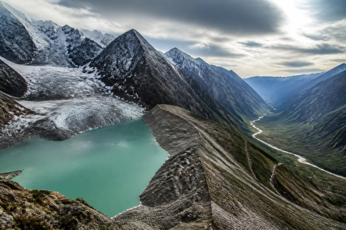
The glacial lake outburst flood from Bhutan’s Shintaphu Lake did not cause major damage in north Bengal or Assam, but the event exposed a wider cross-border risk: changes in Bhutan’s high-altitude landscape can rapidly become a disaster-management challenge downstream in India. A field assessment by Bhutan’s National Centre for Hydrology & Meteorology (NCHM) has attributed the October 29 outburst to ice breaking off a glacier and falling into the lake, generating waves that damaged the moraine barriers holding back the water.
The immediate warning reached Alipurduar in Bengal and Dhubri in Assam after water from Shintaphu Lake entered the Mo Chhu river. The river eventually flows into India as the Sankosh, which passes through areas linked to both districts. Residents living near the Sankosh were moved to safer locations as authorities prepared for a possible flash flood. The evacuation was precautionary: no major impact from the outburst was reported in the two districts, and residents returned home soon afterwards.
That limited downstream impact should not obscure the significance of the event. A GLOF is not simply a flood originating in a conventional river catchment. It begins when a lake formed by glacial retreat or ice and debris accumulation suddenly releases a large volume of water. The flood can travel rapidly through steep mountain valleys, cross administrative borders and leave downstream authorities with little time to assess the threat or move people.
The Shintaphu incident also illustrates how a cascade can develop. According to the field assessment cited in the report, ice from a glacier fell into the upper lake at Shintaphu. The resulting impact eroded the moraine dam, allowing water to pour into a lower lake. The lower lake’s moraine dam then failed as well. In total, about 6.1 million cubic metres of water were released and flowed downstream into the Mo Chhu.
The important point for downstream districts is that the flood hazard is connected to a chain of physical systems rather than a single lake. The location of a potentially dangerous lake, the condition of its moraine dam, the volume of water stored behind it and the river network below all determine how an event may affect settlements in India. The same river system can therefore connect a high-altitude hazard in Bhutan with evacuation decisions in Bengal and Assam.
The NCHM has identified 17 of Bhutan’s 620 glacial lakes as potentially dangerous, according to the report. Nine of the 17 are located in the Pho Chhu basin, three in the Chamkhar Chhu basin, two in the Mo Chhu basin and three in other areas. These basin-level details matter because the risk does not stop at the national boundary. The Pho Chhu joins the Mo Chhu at Punakha in Bhutan before the combined flow continues downstream as the Sankosh, part of the Brahmaputra river basin. The Chamkhar Chhu meets the Manas, another tributary of the Brahmaputra.
This geography places the issue within the wider logic of transboundary river management. A warning generated in Bhutan may be operationally useful only if it reaches Indian authorities quickly and in a form that local administrations can act on. In the Shintaphu case, authorities in Alipurduar and Dhubri received an alert and shifted residents to safer locations. The episode therefore shows both the value of communication across the border and the difficulty of managing a hazard whose origin, path and impact are distributed across different jurisdictions.
The report also identifies a longer-term environmental change behind the rising concern. NCHM sources cited by Bhutan’s national newspaper Kuensel said the number of glaciers in the country had fallen by 27 compared with Bhutan’s 2018 glacial inventory. At the same time, the number of glacial lakes reportedly increased from 567 in 2021 to 620 in the period covered by the report. The figures do not establish that every additional lake is dangerous, but they indicate a changing high-altitude water landscape that requires continued assessment.
The relationship between fewer glaciers and more glacial lakes is central to understanding the risk. As glaciers reduce, meltwater can accumulate in depressions formerly occupied or surrounded by ice. These lakes may be held back by moraines, which are deposits of rock and debris and can be less stable than engineered structures. The report’s account of the Shintaphu failure demonstrates how an external shock, in this case falling ice, can destabilise one barrier and trigger the failure of another.
For Indian districts downstream, the challenge is not limited to flood relief after water reaches the plains. It includes identifying which settlements, roads, bridges and riverbank communities are exposed to flows from specific Bhutanese basins; maintaining communication systems; and ensuring that warnings translate into timely movement of people. The supplied report does not provide a detailed inventory of vulnerable infrastructure or a formal early-warning protocol, so the precise level of preparedness in the affected districts cannot be established from the available evidence.
The institutional chain is nevertheless visible. Bhutan’s NCHM conducted the field assessment and identified the likely physical trigger. Bhutanese media reported the findings and the wider lake inventory. Indian irrigation officials assessed the downstream implications, while district administrations in Bengal and Assam handled the immediate public-safety response. Each institution has a different role, but the event shows that no single authority controls the entire risk.
The warning issued during the Shintaphu outburst also underlines the importance of the last mile of disaster management. A technical assessment at the lake is only the first step. Authorities in downstream districts must receive the alert, determine which settlements could be affected, communicate the danger clearly and arrange temporary relocation. The fact that residents near the Sankosh returned home after no major impact was felt indicates that the response was precautionary, but the report does not say how long the warning remained active or what criteria were used to permit their return.
The available numbers provide a clear, if incomplete, picture. One event released approximately 6.1 million cubic metres of water. Bhutan has 620 glacial lakes, of which 17 have been identified as potentially dangerous. The country has also recorded a reduction of 27 glaciers compared with its 2018 inventory, while the reported number of lakes rose from 567 in 2021 to 620 in the later assessment. Together, these figures show why the Shintaphu flood is more than an isolated incident, even though its direct impact downstream was limited.
What remains uncertain is equally important. The report does not specify the probability of an outburst from each of the 17 lakes, the volume stored in those lakes, the expected travel time of flood waves, or the number of Indian settlements and infrastructure assets exposed in each river basin. It also does not establish whether the increase in lake numbers reflects newly formed lakes, improved mapping, or both. Those details are necessary for converting a broad regional warning into location-specific risk planning.
The larger urban and regional question is how settlements in north Bengal and Assam should prepare for hazards generated beyond their administrative boundaries. The Shintaphu event shows that even when a GLOF produces no major damage, it can trigger evacuations and disrupt the normal relationship between communities and rivers. As Bhutan’s glacial landscape changes and potentially dangerous lakes remain under observation, the effectiveness of future responses will depend on the quality of cross-border alerts, basin-level understanding and local evacuation capacity.
The evidence confirms that the October 29 GLOF was linked by Bhutanese experts to an ice break-off and cascading moraine-dam failures, and that 17 Bhutanese glacial lakes have been identified as potentially dangerous. The next critical developments are further assessments of those lakes and clearer information on how warnings will reach exposed districts along the Sankosh, Manas and connected river systems.

