


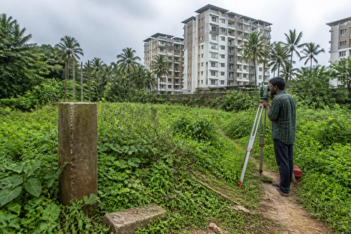
The dispute over surplus government land in Churnikkara gram panchayat is not simply a boundary-marking exercise. It is a test of whether a local body can complete the basic administrative work needed to recover public land and move a housing project for people without land or homes. According to a report by Kerala Kaumudi, survey teams have visited the Companypadi area three times to demarcate government land beside a private flat development, but the survey remains incomplete because the panchayat has not cleared vegetation or provided the boundary stones required for the work.
The report says the issue involves land recorded under survey numbers 177/1 and 177/2. The identified areas cover 17 acres and five acres respectively, although the extent of surplus land within them is estimated at about 44 cents. Of the 39 points where boundary markers are required, survey officials have located only 11. The remaining points cannot be marked until the site is made accessible and the required survey stones are made available.
That gap between identifying public land on paper and securing it on the ground is central to the Churnikkara case. Land records, survey numbers and administrative directions have limited value if officials cannot physically enter a site, establish its boundaries and place durable markers. Until that chain is completed, the government’s claim over the land remains difficult to enforce in practical terms, and any public-purpose use of the site remains exposed to delay and uncertainty.
The report attributes the latest delay to the panchayat’s failure to undertake vegetation clearance and arrange the boundary stones despite directions from the district collector and the joint director of the local self-government department. A survey team reportedly left the site on October 24 because the vegetation had not been cleared. The taluk land records tahsildar then sent another written communication to the panchayat secretary last week, seeking urgent action to clear the area and provide the materials needed for demarcation.
The panchayat’s reported position is that a decision to clear the land and make the survey stones available will be taken at its next committee meeting. That response is important because it places the immediate responsibility for unlocking the survey process with the local institution. The case therefore illustrates how the recovery of public land can become dependent on a sequence of administrative actions spread across different levels of government: the district administration issues directions, the revenue machinery conducts the survey, and the panchayat must provide access and local support.
The institutional chain matters because the land is linked to a proposed housing intervention. In an earlier survey of survey number 176/1, officials reportedly identified 42 cents of surplus land several months ago and installed a board declaring it government property. Based on a detailed project report prepared by the district coordinator of the Life Mission housing programme, steps have begun towards a cluster housing project on that parcel.
The report does not establish that the proposed cluster housing project has received every approval required for construction, nor does it provide a construction schedule, sanctioned cost or beneficiary list. What it does show is that land identification and project preparation have begun on one parcel, while the demarcation of additional land remains incomplete. The distinction is significant. A detailed project report can set out a housing proposal, but it cannot substitute for possession, boundary verification and the formal protection of government land.
The human consequence of the delay is represented in the report through the figure of around 600 people described as landless and homeless in the panchayat. That number gives the boundary dispute a wider housing dimension. For households without land, the availability of public property is often the starting point for any affordable housing intervention. But land must first be legally established, protected and made development-ready. Each unresolved survey point can therefore hold up the administrative transition from a vacant or disputed parcel to a public housing asset.
The report also carries an allegation that the panchayat authorities are not cooperating in order to help private flat owners whose land lies next to the government property. That allegation is not independently established in the supplied material. It should therefore be treated as an allegation rather than a proven motive. The documented issue is narrower and clearer: survey teams were unable to complete the demarcation because the site had not been cleared and the required boundary stones had not been provided, despite written directions and follow-up communication.
This distinction is essential in land and redevelopment disputes. Boundary surveys can affect private property, public ownership and future construction rights at the same time. An incomplete demarcation creates uncertainty for all sides. It may weaken the government’s ability to prevent encroachment, complicate the use of land for housing and prolong disputes between public agencies and adjacent owners. It also makes accountability harder because responsibility is distributed across records, field surveys, local decisions and higher-level directions.
Churnikkara’s case highlights the difference between discovering surplus land and recovering it. The report says that approximately 44 cents may exist across survey numbers 177/1 and 177/2, but only 11 of the 39 required points have been located. This means the stated extent is not yet the same as a fully secured parcel. The physical boundary, access conditions and exact survey points still have to be established before the land can be treated as ready for a public project.
The earlier action on survey number 176/1 provides a partial contrast. There, 42 cents were surveyed and a government-land board was installed. Those steps do not by themselves prove that the parcel is ready for construction, but they represent a more complete stage of public-land identification than the areas where most boundary points remain unmarked. The contrast shows why survey completion is not a minor technical detail: it determines whether the state can visibly assert ownership and proceed to the next administrative stage.
The case also raises a question about the operational capacity of local governments. Panchayats are often the point at which land, roads, drainage, waste services and housing schemes meet residents. Yet the report suggests that a relatively basic enabling task—clearing vegetation and arranging survey stones—has remained unresolved even after directions from district and local-government authorities. The supplied material does not explain why the work was delayed, whether funds were unavailable, whether the panchayat disputed the directions or whether there were legal objections at the site. Those unanswered questions should be clarified before responsibility is assigned.
What is established is that the revenue administration has continued to pursue the matter. The tahsildar’s fresh written letter indicates that the survey process has not been abandoned. The proposed panchayat committee decision is the next stated administrative milestone. Its outcome will determine whether the survey team can return, locate the remaining points and install the boundary stones required to complete the demarcation.
The wider lesson is that housing delivery depends on more than a scheme, a project report or an identified need. It also depends on the slow infrastructure of public administration: accurate records, accessible sites, physical markers, coordinated departments and decisions taken within the authority of local institutions. In Churnikkara, the proposed cluster housing project and the status of nearly 44 cents of suspected surplus land remain tied to that sequence.
The available report confirms that a significant portion of the boundary work is unfinished, that officials have issued repeated directions and that the land is being considered in connection with housing for people without land or homes. It does not establish the alleged motive attributed to the panchayat, the final legally recoverable extent of land or a construction timeline for the proposed housing project. The next decisive development is the panchayat committee’s action on vegetation clearance and the provision of survey stones, followed by the revenue survey team’s completion of the remaining boundary points.

