


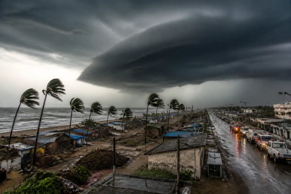
Cyclone Arnab’s delayed landfall on India’s east coast was not caused by a single change in direction. According to India Meteorological Department director general Mrutyunjay Mohapatra, an anticyclone over the China-Myanmar region, strong westerly winds and a low-pressure system over the south Bay of Bengal created an atmospheric tug-of-war that left the cyclone almost stationary for nearly six hours.
The episode is important because landfall is often treated as a single, easily understood moment: the point at which a cyclone crosses the coast. In operational terms, however, the process can be prolonged and difficult to time when several weather systems influence the storm simultaneously. Arnab’s case shows why the forecast of a cyclone’s arrival is not simply a matter of tracking its location on a map. It also depends on how surrounding systems steer, resist or attract the storm.
The IMD had initially forecast that Arnab would make landfall during the forenoon of Wednesday. The agency later revised the expected window to between 2 am and 4 am. The landfall process ultimately lasted from 2 am to 8 am, according to Mohapatra’s account cited by the Times of India. The forecast had, however, identified the broad landfall area between Bapatla and Visakhapatnam, to the southwest of Yanam, and had assessed the cyclone’s intensity at 135 km as almost accurate.
That combination of outcomes matters. The timing of the landfall changed, but the larger forecast picture—where the cyclone would cross the coast and how strong it would be—remained close to the eventual outcome. It underlines the difference between forecasting a storm’s broad path and estimating the precise timing of a complex landfall.
Mohapatra described the interaction as rare and academically fascinating. His explanation identifies three distinct forces. The anticyclone was steering Arnab. Strong westerly winds, which are generally strong in October, were pushing the cyclone back. At the same time, the low-pressure system over the south Bay of Bengal was pulling the cyclone towards itself.
A cyclone is an intense low-pressure system in which air rises and moves inward. An anticyclone works in the opposite way, with air sinking and spreading outward. When these systems interact around a developing cyclone, their effects are not necessarily straightforward. In Arnab’s case, the competing influences reduced the storm’s forward movement and made it almost stationary, prolonging the landfall process.
The distinction between a storm slowing before landfall and a storm taking longer to complete landfall is operationally significant. A delayed or extended landfall can alter the period during which coastal areas experience the storm’s strongest conditions. The supplied report does not provide a detailed account of rainfall, wind damage, storm surge or evacuation numbers linked to Arnab, so the direct effects on residents and infrastructure cannot be assessed from the available evidence. What can be established is that the atmospheric arrangement complicated the timing of the event.
For coastal administrations, time is a central planning variable. Forecast windows inform decisions related to warnings, movement restrictions, emergency deployments and the readiness of local authorities. A change in the expected landfall time can affect when those measures are intensified or maintained. The report does not state which specific administrative decisions were changed because of Arnab’s delayed movement, but the episode demonstrates why authorities must work with forecast ranges rather than treat an initial time estimate as fixed.
The case also highlights the different layers of information contained in a cyclone forecast. The likely landfall zone, the storm’s intensity, its direction of movement and the timing of landfall are connected, but they are not identical forecast questions. Arnab’s predicted path and intensity were described as nearly accurate even though the timing was revised. That suggests that a forecast can perform well on some dimensions while remaining uncertain on another.
This is especially relevant in regions where coastal settlements, transport links, utilities and public facilities may be exposed to the same weather system. A broad forecast of the landfall zone can help identify the affected belt, while the timing estimate determines when the most intense conditions are expected. When the storm becomes almost stationary, the duration and sequence of impacts may be harder to communicate through a single headline or one fixed arrival time.
Arnab’s sharp right turn after landfall provided another visible sign of the competing forces around the cyclone. Mohapatra linked the change in track to the unusual interaction of the anticyclone, westerly winds and the south Bay low-pressure system. The turn was not presented as an isolated deviation but as part of the same atmospheric arrangement that had delayed the storm.
The event also places the current cyclone in a longer record of complex landfalls. Mohapatra cited the 1999 Odisha supercyclone, which remained nearly stationary over the Odisha coast for around 30 hours. He also referred to Cyclone Burevi, whose landfall in December 2020 was prolonged and complex. These examples establish that Arnab’s behaviour was unusual but not without precedent.
The comparison with the 1999 supercyclone should not be read as an assessment that Arnab had a similar intensity or impact. The supplied report makes no such claim. Its relevance is narrower: it shows that prolonged or nearly stationary cyclone behaviour has occurred before along India’s coast, and that the duration of landfall can become a defining feature of a storm’s movement.
The institutional lesson is that cyclone monitoring cannot rely only on the storm’s internal structure or its immediate track. The IMD’s explanation places the surrounding atmospheric environment at the centre of the forecast. Systems located far from the point of landfall—in this case, an anticyclone over the China-Myanmar region and a low-pressure system over the south Bay of Bengal—can influence the timing and direction of a cyclone affecting India’s east coast.
That wider spatial field makes forecasting a coordination problem between multiple weather signals. The cyclone is the most visible system, but it is not the only one determining its movement. Strong seasonal winds can act against the storm’s progress, while another low-pressure system can draw it in a different direction. A forecast must therefore account for interactions rather than read the cyclone as an independent object moving across a static map.
Arnab’s delayed landfall also shows why forecast revisions should not automatically be interpreted as a failure. The IMD changed the expected timing from the forenoon to a 2 am to 4 am window as the atmospheric conditions developed. The eventual landfall lasted until 8 am, but the agency’s assessment of the landfall area and intensity remained close to the observed outcome. The available evidence supports a more precise conclusion: the timing was difficult because the cyclone’s movement was affected by a rare combination of surrounding systems, while other parts of the forecast were comparatively stable.
For citizens, the practical implication is that cyclone alerts need to communicate uncertainty without weakening the urgency of preparedness. The supplied report does not record public messaging details or resident responses, so it cannot establish how Arnab’s revised timing was understood on the ground. It does show, however, why a forecast window can change as new atmospheric interactions become clearer.
The larger urban question is how coastal settlements and infrastructure systems prepare for weather events whose timing may shift even when the broad track is known. Roads, power networks, communications systems, ports, homes and emergency facilities all depend on time-sensitive decisions. A storm that slows or changes direction can extend the period during which these systems must remain on alert. Arnab’s case does not provide damage or disruption data, but it identifies the forecasting challenge that precedes those outcomes.
What the evidence confirms is that Cyclone Arnab’s landfall was prolonged by the combined influence of an anticyclone, strong westerly winds and a south Bay of Bengal low-pressure system. The storm’s broad landfall zone and intensity were forecast with near accuracy, while its timing was revised and the landfall continued for six hours. The available report does not establish the cyclone’s full public or infrastructure impact. The next developments to monitor are the IMD’s continuing assessment of the storm’s track, intensity and effects, along with any official account of damage, rainfall or disruption across the affected coastal areas.

