


Bengaluru | September 9, 2026
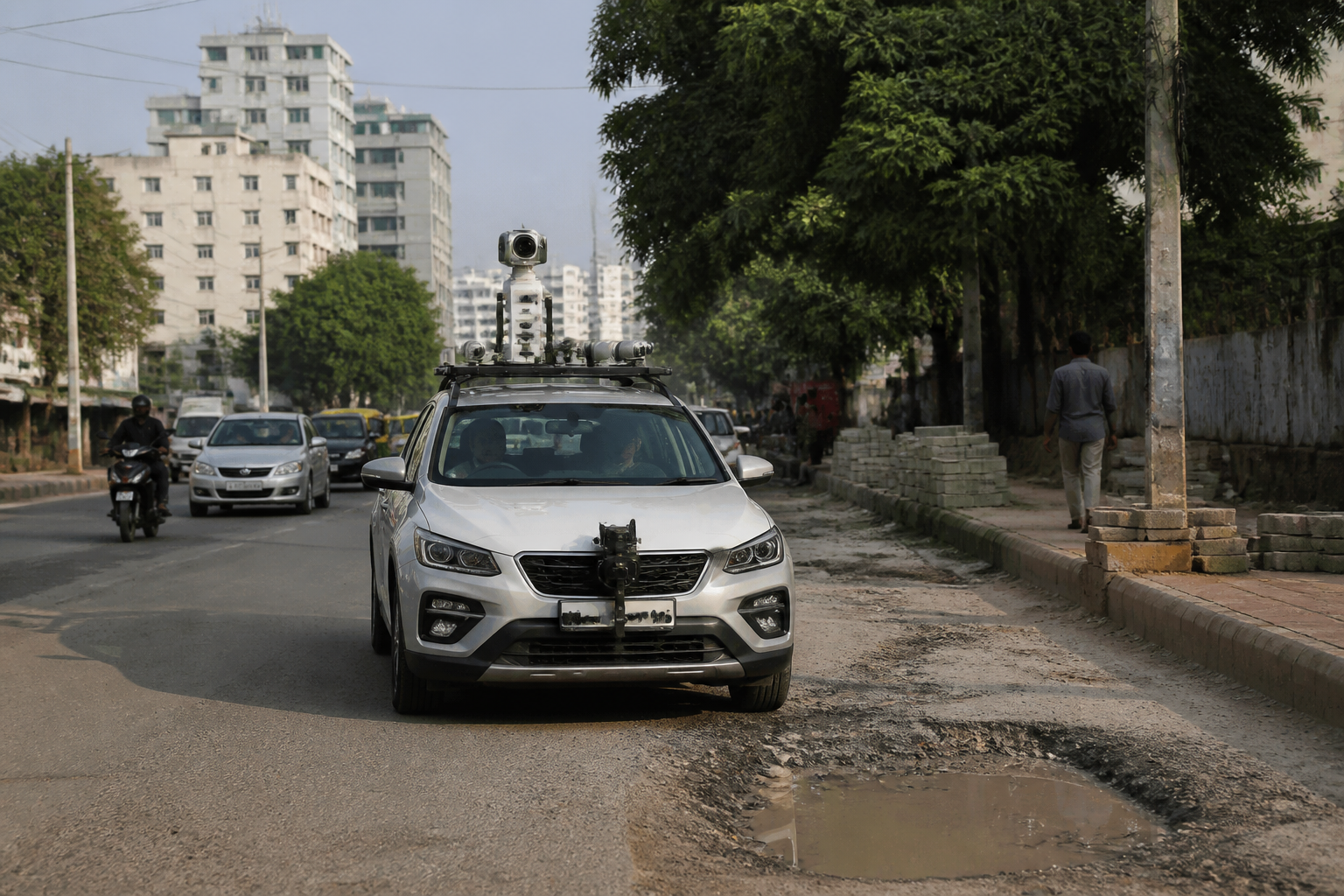
Bengaluru South civic authorities have begun a pilot using AI-enabled vehicles to detect potholes, garbage, footpath encroachments, construction waste, damaged manholes and dangerously hanging cables across selected roads, municipal commissioner K.N. Ramesh said.
The AI road monitoring system uses cameras and GPS equipment fitted to a vehicle that travels through the civic zone, capturing photographs and video of public-space and road-related problems. The visual data is then analysed by artificial intelligence software, which identifies reported defects and sends details to the relevant officials, according to Ramesh.
The pilot currently covers about 75 kilometres of roads within the Bengaluru South municipal area. The zone has 311 roads in total. Authorities said the system could be extended to all roads in the jurisdiction if the trial produces the expected results.
Each issue identified by the vehicle is automatically recorded in the civic body’s complaint-ticket system along with its GPS location. The tickets are sent directly to the assistant executive engineers responsible for the relevant ward and to the login accounts of the departments concerned.
Officials are expected to visit the location and address the reported problem before closing the ticket. Photographs taken before and after the work are to be uploaded to the system as part of the closure process.
Ramesh said the system is intended to allow the civic body to identify and address problems proactively instead of waiting for residents to file complaints. The categories being monitored include potholes, garbage piles, construction debris, encroached footpaths, hazardous cables and damaged manholes.
The proposed uses extend beyond routine road maintenance. Authorities are also considering using the technology to identify property-tax-related issues and violations of building regulations. Ramesh said AI cameras could record cases where ground floors intended for parking have allegedly been converted into commercial shops.
The system may also be used to identify unauthorised shops and advertising boards occupying pedestrian paths, as well as electricity poles identified as obstructions, for action by the relevant departments.
The pilot’s immediate operational test will be whether detected issues are assigned to the correct officials, resolved at the location and documented through before-and-after photographs. The municipal administration has not announced a completion date for the 75-kilometre survey or a timeline for expanding the system to all roads.
